Download
1 / 21
230 likes | 505 Vues
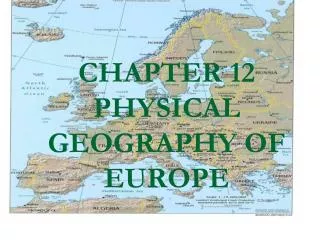
THE PHYSICAL GEOGRAPHY of EUROPE. What makes it a Region?. Located in the Northern Hemisphere Generally mild climate Many languages and cultures Dreadful common past (wars, famines, etc) Powerful and emerging economies. The Land. Key Terms: Glaciation Loess Dike Polder Fjord.

E N D
What makes it a Region? • Located in the Northern Hemisphere • Generally mild climate • Many languages and cultures • Dreadful common past (wars, famines, etc) • Powerful and emerging economies
The Land • Key Terms: • Glaciation • Loess • Dike • Polder • Fjord
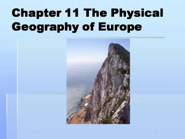
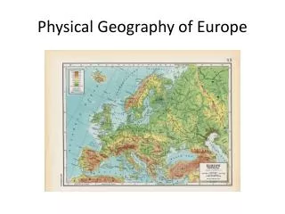
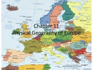
Places of Interest • Alps • Rhine River • Po River • Northern European Plain • Baltic Sea • North Sea • Mediterranean Sea • British Isles • Aegean Sea • Danube River • Black Sea
The Land: Main Idea • Europe’s Landscape has shaped the lives and settlement patterns of Europeans • Northwestern mountains rounded by erosion and glaciation (how glaciers form and spread) • Ex: Ben Nevis- highest peak in British Isles • Central Uplands (Iberian Peninsula to Eastern Europe) • Meseta- Spain • Massif Central- France • Southern Europe (Jagged mountains) • Pyrenees and Alps • Alps- S. France to Balkan Peninsula • Mont Blanc- Highest peak in Alps (15, 771 ft) • Po and Rhine head waters in the Alps
Southern Europe (cont) • Carpathian Mountains • Eastern Europe- from Slovakia to Romania • Northern European Plain • Fertile = farming • 1800s- discovery of mineral deposits • Paris, and Berlin located there • Other point of interest • Great Hungarian Plain
Seas, Peninsula’s and Islands • Most of Europe is about 300 miles from the sea coast • Good and bad • Netherlands • 25 % of it is under sea level • Forced to build dikes to hold back water • Polder- land between dikes
Europe’s Peninsula’s • Northern Peninsula- largest • Scandinavian Peninsula- • Caused by glaciation • Fjords- steep sided inlets • Southern Peninsula • Main feature = Mediterranean Sea
Europe’s Islands • Iceland • Volcanoes, hot springs, and geysers • Hot springs provide natural heating for homes • British Isles • Great Britain, Ireland, and many small islands • Rocky cliffs; steep bays • Mediterranean Sea • Sicily, Corsica, Sardinia, Crete, Cyprus
Water Systems • Rivers flow from the mountains to the coast • Used for transport, irrigation, and hydroelectric power • Different regions, different systems • Scandinavian Peninsula = short and not connected • Iberian Peninsula = narrow and shallow • England (Thames) = ships can reach the Port of London • Rhine • Most Important in Western Europe • Swiss Alps to France, Germany, and the Netherlands • Connects industrial cities to the Port of Rotterdam in the Black Sea
Water Systems (cont) • Danube • Links southern Germany to Hungary and Romania • Natural Resources • Influence economic activity in Europe • Iron and coal led to the modernization of Europe • Coal, Iron, Oil, Natural Gas, Nuclear and Hydroelectric power • France, Sweden, Ukraine – Iron Ore
Climate and Vegetation • Key Terms: • Permafrost, timberline, mistral, sirocco, foehn, avalanche • Main Idea • Latitude, mountain barriers, wind patterns, and distance from large bodies of water influence Europe’s climate • Vary from cold and barren to warm and shrub covered
Western and Southern Climate • Maritime winds shape it • North Atlantic Current – leads to mild climate • Eastern and Northern • Colder because of distant from the Atlantic Ocean
Climate Regions • Cold in the North to dry steppe in the South • Wind, ocean currents, latitude, and landforms, all shape Europe’s climates • High – Latitudes • Cold winter; short summer • Tundra regions = have permafrost • Subarctic = coniferous • EXCEPTION • Western Norway, Iceland, and Sweden • Warmer because they are on the water • 90 inches of rainfall annually, because of the Norwegian, and North Atlantic Currents
Midlatitudes • Marine West Coast • Mild winters, cool summers, abundant rainfall • Shaped by the Gulfstream and North Atlantic Currents • Deciduous (leaves fall in Winter) and coniferous trees • Southern Europe • Mediterranean Climate • Hot, dry Summer; mild rainy Winter • Other forces • Mistral – strong wind from Northern Alps; bitterly cold winds • Siroccos – dry winds blowing in from Africa; heat wave
Eastern Europe • Humid – continental • Cold, snowy winters; hot summers • Alps • Highland Climate • Foehns- winter winds that cause avalanches
Dry Regions • Parts of S.E. and S.W. Europe • Dry steppe climate • Dry cold grassland from Hungary, Serbia, Montenegro, and Romania • Hot Summer; Extreme Winter • Meseta • 81,000 sq. mi • Madrid is at its center