Download
1 / 40
400 likes | 500 Vues
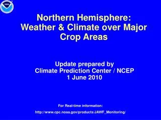
Northern Hemisphere: Weather & Climate over Major Crop Areas. Update prepared by Climate Prediction Center / NCEP 1 June 2010. For Real-time information: http://www.cpc.noaa.gov/products/JAWF_Monitoring/. Outline. Highlights ENSO Current Status MJO Current Status

E N D
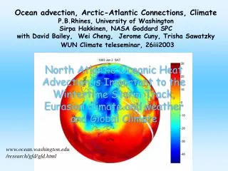
Northern Hemisphere: Weather & Climate over Major Crop Areas Update prepared by Climate Prediction Center / NCEP 1 June 2010 For Real-time information: http://www.cpc.noaa.gov/products/JAWF_Monitoring/
Outline • Highlights • ENSO Current Status • MJO Current Status • Monsoons Current Status • Northern Hemisphere Circulation • Rainfall & Temperature Patterns • NCEP/GFS Model Forecast • Forecast Verification
Highlights Canada and US: Unusually wet weather impacted the north-central US and south-central Canada. Forecasts indicated wet weather will continue in the northwest US. Mexico and Central America: Tropical Storm Agatha brought heavy rain to northern Central America. The GFS forecasts moderate precipitation for Central America during the next week. Eurasia: Heavy rainfall impacted parts of southeast Asia and the Maritime Continent. Tropical Cyclone Three, currently in the Arabian Sea, is expected to impact Pakistan and northwest India in the next few days.
ENSO Current Status • General Summary: • A transition from El Niño to ENSO-neutral is underway. • Sea surface temperatures (SST) are decreasing across much of the Pacific Ocean and have recently become below-average in portions of the eastern half of the basin. • Although many models predict ENSO-neutral conditions, there is a growing possibility of La Niña developing during the second half of 2010. During the last 4 weeks (2 – 29 May 2010), SSTs were at least 0.5 deg C below average between 150 W and115 W. In the western Pacific, equatorial SSTs were 0.5 deg C above average. For more information go to: http://www.cpc.noaa.gov/products/precip/CWlink/MJO/enso.shtml
MJO Index -- Recent Evolution Ensemble GFS (GEFS) MJO Forecast • The axes (RMM1 and RMM2) represent daily values of the principal components from the two leading modes • The triangular areas indicate the location of the enhanced phase of the MJO • Counter-clockwise motion is indicative of eastward propagation. Large dot most recent observation. • Distance from the origin is proportional to MJO strength • Line colors distinguish different months RMM1 and RMM2 values for the most recent 40 days and forecasts from the ensemble Global Forecast System (GEFS) for the next 15 days light gray shading: 90% of forecasts dark gray shading: 50% of forecasts Yellow Lines – 20 Individual Members Green Line – Ensemble Mean MJO Current Status During the majority of the past week, the MJO index showed a weak amplitude. The GFS forecasts indicate an eastward propagating MJO signal during the next two weeks. Uncertainty during the Week-2 period increases significantly. The latter signal is most likely related to a combination of subseasonal variability rather than a coherent MJO signal emerging. For more information go to: http://www.cpc.noaa.gov/products/precip/CWlink/MJO/mjo.shtml
Northern Hemisphere Monsoons Current Status North America West Africa East Asia Rainfall Anomalies: Last 90 Days Rainfall Anomalies: Last 90 Days Rainfall Anomalies: Last 90 Days Monsoon Season: JUN-SEP Monsoon Season: MAY-OCT Monsoon Season: JUN-SEP Seasonably dry conditions have persisted in the southwest US. During the last 90 days near average rainfall has occurred in west Africa near Senegal and Guinea. Near average rainfall has occurred in the coastal Gulf of Guinea region and Sudan. During the last 90 days near to below average rainfall has occurred in southeast Asia and above average precipitation has occurred in eastern China. For more information go to: http://www.cpc.noaa.gov/products/Global_Monsoons/
200-hPa, 925-hPa Wind & Temperature Anomalies- Recent 7 days Northern Hemisphere Circulation A C C A Low-level (~600 m) wind and temperature anomalies are based on the NCEP Climate Data Assimilation Systems (CDAS) analysis. The patterns of anomalous temperature and wind at 925-hPa are usually similar to surface observations. Note: Areas with surface pressure below 925-hPa are masked out. • During the 7-day period (23-29 May 2010), anomalous 200-hPa anticyclonic circulation centers were located over eastern Canada and Saudi Arabia. Anomalous 200-hPa cyclonic circulation centers were located over the northwest US and western Atlantic. • During the same 7-day period temperatures were above average over eastern North America. Temperatures were below average over northern Africa and Japan.
Omega Anomalies and Total Precipitation - Recent 7 days Northern Hemisphere Circulation Rising motion (negative omega, yellow/red shading), usually associated with wetter- than-normal conditions. Sinking motion (positive omega, blue shading), usually associated with drier-than-normal conditions. CPC daily gridded precipitation analysis over land only. The daily gauge analysis is created on a 0.5 degree lat/lon over the global land by interpolating gauge observations from ~30,000 stations. • During the 7-day period (23-29 May 2010), anomalous rising motion (negative omega) was observed over the northwest and north-central US and Central America (top panel red ovals). • During the same time period precipitation was observed over the same areas.
Canada and US • Rainfall Total & Anomaly Patterns • Temperature Patterns • GFS Forecast
Rainfall Total & Anomaly Patterns: Last 7 Days Total Anomaly During the last 7 days, unusually wet weather impacted the northern US plains and south-central Canada, while showers fell across the northwest US.
Rainfall Total & Anomaly Patterns: Last 15 Days Total Anomaly During the last 15 days, precipitation was above average in the northwest and north-central US and south-central Canada. Precipitation was below average in the northeast US and southern Plains.
Rainfall Total & Anomaly Patterns: Last 30 Days Total Anomaly During the last 30 days, precipitation anomalies were similar to the 15 day period.
Temperature (°C)Based on GTS Stations (no QC) Anomaly Extreme Minimum Much above average temperatures were observed in eastern Canada while low temperatures were below freezing in parts of western Canada. Anomaly Extreme Minimum
Temperature (°C)Based on GTS Stations (no QC) Anomaly Extreme Minimum Unusually cool temperatures were observed over the western US associated with wet weather and a trough of low pressure. Anomaly Extreme Minimum
NCEP/GFS Precipitation Forecasts Forecasts from 1 Jun 2010 – Days 1-7 Total Anomaly For Days 1-7 the GFS forecasts wet weather for the Pacific northwest and eastern US.
NCEP/GFS Precipitation Forecasts Forecasts from 1 Jun 2010 – Week 2 Total Anomaly For Days 8-14 the GFS forecasts wet weather for the east-central US and below average precipitation in the southern Plains.
Forecast from 17 May 2010 Valid 24 - 30 May 2010 Forecast from 24 May 2010 Valid 24 - 30 May 2010 Observed 24 - 30 May 2010 Total Total Total Anomaly Anomaly Anomaly Forecast Verification: North America
Mexico and Central America • Rainfall Total & Anomaly Patterns • Temperature Patterns • GFS Forecast
Rainfall Total & Anomaly Patterns: Last 7 Days Total Anomaly During the past 7 days, Tropical Storm Agatha brought heavy rain to northern Central America. The storm made landfall May 29 near the Mexico/Guatemala border. For more information see: http://www.cpc.ncep.noaa.gov/products/fews/central_america/central_america_hazard.pdf
Rainfall Total & Anomaly Patterns: Last 15 Days Total Anomaly During the past 15 days, precipitation was below average in Mexico and above average in Central America.
Rainfall Total & Anomaly Patterns: Last 30 Days Total Anomaly During the past 30 days, precipitation was below average in Mexico and above average in Central America.
NCEP/GFS Precipitation Forecasts Forecasts from 1 Jun 2010 – Days 1-7 Total Anomaly For Days 1-7 the GFS forecasts moderate precipitation for Central America and mostly dry weather for Mexico.
NCEP/GFS Precipitation Forecasts Forecasts from 1 Jun 2010– Week 2 Total Anomaly For Days 8-14 the GFS forecasts active convective rainfall southern Mexico and Central America.
Forecast from 17 May 2010 Valid 24 - 30 May 2010 Forecast from 24 May 2010 Valid 24 – 30 May 2010 Observed 24 – 30 May 2010 Total Total Total Anomaly Anomaly Anomaly Forecast Verification: Central America
Eurasia • Rainfall Total & Anomaly Patterns • Temperature Patterns • GFS Forecast
Rainfall Total & Anomaly Patterns: Last 7 Days Total Anomaly During the past 7 days, heavy rainfall impacted parts of southeast Asia and the Maritime Continent.
Rainfall Total & Anomaly Patterns: Last 15 Days Total Anomaly During the past 15 days, precipitation was above average in eastern Europe, eastern China, and the Bay of Bengal region. Below average precipitation has fallen in central Africa.
Rainfall Total & Anomaly Patterns: Last 30 Days Total Anomaly During the past 30 days, below average precipitation has been observed over central Africa and in southeast Asia. Above average precipitation has fallen across eastern Europe, northeast China, and the Maritime Continent.
Temperature (°C)Based on GTS Stations (no QC) Anomaly Extreme Minimum During the past 7 days low temperatures were in the single digits in northern Europe. Anomaly Extreme Minimum
Temperature (C)Based on GTS Stations (no QC) Anomaly Extreme Minimum After three weeks of above average temperatures, near average temperatures were observed during the past week across most of the region. Anomaly Extreme Minimum
Temperature (C)Based on GTS Stations (no QC) Anomaly Extreme Minimum Above average temperatures continued in central India. Anomaly Extreme Minimum
NCEP/GFS Precipitation Forecasts Forecasts from 1 Jun 2010 – Days 1-7 Total Anomaly For Days 1-7 Tropical Cyclone Three, currently in the Arabian Sea, is expected to impact northwest India and Pakistan. Above average rainfall is forecast for the western Maritime Continent. For more information on Global Tropical Hazards see: (updated Monday at 4pm) http://www.cpc.ncep.noaa.gov/products/precip/CWlink/ghazards/ghaz.shtml
NCEP/GFS Precipitation Forecasts Forecasts from 1 Jun 2010 – Week 2 Total Anomaly For Days 8-14 above average precipitation is expected over parts of the Maritime Continent.
Forecast from 17 May 2010 Valid 24 - 30 May 2010 Forecast from 24 May 2010 Valid 24 – 30 May 2010 Observed 24 – 30 May 2010 Total Total Total Anomaly Anomaly Anomaly Forecast Verification: Eurasia
Famine Early Warning System Network (FEWS) Meteorological Products for the Famine Early Warning System Network (FEWS-NET) Mesoamerica Famine Early Warning System (MFEWS) Asia Flood Network (AFN) Funded by the United States Agency for International Development (USAID) Hazards Impacts Assessments for Central America http://www.cpc.ncep.noaa.gov/products/fews/central_america/central_america_hazard.pdf Africa http://www.cpc.ncep.noaa.gov/products/fews/africa_hazard.pdf Afghanistan http://www.cpc.ncep.noaa.gov/products/fews/AFGHANISTAN/afghanistan_hazard.pdf Additional products at: http://www.cpc.ncep.noaa.gov/products/fews/
Major World Crop Areas and Climate Profiles Crop Calendars by Month http://www.usda.gov/oce/weather/pubs/Other/MWCACP http://www.usda.gov/oce/weather/CropCalendars USDA Crop Information