Air – Sea Interactions
Air – Sea Interactions. Weather vs. Climate. Weather is the current condition of the ATMOSPHERE at any moment. Can change HOURLY and DAILY Climate is the OVERALL yearly average temperature and precipitation .
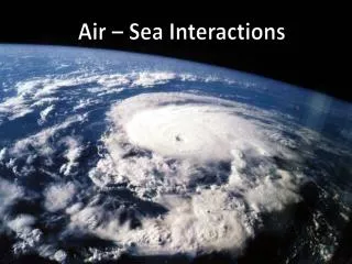

Air – Sea Interactions
E N D
Presentation Transcript
Weather vs. Climate Weather is the current condition of the ATMOSPHERE at any moment. Can change HOURLY and DAILY Climate is the OVERALLyearlyaveragetemperatureandprecipitation.
“Warm air is LESS dense than cold air, so warm air RISES… Cold air SINKS” To understand weather and climate, you need to know one simple concept….
Layers of the Atmosphere • Troposphere • Made up of 78%nitrogen, 21%oxygen. • All weather occurs here • Both temperature and air pressuredecrease as altitude increases.
Layers of the Atmosphere • Stratosphere • As altitude increases, temperature will increase, but air pressure will continue to decrease. Contains the ozone (O3)layer which absorbs most (95%) of the UV radiation from space
Layers of the Atmosphere • Mesosphere • As altitude increases, temperature will decrease, but air pressure will stay constant. • This layer is the coldest, yet meteoritesburn up here.
Layers of the Atmosphere • Thermosphere • This is the hottest layer, but no heat is felt due to very few molecules present. • Contains a layer of ionized gases called the ionosphere, which is used to transmit radio signals.
Layers of the Atmosphere • At the top of each layer is a “pause”. • Notice that the temperature remains constant in these areas.
Weather Conditions include… 1. AIR TEMPERATURE: measured in oF or oC.
Weather Conditions include… 2. AIR PRESSURE: measure of the “weight” of the air on the surface of the Earth. Measured in inches of MERCURYor MILLIBARS. Measure by a BAROMETER.
Weather Conditions include… As elevation/ altitude increases, air pressure will DECREASE. Air pressure at sea level is 1008 mb 100 kPa = 1.0 b = 1000 mb
Weather Conditions include… 3. PRECIPITATION: any phase of water that is falling. RAIN SLEET HAIL SNOW DRIZZLE FREEZING RAIN
Weather Conditions include… 4. CLOUD COVER: the amount and type of clouds in the sky. alto = middle cumulo = puffy cirro = high strato = layer nimbus = rain
Infrared SATELLITE image shows CLOUD COVER and TEMPERATURE This is the radar image that shows the precipitation in the clouds.
Weather Conditions include… • 5. WIND SPEED & DIRECTION: direction and speed the wind is coming… FROM!! • Winds blow from HIGH pressure LOWpressure. • HUMIDITY: measure of the amount of WATER VAPOR in the air. • Warmer air holds MORE water vapor than cold air. • RELATIVEHUMIDITYis the amount of water vapor in • the air compared to how much it can hold at a certain • temperature. • DEW – POINT TEMPis the temperature at which • the air is saturated and has a relative humidity of 100% • When dew-point temp =air temp; R.H = 100%
Compare the air temperature and the dew pt for each location. Notice how the relative humidity changes as the air temp and dew pt temp get closer.
Compare…Air Temperature to Dew Point and notice how the relative humidity changes.
At 8pm air temp was 54o with a dew pt of 41o and the RH is 61%. By 9 pm, the air temp decreased to 53o but the stayed at 41o. Notice how the RH increased from 61% to 65% with the 1 degree decrease in air temp.
The air temp from 9-11 pm stayed at 53o BUT the dew pt temp increased each hour from 41 to 42 to 43…so as the air temp and dew pt got closer, the RH increased from 65% to 67% to 70%.
Air Masses: large masses of air with the same properties throughout.
Fronts occur where two air masses meet…. Can you identify the air masse on this map? ? ? ? 03/06/2013 @ 9:28 am
These maps show the weather fronts and the associated precipitation and cloud cover.
High & Low Pressure Systems CORIOLIS Effect ( ) : Causes moving objects such as air and water to get deflected to the RIGHT in the Northern Hemisphere and to the LEFT in the Southern Hemisphere. Bird’s eye view L H Click here for animation Demonstration
High & Low Pressure Systems CORIOLIS Effect ( ) : Causes moving objects such as air and water to get deflected to the RIGHT in the Northern Hemisphere and to the LEFT in the Southern Hemisphere. Bird’s eye view L H
High & Low Pressure Systems Animations (click here)
High & Low Pressure Systems D.O.C goes to the I.C.U
Climate & Seasons Climate and the Seasons: - Climate is the overall yearly average of TEMPERATURE and PRECIPITATION an area receives. Factors that affect Climate - TILT of the Earth: The Earth’s axis is tilted 23 ½ degrees. This causes the UNEVEN heating of the Earth’s surface. - LATITUDE: The equatorial regions receive more DIRECTIncoming Solar radiAtionthan the poles.
The Seasons Vernal Equinox = March 21 Day = night Winter Solstice = Dec 21 shortest “day” Summer Solstice = June 21 longest “day” Days get longer, Nights get shorter Days get longer, Nights get shorter Days get shorter, Nights get longer Days get shorter, Nights get longer Animation (click here) Autumnal Equinox = Sept 21 Day = Night
Notice the Earth is closer to the sun in the Winter (Jan 3) than it is in the Summer (July 4) This is the position of the Earth during the summer. It is tilted 23 ½ degrees TOWARD the sun, so we get MORE direct sunlight during the summer time.