Download
1 / 54
560 likes | 737 Vues
Geography Nature and Perspectives. Five Themes of Human Geography and Spatial Interaction Maps. What is human geography and how is it related to the geographic perspective? How is HG a field of inquiry? How is spatial analysis embedded in the geographic perspective?

E N D
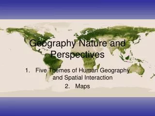
Geography Nature and Perspectives Five Themes of Human Geography and Spatial Interaction Maps
What is human geography and how is it related to the geographic perspective? • How is HG a field of inquiry? • How is spatial analysis embedded in the geographic perspective? • How are humans and their landscapes related? • What is scale and how does it effect geographic inquiry? • What is regionalization and how does it effect HG? • What effect does globalization and spatial interconnection have on people and places? • How are various maps formed and spatial data used? • How does technology relate to HG?
“The why of where” • Search for the reasons • Hindus in India- but why? • Geography- write about the earth-
Spatial Perspective • Spatial Perspective- • How are things distributed • Relation to other space • What happens in this space • Geographic Models- explains spatial interactions • Why of the world- Population in Jakarta vs. LA • All models have + and – “Von Thunnen’s” • Physical vs. Human
Distribution- Spatial arrangments of an item over a given area
Von Thunen’s theories are the beginning of location economics and analysis (1826)Locational Theory : butter and cheese more common than milk with increasing distance from cities and in West.
Five themes of Spatial Interaction • Like your senses • Location • Absolute- location on a grid- There can only be one location • latitude and Longitude- • or exact location 100 Pine Knoll Greenville SC • Lines of Latitude- “Parallels”- Equator is “0” • North Pole is 90- South Pole? • Equator has the largest Circumference • Longitude- “Prime Meridian”- Greenwich England • 180 degree is the international date line- every 15 degrees • Anglo centric • Written in Degree (1-69 miles) Minutes (60- 1.1 miles) and sec (60- 100 ft) As they get closer to the poles they all reduce
Greenwich Mean Time- Universal Time • Taiwan is about 12 hours from Kentucky- so?? • 24 standard Time Zones • 15 degree- However a country can choose- China • Great Circle- quickest point from a-b on a globe
Relative Location- what is around it • Contextual subject to change • Site- internal physical and cultural situation • Tokyo, Japan- Rocky beaches, humid climate, Buddhist • Situation • The location of a place relative to another place • Helps us find an unfamiliar place by locating a familiar one • The situation also allows us to see the importance of a location compared to accessibility to another place
2. Human-Environment Interaction- • Culture- Groups way of life- Interactions change culture • Cultural Ecology- Impact of Humans on the environment and Environment on Humans • Environmental determinism- people actions are caused by their environment • Alexander Humbelt, Carl Ritter, Fredrick Ratzel, Ellen ChurchhillSemple, Ellsworth Huntington • Possibilism- peoples actions are limited to their environment, Domestication of animals • Resources, food production, buildings etc.. Wealth and technology influence both of these, how?
3. Regions- Spatial units that share similarities (3 types) • Formal (uniform regions)- common cultural or physical characteristics • Country under one Govt.- North Korea • Region of a language or religion- Christianity • Climate- North vs. South • Functional Region (Nodal)- linked together by a function or Node- • Disease, Pizza Hut, Greenville News, Airline, TV station • Perceptual (Vernacular)- by peoples beliefs- • Cool kids in the cafeteria- the South in the USA- Valley vs. Hollywood
4. Place- combination of physical and cultural attributes that make unique • Sense of place- humans unique identity to some where- • Christmas in at your Grandparents • Also through other perceptions- TV, Radio- (Siberia) • Placelesness- No sense of authenticity • How does this happen?
5. Movement- people, information, goods, phenomenon • Spatial Interaction- interact through movement (Distance) • Friction of Distance- degree of interaction • You flying to Japan for Sushi- This has softened why? • Space Time Compression- reducing perceived distance- Kpop • Distance Decay- the further away you go the less influence it has- also softened in recent years- Ripples on a pond
Spatial Interaction Figure 1-30 Transportation networks Transnational Corporations Electronic communications and the “death” of geography? Distance decay
Interactions • Push- Pull Factors- EX. Diaspora vs. Disney Land • Intervening Opportunity • Intervening Obstacle • Cultural Divergence • Mutualism • Stimulus Diffusion- 3 types – Move in a pattern • Cultural Lag- Cultures resistance • Relocation Diffusion- Movement with Culture
SPACE-TIME COMPRESSION, 1492-1962 • Space-time compression is the reduction in time it takes for something to reach another place. The times required to cross the Atlantic, or orbit the earth, illustrate how transport improvements have shrunk the world.
Questions • Explain the absolute location of WHHS vs. the Relative Location • What are two positives of describing a place in such manner/ two negatives • Explain WHHS site and situation • If this situation is 120 degrees West of Greenwich England and in England it is 9 PM- What time is it in Greenville SC • Using a Map of the USA come up with a formal. Functional, and perceptual region (Please be creative and do not use an example we covered) Make a Key
Mapmaking • Map- 2D model of the earth • Cartography- art of map making- • Simplification- Why? Elimination of details is inevitable • Four main properties- Shape, Size, Distance, Direction • Cardinal, Intermediate, Relative directions • Distortion- “all maps lie flat, and all flat maps lie” • Projections- 3D to 2D • Equal Area (equivalent)- maintain are distort other • Conformal (orthomorphic)- maintain shape distort other • Azimuthal – Maintain direction distort other • Equidistant- maintain distance distort other
Uses of Projections- • Robinson- Slight distort. Of all four/ Used in Social Studies • Mercator- Shapes are ok/ Size are distorted- Used in the Cold War in Social Studies Class in the USSR • Peter Projection- distorts shape not size
History of Map Making • Inuit and other tribes made maps of rivers why? • Greco-Roman- Empires- became important • 1000BCE- Aristotle- Proved earth was round • Eratosthenes- “Geography” • Ptolemy- Guide to Geography • Fall of Rome- Based on religion • Catholics vs. Muslims • Age of Exploration- 16th Mercator Map
Cognitive Maps (Mental)- maps drawn from memory- often shows the importance of a place or natural feature- Individual perceptions • Cognitive Distance (Space)- Perceived Area (Distance) • Scale- the scope of a particular idea or function, “ Think globally act locally” • Map Scale • Relation of something's size and its actual size on the earth • Most are scaled down, obviously • The larger the area the smaller the scale- Africa is a small scale
SCALE DIFFERENCESMAPS OF WASHINGTON STATE The effects of scale in maps of Washington State. (Scales from 1:10 million to 1:10,000)
Categories of maps • Reference Maps- boundaries, roads, mountains, cities • Thematic Maps- Specific map or feature • Isoline- lines the connect equal value- elevation levels • Contour Lines • Choropleth- Specific pattern or variable/ Population density, voting regions- used in colors • Proportional Symbol- Uses symbol to display frequency/ Circles, stars, McDonalds • Dot Density- frequency of variable in a given area/ high school graduates • Cartogram- proportionality to show a variable
New Geographical Technologies and Data • Geographic Information System (GIS)- layers map data