Download
1 / 53
560 likes | 734 Vues
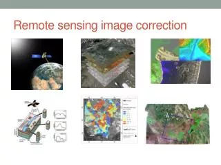
Maa-57.2040 Kaukokartoituksen yleiskurssi General Remote Sensing Image enhancement II. Autumn 2007 Markus Törmä Markus.Torma@tkk.fi. Image indexes. Idea is to combine different channels from multispectral image so that desired feature is enhanced ratio, difference or combination of these

E N D
Maa-57.2040 Kaukokartoituksen yleiskurssiGeneral Remote SensingImage enhancement II Autumn 2007 Markus Törmä Markus.Torma@tkk.fi
Image indexes • Idea is to combine different channels from multispectral image so that desired feature is enhanced • ratio, difference or combination of these • larger value, feature is more present • It is useful to know spectral characteristics of different material when developing index • Vegetation indexes most important group
Vegetation index • Vegetation index is a number that is • generated by some combination of remote sensing bands and • may have some relationship to the amount of vegetation in a given image pixel • Vegetation indices are generally based on empirical evidence and not basic biology, chemistry or physics • A FAQ on Vegetation in Remote Sensing http://hyperdaac.webthing.com/html/rsvegfaq.txt
Basic assumptions made by the vegetation indices • Some algebraic combination of remotely-sensed spectral bands can tell you something useful about vegetation • There is fairly good empirical evidence that they can • All bare soil in an image will form a line in spectral space • This line is considered to be the line of zero vegetation • Isovegetation lines: lines of equal vegetation • All isovegetation lines converge at a single point • Measure the slope of the line between the point of convergence and the red-NIR point of the pixel • E.g. NDVI, SAVI, and RVI • All isovegetation lines remain parallel to soil line • Measure the perpendicular distance from the soil line to the red-NIR point of the pixel • E.g. PVI, WDVI, and DVI
RVI (ratio vegetation index) • RVI = NIR / PUN • values: 0 - inf
NDVI: Normalized Difference Vegetation Index • NDVI = (NIR-PUN)/(NIR+PUN) • values: -1 - +1 • most used and well-known • water: low (negative) values • forest 0.5-0.8 • open land 0.5-0.6
April 19 Clouds: grey Areas with chlorophyll: white Snow in Lapland: dark grey Water: black NDVI
IPVI: Infrared Percentage Vegetation Index: • IPVI = NIR/(NIR+PUN) • values: 0 - +1
Some more • Difference Vegetation Index (DVI): DVI = NIR - PUN values: -max(PUN) - max(NIR) • Transformed Vegetation Index (TVI): TVI = ((NIR-PUN)/(NIR+PUN)+0.5)0.5 x 100
Soil line • Line in spectral space • describes the variation of bare soil in the image • Line can be found by locating two or more patches of bare soil in the image having different reflectivities and finding the best fit line in spectral space
Vegetation index • Some vegetation indices use information about soil line • Perpendicular Vegetation Index PVI = sin(a)NIR-cos(a)red • a is the angle between the soil line and the NIR axis • Weighted Difference Vegetation Index WDVI = NIR-g*red • g is the slope of the soil line
Vegetation index • Some vegetation indices try to minimize soil noise • All of the vegetation indices assume that there is a single soil line • However, it is often the case that there are soils with different red-NIR slopes in a single image • Changes in soil moisture change index value • Problem of soil noise is most acute when vegetation cover is low • Soil Adjusted Vegetation Index SAVI = (( NIR-red )/(NIR+red+L))(1+L) • L is a correction factor which ranges from 0 (high vegetation cover) to 1 (low cover)
Normalized Difference Moisture Index • NDMI = ( NIR - MIR ) / ( NIR + MIR ) • E.g. ( ETM4 - ETM5 ) / ( ETM4 + ETM5 )
Normalized Difference Snow Index • NDSI = ( GREEN – MIR ) / GREEN + MIR ) • E.g. ( ETM2 – ETM5 ) / ( ETM2 + ETM5 )
Spectral Indices Disadvantages • Not physically-based • Empirical Relations • Correlation not Causality • NDVI vs. Tourism in Italy • Only small amount of spectral information used • Rarely simple relationship between variable and index
Difference in vegetation indexes:difference in vegetation • Compute vegetation indexes for images taken at different times • Simple way to characterize changes in vegetation
Tasseled cap transform • Linear transform for multispectral images • Multispectral image is tarnsformed to images describing some scene property • brightness • greenness • moisture • haze • Originally developed for Landsat MSS, then TM, ETM and other instruments
Tasseled cap transform • Kauth and Thomas noticed that growing cycle of crop • started from bare soil • then to green vegetation and • then to crop maturation with crops turning yellow http://www.cnr.berkeley.edu/~gong/textbook/chapter6/html/sect65.htm
Tasseled cap transform • They developed linear transformation to characterize that • Landsat MSS: • Redness (soil) • Greenness (vegetation) • Yellowness • Noise http://www.cnr.berkeley.edu/~gong/textbook/chapter6/html/sect65.htm
Tasseled Cap (Landsat-7 ETM) • ETM-image should be converted to radiances • Brightness = 0.3561 * Ch1 + 0.3972 * Ch2 + 0.3904 * Ch3 + 0.6966 * Ch4 + 0.2286 * Ch5 + 0.1595 * Ch7 - Corresponds to soil reflectance • Greenness = -0.3344 * Ch1 - 0.3544 * Ch2 - 0.4556 * Ch3 + 0.6966 * Ch4 - 0.0242 * Ch5 - 0.2630 * Ch7 - Amount of vegetation • Moisture= 0.2626 * Ch1 + 0.2141 * Ch2 + 0.0926 * Ch3 + 0.0656 * Ch4 - 0.7629 * Ch5 - 0.5388 * Ch7 - Soil and vegetation moisture
Karhunen -Löwe transform • Aim is to decrease number of channels and preserve information • Idea: remove correlations between channels • same information in different channels • E.g.: TM-image, 6 channels transformed image, 3 channels
Karhunen -Löwe transform • y = A * x • x original pixels • y transformed pixels • A transformation matrix • Transformation matrix compresses information to less number of channels than originally
Karhunen-Löwe muunnos • Different transformation matrices: • Principal component analysis / transformation: variance of data is maximized • Canonical correlation: maximize class separability • Based on turning of coordinate system according to largest variance
Principal Component Analysis • PCA: Principal Component Analysis • Mean vector of data • Covariance matrix of data • describes the variance of data according to different coordinate axis • Hypothesis: • large variance much information
Principal Component Analysis 1. PC Channel 2 Channel 1
Principal Component Analysis • Landsat ETM:6 channel, 6-dimensional space • Usually 3 first principal component as computed
PCA example 1 • Porvoo: Landsat ETM 743 and PCA 123 • Principal component images have been computed from all ETM-channels
PCA example 1 • Landsat ETM 743 and PCA 1
PCA example 1 • Landsat ETM 743 and PCA 2
PCA example 1 • Landsat ETM 743 and PCA 3
PCA example 1 • Landsat ETM 743 and PCA 4
PCA example 1 • Landsat ETM 743 and PCA 5
PCA example 1 • Landsat ETM 743 and PCA 6
PCA example • Proportion of variances of different principal component images • 73 % • 19 % • 3 % • 0.7 % • 0.3 % • 0.2 % • Three first: about 99% information
Decorrelation strecth • Image enhancement method • Make PCA-images • PCA-images are scaled (streched) so that their variance is equal to variance of first PCA-image • Make inverse PCA, i.e. return to original image-space
Data fusion: Spatial resolution enhancement • Generally: • Good spatial resolution bad spectral or radiometric resolution • Bad spatial resolution good spectral or radiometric resolution • For example: • Spot-5 PAN: 5m, 0.48 - 0.71 µm • Spot-5 XS: 10m, Green: 0.50 – 0.59 µm, red: 0.61 – 0.68 µm, NIR: 0.78 – 0.89 µm, 20m, SWIR: 1.58 – 1.75 µm
Spatial resolution enhancement • Sköldvik Landsat ETM 342 and PAN
Spatial resolution enhancement • Sköldvik Landsat ETM 342 and PAN- ja XS-average image
Spatial resolution enhancement • Sköldvik Landsat ETM 342 and data fusion by principal component method