1 / 68

Deep Gas Reservoir Play, Central and Eastern Gulf

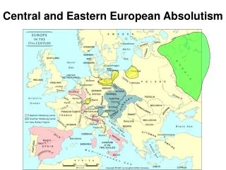
Deep Gas Reservoir Play, Central and Eastern Gulf. Summary. Introduction Petroleum System Analysis Resource Assessment Exploration Strategy. Introduction. Gulf Coast Interior Salt Basins. Gulf Coast Interior Salt Basins. Stratigraphy. Petroleum System Analysis. Petroleum Source Rocks.

kana
Télécharger la présentation

Deep Gas Reservoir Play, Central and Eastern Gulf

An Image/Link below is provided (as is) to download presentation Download Policy: Content on the Website is provided to you AS IS for your information and personal use and may not be sold / licensed / shared on other websites without getting consent from its author. Content is provided to you AS IS for your information and personal use only. Download presentation by click this link. While downloading, if for some reason you are not able to download a presentation, the publisher may have deleted the file from their server. During download, if you can't get a presentation, the file might be deleted by the publisher.

E N D

Presentation Transcript


  1. Deep Gas Reservoir Play, Central and Eastern Gulf

  2. Summary • Introduction • Petroleum System Analysis • Resource Assessment • Exploration Strategy

  3. Introduction

  4. Gulf Coast Interior Salt Basins Gulf Coast Interior Salt Basins

  5. Stratigraphy

  6. Petroleum System Analysis

  7. Petroleum Source Rocks • Upper Jurassic Smackover lime mudstone beds served as an effective regional petroleum source rock • Upper Cretaceous Tuscaloosa Marine shale beds served as a local source rock • Upper most Jurassic and Lower Cretaceous beds were possible source rocks

  8. Burial History

  9. North Louisiana Salt Basin Cross SectionsLocation K’

  10. North Louisiana Salt Basin Cross Section N S VE: 32X

  11. Burial History Profile North Louisiana Salt Basin API: 1706920079 - Sediment accumulation rates were greatest in the Jurassic (196-264 ft/my) - 50-60% of the tectonic subsidence occurred in the Late Jurassic (135-157 ft/my)

  12. North Louisiana Salt Basin, Sabine Uplift Cross Section N S VE: 22X

  13. Burial History Profile NLSB, Sabine Uplift

  14. North Louisiana Salt Basin, Monroe Uplift Cross Section N S VE: 30X

  15. North Louisiana Salt Basin Cross Section W E VE: 22X

  16. Burial History Profile NLSB, Monroe Uplift

  17. Mississippi Interior Salt Basin Cross Section Location

  18. Mississippi Interior Salt Basin Cross Section N S VE: 16X

  19. Burial History ProfileMississippi Interior Salt Basin

  20. Thermal Maturation and Expulsion History

  21. North Louisiana Salt Basin Cross Section Location K’

  22. Model Calibration

  23. Thermal Maturation History Profile North Louisiana Salt Basin

  24. Thermal Maturation Profile Cross Section North Louisiana Salt Basin Average Maturation Depth 6,500ft 12,000ft

  25. Hydrocarbon Expulsion Profile North Louisiana Salt Basin Peak Oil Peak Gas

  26. Thermal Maturation History Profile NLSB, Sabine Uplift

  27. Hydrocarbon Expulsion Plot NLSB, Sabine Uplift

  28. Thermal Maturation History Profile NLSB, Monroe Uplift

  29. Hydrocarbon Expulsion Plot NLSB, Monroe Uplift

  30. Mississippi Interior Salt Basin Cross Section Location

  31. Thermal Maturation History Profile Mississippi Interior Salt Basin

  32. Thermal Maturation Profile Cross Section Mississippi Interior Salt Basin Average Maturation Depth 8,000ft 16,000ft

  33. Hydrocarbon Expulsion PlotMississippi Interior Salt Basin Peak Oil Peak Gas

  34. Comparison of NLSB and MISB Modified from Mancini et al. (2006a)

  35. Event Chart for Smackover Petroleum System in the North Louisiana and Mississippi Interior Salt Basins

  36. Geologic ModelSSW-NNE Section (B-B’)

  37. Oil MigrationSW-NE Section (B-B’)

  38. Gas MigrationSW-NE Section (B-B’)

  39. Gas Migration at 99 Ma SW-NE Section (B-B’)

  40. Geologic ModelNW-SE Section

  41. Gas Migration ProfileNW-SE Section

  42. Gas Migration at 99 MaNW-SE Section

  43. Geologic ModelN-S Section

  44. Oil MigrationN-S Section

  45. Gas Migration at 99 MaN-S Section

  46. Geologic ModelN-S Section (Monroe Uplift)

  47. Oil MigrationN-S Section (Monroe Uplift)

  48. Gas Migration at 52 MaN-S Section (Monroe Uplift)

  49. Resource Assessment

  50. Production Data

More Related