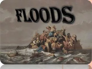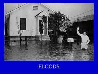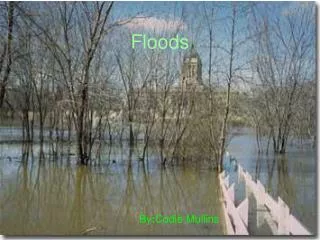
FLOODS
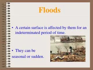
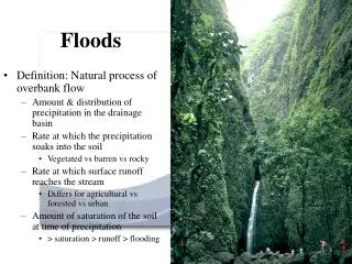
FLOODS. PG. 50 FLOODS CHAPTER 12 Part of the Hydrologic Cycle - the circulation of Earth's water supply Streams are defined as running water confined to a channel that moves due to gravity Streams are erosional (take stuff away) and depositional (leave stuff behind) agents

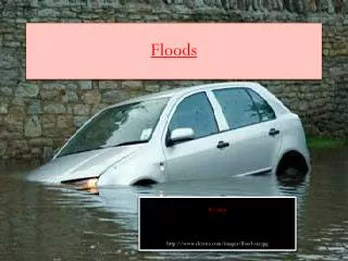
FLOODS
E N D
Presentation Transcript
FLOODS PG. 50 FLOODS CHAPTER 12 Part of the Hydrologic Cycle - the circulation of Earth's water supply Streams are defined as running water confined to a channel that moves due to gravity Streams are erosional (take stuff away) and depositional(leave stuff behind) agents Variables that control a stream's ability to erode and transport material depends on VELOCITY (including discharge and gradient) available sediment and channel sinuosity.
FLOODS PG. 50 1. Three things affect velocity A. Gradient - the slope of a stream channel sinuosity=channel length/straight line length MOST STREAMS FOLLOW THIS RULE 1.) lower gradient=downstream section =higher sinuosity= meandering 2.) higher gradient = upstream section=lower sinuosity= straighter BOARD and ROPE demo B. Channel Characteristics - reduce friction a. shape- semicircle ideal; least amount of water in contact with channel b. roughness- smooth less friction c. size- reduce ratio of WETTED perimeter to x-section.
FLOODS PG. 50 1. Three things affect velocity:continued C. Discharge - volume of water that flows past a point in a given unit of time (cfs) a. measured in CFS (cubic feet per second) b. AV=Q A is cross-section area (width x depth) V is velocity Q is discharge The river is a flowing “loaf” of bread and the cross section is a “slice” of bread. The discharge is simply adding up all the slices and wha la you get the total volume/dischage “the loaf”
FLOODS • Pg. 51 • Streams seek equilibrium (give and take) – • a state of balance between • deposition (put) and erosion (take). • Stream equilibrium depends on • 1.) discharge • 2.) available sediment that can be moved • 3.) gradient • 4.) sinuosity of the stream channel • For every change in one or any of the above the stream will respond and attempt to return to equilibrium by doing almost the opposite
FLOODS ADD Pg. 51 NEGATIVE FEEDBACK: a change will elicit or cause an opposite change to return BACK to the previous state. POSITIVE FEEDBACK: a change causes further changes. EXAMPLES Does negative mean bad? always, never, sometimes? Is positive mean good? always, never, sometimes?
FLOODS Pg. 51 Increase discharge causes an increase in velocity and thus energy the stream has. This increases EROSION of the stream bottom or increases SINUOSITY of the channel by eroding the stream banks. Increase load causes sediment deposition on stream bottom creating a braided stream (lots of sand bars).
FLOODS Pg. 51 ADD THIS SO LET’S THINK ABOUT HOW A RIVER WILL RESPOND TO CHANGES: THOUGHT EXPERIMENTS CASE #1: Too much discharge The river tries to reduce this increase of discharge/velocity HOW WILL IT SLOW ITSELF DOWN? 1.) excess energy erodes the stream bottom ND pg. 374 fig. 13.4 2.) excess sediments will also use up excess energy 3.) the vertical drop will decrease-river is trying to get closer to base level which slows down river. ND pg. 374 fig. 13.4
FLOODS Pg. 51 CONTINUED ADD THIS SO LET’S THINK ABOUT HOW A RIVER WILL RESPOND TO CHANGES: THOUGHT EXPERIMENTS CASE #1: Too much discharge. The river tries to reduce this increase of discharge/velocity HOW WILL IT SLOW ITSELF DOWN? 4.) A river may also slow itself down by eroding the banks AND therefore increasing it’s path-increasing sinuosity. ND pg. 376 Fig. 13.6 BOARD DEMO with rope.
FLOODS Pg. 51 CONTINUED ADD THIS SO LET’S THINK ABOUT HOW A RIVER WILL RESPOND TO CHANGES: THOUGHT EXPERIMENTS CASE #2: Too much load. The river gets choked with sediments. This causes deposition/build up of sediments. The river tries to increase the velocity to help increase erosion/taking away the excess sediments. HOW WILL IT SPEED ITSELF UP? 1.) The build up of sediments increases slope=increase in velocity ND pg. 378 fig. 13.7 and fig. 13.6 2.) straightening the channel increases slope=take away sediments BOARD AND ROPE DEMO
FLOODS Pg. 51 3. Streams erode (removal of material) by: A.) Hydraulic action - generally unconsolidated material Push and pull of the moving of water. B.) Abrasion – “sand blasting” and “sand papering” with transported material (load) bedrock channel eroded as load (sediments) scrapes along. ADD these are both controlled by…. Discharge HOW? Sediment load HOW? Which river is eroding more? WHY? River 1 River 2
FLOODS • Pg. 51 • 4. Streams transport material • A. suspended load- Suspension – “floaties” • Bed Load - move along bottom, too large to be • suspended – rolled and bounced-Logan River boulders River Flow Suspended Load Bed Load
FLOODS Pg. 51 5. Control on erosion and stream valley development A. BASE LEVEL- a. Ultimate base level - ocean b. Temporary base level - lake, main stream to tributary ADD c. When a river reaches base level there is no more “down” to drive the river and the river is at equilibrium BOARD DEMO and Board sketches
FLOODS • Pg. 52 • Anything that changes base level will affect • the erosional ability of the stream • a. Earthquake/faults causing uplift land will cause….? • b. drop sea level will cause….? • c. remove temporary base level will cause…? • Let’s check it out • Remember how a river wants to reach equilibrium? • BOARD DEMO for each
FLOODS • Pg. 52 • Any change in gradient will change erosional ability • of stream. WHY??? This diagram again. • a. Channelization -river cutting deeper into the ground • and moving debris out of channel-increases velocity • If we increase slope…? • If we decrease slope? • If we lift up an area of land? (lower base level) • If we lower an area of land? (lift up or increase base level) • BOARD DEMO
FLOODS Pg. 52 6. Stream valleys and characteristic features A. Narrow stream valleys-tend to be young and/or farther upstream a. V-shaped, steep valley walls b. waterfalls and rapids common c. relatively straight channel d. far from (above) base level, erode downwards lots of channelization WHY???????
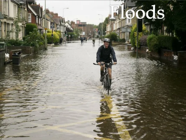
FLOODS Pg. 52 B. Wide stream valleys -tend to be old and/or farther down stream a. wide valleys b. floodplains, meanders Flood plain photo -Why would people live here? c. very sinuous channel (meanders) d. close to base level, erode laterally (meanders)-Not much channelization e.) ADD where on a meander does erosion take place? WHY? WHY??????
FLOODS • Pg. 53 • Why do floods occur? • Streams develop channels during times of normal • rainfall/normal streamflow • 2. Floods occur when: • a) precipitation is above normal in drainage basin • b) sudden snow/ice melt • c) landslides-damming • Basically, too much water for the channel that was created under “normal” conditions.
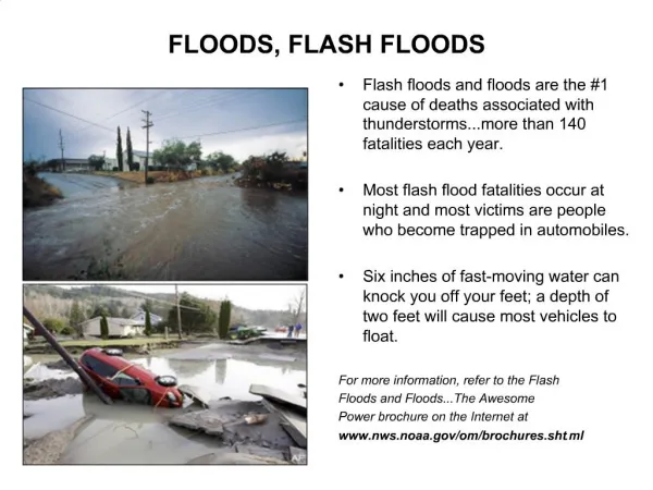
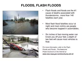
FLOODS • Pg. 53 • TYPES OF FLOODS • FLASH FLOODS - very rapid, usually small drainage • basin • occur in semi arid areas most often • canyons most dangerous
FLOODS Pg. 53 FLASH FLOOD CASE STUDY 1) Antelope Canyon, AZ 1997 (Photo: NWS-Flagstaff) a) slot canyon - up to 100’ deep and few feet wide b) rain in area 11 miles away c) 11’ high wall of water moved down canyon d) 11 dead - one survivor (guide only one to survive. Hmmmm… makes ya wonder)
FLOODS Pg. 54 2) Big Thompson Canyon, CO 1976 popular recreation area outside of Denver Photo by W. R. Hansen, Courtesy US Geological Service a) 139 dead b) $36 - 50 million in damage c) 7.5 “ rain in 4 hours ND pg. 382 fig. 13.15 d) 20’ high wall of water e) New Road Signs - climb to safety in case of flash flood!
FLOODS Pg. 54 2. REGIONAL OR SLOW-RISE FLOODS High water may cover an area for weekscause extensive damage Occur in large river valleys.
FLOODS • Pg.54 • REGIONAL FLOOD CASE STUDY • 1) Mississippi River 1993 • Most expensive and deadly ever - $15-20 Billion • 48 dead • b) Why did it happen? • 1. weather - Jan -July >ave. rainfall in drainage basin • 2. Dikes and Levees help make flood BIG • 3. How do levees fail? ND pg. 387 fig. 13.21 and 13.22 • PHOTO 1PHOTO 2
FLOODS Pg. 54-55 1717 New Orleans build levees 1879 major emphasis on levee building 1927 more levees and dams Despite all these efforts the river still floods. When you contain the water in dikes/levees you are creating potential for a HUGE flood. Levee systems give a false sense of security and lead to increased development in flood-prone areas. Some say remove levees - others argue they help.
FLOODS Pg. 55 HOW OFTEN DO FLOODS OCCUR? 1. Calculate flood frequency = how large and how often Need a flood frequency curve ND pg. 379 Fig. 13.12 Data on discharge from stream from gauging station a) highest discharge each year plot against time
FLOODS Pg. 55 continued HOW OFTEN DO FLOODS OCCUR? b) curve constructed = gives discharge expected for 50 and 100 year floods. AND others too. c) there is a 1% chance any given year that you may have a 100 year flood - does not mean happens every 100 years EXACTLY. Recurrence interval = certain sized flood happens every 100 years ON AVERAGE AND BASED ON THE DATA WE HAVE COLLECTED MORE TIME=MORE DATA=BETTER PREDICTIVE ABILITY Annual Probability =reciprocal of recurrence interval EXAMPLES AND ND pg. 378 Fig. 13.11 ND pg. 379 Table 13.2
FLOODS • Pg. 55 • URBANIZATION AND FLOODING • RECALL WHAT INLFUENCES RIVER VELOCITY • 1.Floods rise faster & higher - ground paved, • causes less ground infiltration • HUMAN INDUCED channelization - clear of debris, • wider, deeper, straighter, and smoother • Net result: water velocity and discharge increased so can • erode more causing more damage • HYDROGRAPH • ND pg. 392 fig. 13.28 • Dams - do not provide flood control because they • are usually too full. They can fail.
FLOODS Pg. 56 CASE STUDY 1) Tijuana and San Diego - a) Tijuana channels and San Diego doesn’t – water spreads out in S.D.= flooding WHY?? ND pg. 394 Fig. 13.31
FLOODS Pg. 56 2) Tucson - not consistent with building protective walls no walls and stream widens & erodes ND pg. 396 fig. 13.35 Statement by Metropolitan Tucson Convention and Visitor Bureau The 100-year flood has come and gone, so, by all rights, Tucsonans should enjoy another century of great southwestern weather.
a.) b.) 3m 3m 1m 1m 24m 8m c.) 4m 4m 6m FLOODS QUIZ 1.) What feature is this feature? 2.) The cross section of the rivers below is the same, what is this cross sectional area? a.) 24m2 b.) 12 m2 c.) 8m2 d.) 6m2
a.) b.) 3m 3m 1m 1m 24m 8m c.) 4m 4m 6m FLOODS QUIZ 3.) Which channel will produce the most friction due to wetted perimeter? a.)a b.)b c.) c
FLOODS QUIZ 4.) Which stream is probably the slowest due to friction? 5.) Which stream represents a highly channelized stream? a. b. c.
FLOODS • QUIZ • 6.) What is the main thing that influences a streams • ability to transport and erode? • sediment size B) meander pattern C) velocity • D) hydraulic action E) drainage patterns • 7.) What are the 3 main things that control velocity • a.) meanders, sediment load, gradient • b.) hydraulic action, channel characteristics, sediment load • c.) discharge, abrasion, bed load • d.) gradient, channel characteristics, discharge
FLOODS QUIZ 8.) Which of the following represents a river high above base level? 9.) Which of the following would be eroding more? 10.) Depositing more? a. OCEAN b. OCEAN c. OCEAN
FLOODS 11.) Flash floods are best described as a.) fast and covering large area b.) slow and covering large area c.) fast covering small area d.) slow covering small area 12.) Big Thompson Canyon is best described as a.) fast and covering large area b.) slow and covering large area c.) fast covering small area d.) slow covering small area
FLOODS 12.) What is the annual probability of a 500 year flood occurring? a.) .02% b.) .2% c.) 2% d.) 20%