Download
1 / 19
190 likes | 383 Vues
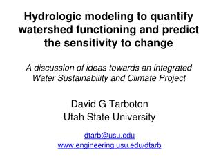
The CUAHSI Hydrologic Information System and NHD Plus A Services Oriented Architecture for Water Resources Data. David G Tarboton David R. Maidment (PI) Ilya Zaslavsky Michael Piasecki Jon Goodall. Support EAR 0622374. http://www.cuahsi.org/his.html. What is CUAHSI?.

E N D
The CUAHSI Hydrologic Information System and NHD PlusA Services Oriented Architecture for Water Resources Data David G Tarboton David R. Maidment (PI) Ilya Zaslavsky Michael Piasecki Jon Goodall Support EAR 0622374 http://www.cuahsi.org/his.html
What is CUAHSI? • CUAHSI –Consortium of Universities for the Advancement of Hydrologic Science, Inc • Formed in 2001 as a legal entity. 115+ US Universities • Program office in Washington (5 staff) • NSF supports CUAHSI to develop infrastructure and services to advance hydrologic science in US universities
CUAHSI HIS The CUAHSI Hydrologic Information System (HIS) is a geographically distributed network of data sources and functions that are integrated using web services oriented architecture so that they operate as a connected whole.
CUAHSI Hydrologic Information System Models Databases Analysis Goal: Enhance hydrologic science by facilitating user access to more and better data for testing hypotheses and analyzing processes • Advancement of water science is critically dependent on integration of water information • It is as important to represent hydrologic environments precisely with data as it is to represent hydrologic processes with equations Water quantity and quality Rainfall & Snow Soil water Meteorology Remote sensing
Data Access System for Hydrology (DASH) Website Portal and Map Viewer Preliminary data exploration and discovery. See what is available and perform exploratory analyses 3rd party data servers e.g. USGS, NCDC Internet Service Oriented Architecture for Water Resources Data Downloads Uploads Analysis and Modeling applications HTML -XML Data access through web services GIS WaterOneFlow Web Services Matlab IDL WSDL - SOAP Data storage through web services Splus, R Excel Programming (Fortran, C, VB) Observatory data servers CUAHSI HIS data servers ODM ODM WaterML
HIS Implementation in WATERS Network Information System National Hydrologic Information Server San Diego Supercomputer Center • 11 WATERS Network test bed projects • 16 ODM instances (some test beds have more than one ODM instance) • Data from 1246 sites, of these, 167 sites are operated by WATERS investigators
Streamflow Groundwater levels Precipitation & Climate Soil moisture data Time Water Quality Flux tower data Space Variables CUAHSI Observations Data Model • A relational database at the single observation level (atomic model) • Stores observation data made at points • Metadata for unambiguous interpretation • Traceable heritage from raw measurements to usable information • Standard format for data sharing • Cross dimension retrieval and analysis
Point Observations Information Model http://www.cuahsi.org/his/webservices.html Utah State Univ Data Source GetSites Little Bear River Network GetSiteInfo Little Bear River at Mendon Rd Sites GetVariables GetVariableInfo Dissolved Oxygen Variables GetValues 9.78 mg/L, 1 October 2007, 6PM Values {Value, Time, Qualifier, Offset} • A data source operates an observation network • A network is a set of observation sites • A site is a point location where one or more variables are measured • A variable is a property describing the flow or quality of water • A value is an observation of a variable at a particular time • A qualifier is a symbol that provides additional information about the value • An offset allows specification of measurements at various depths in water Horsburgh, J. S., D. G. Tarboton, D. R. Maidment and I. Zaslavsky, (2008), "A Relational Model for Environmental and Water Resources Data," Water Resources Research (in press).
Web pages Web services We are at a tipping point …. Internet Internet Computer Person Computer Computer People interact with a remote information server Networks of information servers provide services to one another
Water web pages Water web services Information communication Water Markup Language (WaterML) HyperText Markup Language (HTML)
Return data in WaterML Set of query functions WaterOneFlow http://river.sdsc.edu/wateroneflow/ Open Geospatial Consortium, Inc. (2007), CUAHSI WaterML, OGC Discussion Paper, OGC 07-041r1, Version 0.3.0, Zaslavsky, I., D. Valentine, and T. Whiteaker Editors, http://www.opengeospatial.org/standards/dp,
Hydroseekhttp://www.hydroseek.org Supports search by location and type of data across multiple observation networks including NWIS, Storet, and university data
Digital Watersheds A digital watershed is a structured collection of digital representations of inter-related hydrologic objects and measurements that facilitates integrated modeling and analysis.
NHDPlus as a foundation for Digital Watersheds Basins: Administratively chosen drainage areas Watersheds: A tesselation of a basin for a particular purpose Catchments: A tesselation of a basin using physical rules NHDPlus Digital Elevation Model: a representation of the land surface as a spatial continuum
A Digital Watershed connects geospatial and temporal water resources data Streamflow Digital Watershed NHDPlus Weather
Summary • CUAHSI Hydrologic Information Server is functioning at all WATERS Network testbed sites • Academic Investigator and water agency (USGS) data are published in a consistent format (WaterML) • Hydroseek thematically synthesizes registered sources of WaterML data • Applications and analyses can operate seamlessly over the WATERS Network data services • A lot more to be done – GIS, weather and climate, remote sensing, simulation modeling, interpretive analysis, ….. Digital Watershed development!
Getting your own HIS Server • Platform • PC, Windows 2003 Server, IIS 6.0, SQL Server 2005, .Net Framework 2.0, ASP .Net 2.0, ArcGIS Server 9.2 (for DASH) • HIS Software • ODM (+Tools and Data Loaders) • WaterOneFlow Web Services • DASH http://river.sdsc.edu/Wiki/HISServer.ashx http://river.sdsc.edu/Wiki/HIS light.ashx For more information contact: Ilya Zaslavsky zaslavsk@sdsc.edu.
HIS Websitehttp://www.cuahsi.org/his.html • Project Team – Introduces members of the HIS Team • Data Access System for Hydrology – Web map interface supporting data discovery and retrieval • Prototype Web Services – WaterOneFlow web services facilitating downlad of time series data from numerous national repositories of hydrologic data • Observations Data Model – Relational database schema for hydrologic observations • HIS Tools – Links to end-user applications developed to support HIS • Documentation and Reports – Status reports, specifications, workbooks and links related to HIS • Feedback – Let us know what you think • Austin Workshop – Material from WATERS workshop in Austin