Download
1 / 26
260 likes | 360 Vues
Learn the basics of maps and directions, from the Earth's rotation to using a globe. Understand latitude, longitude, and the compass rose. Explore different map styles and symbols, such as the Werner and Goode projections. Discover how maps help us navigate and understand geographic features.

E N D
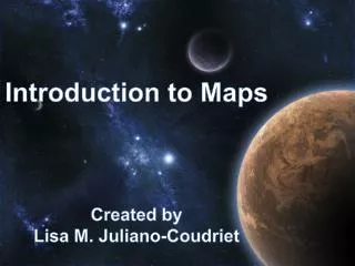
Introduction to Maps Created by Lisa M. Juliano-Coudriet
The direction of the Earth’s rotation, as it revolves (travels) around the Sun.
How do we use a Globe? North Equator West East South First, we have to learn how to tell directions.
Understanding the Globe North West East 0, 0 South
Longitude Latitude Larry the long legged Giraffe hiked up and down the trails. While Dominic the Donkey with the attitude walked around in circles.
Compass Rose • A compass rose is a design on a map that shows directions. It shows north, south, east, west, northeast, northwest, southeast, and southwest. On the compass rose, only north is filled in. Fill in the rest of the directions on the compass rose, using the standard abbreviations: • N=North, • S=South, • E=East, • W=West, • NE=Northeast, • NW=Northwest, • SE=Southeast, • SW=Southwest. • When north is at the top of the compass rose (as it often is), south is at the bottom, east is on the right, and west is on the left. Northeast is between north and east, northwest is between north and west, southeast is between south and east, and southwest is between south and west. NW NE W E SE SW S
The Compass Rose has many different designs, below are a few.It should always put on the map with the North pointing Northward.
Magnetic North attractsthe needle in the compass to ALWAYSpoint towards the North Pole.
You can see all seven continents as the Earth rotates. • Africa • Antarctica • Asia • Australia • Europe • North America • South America
What is the name of the continents you see in this picture? ? • Africa • Antarctica • Asia • Australia • Europe (Greenland which is part of Demark) • North America • South America • Africa • Antarctica • Asia • Australia • Europe • North America • South America ? ?
Different styles of maps. Werner projection Goode homolosine projection Mollweide projection
Government Use Map from C.I.A. website: cia.gov
0 50 100 Distance Scale National Capital Legend / Map Key National Border State Border State Border State Capital Railroad Track Compass Rose Trail Airport Mountains Bus Depot River Police Hospital
These types of maps gives us a clue to what each state produces.
Sources:Wikipedia.comCentral Intelligence Agency: CIA.comScholastic.comEncarta.comflashearth.comNational Geographic.comCreated By Lisa M. Juliano-Coudriet