Download
1 / 32
350 likes | 759 Vues
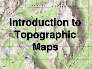
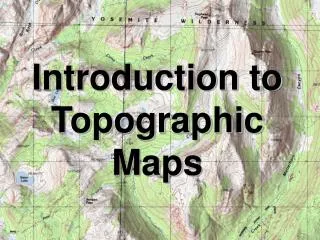
Introduction to Topographic Maps. Topographic Maps. Two dimensional model of the Earth’s surface (represents 3-D world) Topographic maps are also known as contour maps . Show elevation above sea level using contour lines. “Real World”. Contour Map. Topographic Maps. Contour Line –

E N D
Topographic Maps • Two dimensional model of the Earth’s surface (represents 3-D world) • Topographic maps are also known as contour maps. • Show elevation above sea level using contour lines.
“Real World” Contour Map
Topographic Maps • Contour Line – - line on a map that connects points of EQUAL elevation. - show elevation and shape of the land • Relief – Difference between high and low elevations
Topographic Maps • Contour Interval – difference in elevation between each line. MUST be equal spacing. Contour interval = 20 feet 580 560 540 520
Topographic Maps • Index Contour – Usually every 5th line is printed darker and has an elevation printed on it.
Rules for Contours • Contour lines never cross
Rules for Contours 2. Contours form closed loops (even if not shown of the map.
Rules for Contours 3. Contours bend upstream (uphill) when crossing a stream.
Rules for Contours • The maximum possible elevation for a hill is “1” less than what the next contour “should” be. The highest possible elevation of the hill is just below the value of the next line that is not shown 90 80 70 60 50
399 179 239
Closely Spaced Contours • Steeper Slope (Gradient) – contour lines are closer together.
Wide Spaced Contours • Gradual/Gentle Slope (Gradient) – contour lines are farther apart.
A B
Depressions • Contour lines which show a depression, crater, or sinkhole on a map. • Shown by dashed lines (hachure marks) on the inside of a contour line • The elevation of the first depression contour is the same as the lowest regular contour near it.
Rules for Contours The lowest possible elevation for a depression is “1” more than what the next contour “should” be. The lowest possible elevation of a depression is just above the value of the next line that is not shown 90 90 51 80 70 60 50
100 100 50
Benchmarks • a location whose exact elevation is known and is noted on a brass or aluminum plate. • bench marks are shown on maps by an X with the letters BM written next to them.
Map Scales • Indicates the distance on the map compared to distance in the real world • Graphical - by a line divided into equal parts and marked in units of length.
Map Scales • Numerically – usually by writing a fraction to show what part of the true distances map distances really are. • 1:63,360 • One inch on the map equals 63,360 Inches in the real world. (There are 63,360 inches in a mile)
Gradient • The slope between any two points on a hill • Gradient = Change in Field Value Distance
Gradient • A trail is four miles long as measured by the scale on a map. The beginning of the trail is at the 1,060 ft contour line and the end of the trail is at the 960 ft contour line. Calculate the gradient of the trail. Gradient = = 1060 ft – 960 ft 4 miles 25.0 ft/mi
Gradient Contour Interval = 20 ft 200 0 2 4 6 8 10 miles