Exploring Disasters: Understanding Extreme Results
This course examines the processes leading to extreme results through the study of weather-related disasters, earth reactions to stresses, disease-caused disasters, and man-made disasters like habitat loss, threats to people, and pollution. Delve into the history of Haiti, from civil wars to dictator rule, up to the devastating earthquake of January 12, 2010. Gain insight into the socio-political turmoil that has plunged Haiti into poverty, making it the poorest country in the Americas. Explore the impact of the magnitude 7.0 earthquake that struck Haiti, causing widespread destruction and loss of lives, and learn about the aftershocks that followed. Join us on a journey to understand the complexities of disasters and their far-reaching consequences.


Exploring Disasters: Understanding Extreme Results
E N D
Presentation Transcript
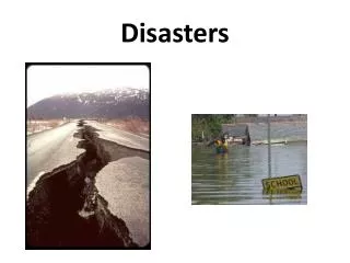
Ms. Pelletier Disasters
This course examines the processes leading to extreme results.We will study weather related disasters, disasters involving the way the earth reacts to stresses, and we will explore disasters that are caused by disease. Wewill also research man-made disasters, including loss of habitat, man-made threats to people, and pollution.
January 12, 2010 - Quake Haiti – already had problems • Haiti is part of the island of Hispanola; which it shares with the country of Santo Domingo; • southeast, off the coast of Florida. • It was established in 1804, after the world’s first successful black slave rebellion • led by Jean-Jacques Dessalines against France. • Civil war and power struggles caused terrible disorder.
Haiti Continues its turbulent history • From 1915 to 1934, U. S. Troops occupied Haiti to quell unrest. • In 1937, a Dominican Dictator, Rafael Trujillo, engineered the massacre of at least 18,000 • Haitians. • In 1957, Francois “Papa Doc” Duvalier took power by force, and ruled by brutally • killing all opposition. Tens of thousands of Haitian’s were tortured and killed under • Duvalier and his son, “Baby Doc.”
Current History Shows Poverty Stricken Country • In 1990, A free election chose Jean-Betrand Aristide, a slum priest, but he was driven out • By a military dictatorship in 1991. • President Bill Clinton sent troops to Haiti in 1994, to bring Aristide back to office. • Later, Aristride was accused of corruption and the military took control until 2006, when the current president, Rene Preval was elected. • The unrest in Haiti’s history has lead to making it the poorest country in the Americas. • The country has been unstable so long, that the infrastructure (buildings, construction, roads, schools, hospitals, etc.) are below a good standard of living.
Magnitude 7.0 HAITITuesday, January 12, 2010 at 21:53:09 UTC A powerful earthquake hit the impoverished country of Haiti on Tuesday, collapsing the presidential palace and numerous other critical government buildings and raising fears of substantial casualties in what a witness called “a major, major disaster.” NBC News Before and After Earthquake Presidential Palace in Port-au-Prince, Haiti
Magnitude 7.0 HAITITuesday, January 12, 2010 at 21:53:09 UTC The earthquake occurred about 10 miles west of the capital of Haiti, Port-au-Prince, and caused extreme shaking. USGS Shaking Intensity Mike Blanpied of the US Geological Survey said that, based on the location and size of the quake, about three million people would have been severely shaken by its impact. Perceived Shaking Extreme Violent Severe Very Strong Strong Moderate Light Weak Not Felt Modified Mercalli Intensity
Magnitude 7.0 HAITITuesday, January 12, 2010 at 21:53:09 UTC Left: Photo taken prior to the earthquake. Low income housing- unreinforced masonry. Below: After Further complicating the situation, many people live in structures that are vulnerable to earthquake shaking. BBC
Magnitude 7.0 HAITITuesday, January 12, 2010 at 21:53:09 UTC Carel Pedre via Twitter BBC "Thousands of people were feared dead today after a powerful earthquake struck Haiti's capital, leaving tens of thousands homeless and buried beneath rubble....Thousands of people gathered in public squares late into the night, singing hymns and weeping, with many seriously injured people sitting in the streets pleading for doctors." The Gazette, U.K.
Magnitude 7.0 HAITITuesday, January 12, 2010 at 21:53:09 UTC Eyewitness Carel Pedre, TV and radio presenter, Port-au-Prince I saw a lot of people crying for help, a lot of buildings collapsed, a lot of car damage, a lot of people without help, people bleeding. I saw a movie theatre, a supermarket, a cybercafe, an apartment building which collapsed. Now it's dark outside, there is no electricity, all the phone networks are down, so there's no way that people can get in touch with their family and friends. There are aftershocks every 15 to 20 minutes. They last from three to five seconds. The first shock was really strong, people were falling in the streets and buildings collapsed. I didn't see any emergency services, the people at the neighbourhood were trying to help each other. The streets are narrow and there is lot of traffic and everyone is trying to reach family and friends. Traffic now is really difficult. People don't know where to go or where to start.
Magnitude 7.0 HAITITuesday, January 12, 2010 at 21:53:09 UTC Aftershocks This earthquake was followed by five powerful aftershocks within the first two hours after the devastating quake. USGS Left: Aftershocks (yellow) In the first eleven hours after the earthquake there have been 32 aftershocks greater than magnitude 4. Google Earth
Magnitude 7.0 HAITITuesday, January 12, 2010 at 21:53:09 UTC Earthquake and Historical Seismicity This earthquake (star), plotted with regional historical seismicity, occurred on the transform plate boundary between the Caribbean and North American plates. As expected for an earthquake on a transform boundary, the depth of the event was quite shallow at about 10 km. The depth and proximity to the population center contributed to the destruction. This powerful earthquake was the largest magnitude this region has seen in two centuries. USGS
Magnitude 7.0 HAITITuesday, January 12, 2010 at 21:53:09 UTC North American Plate Caribbean Plate Pacific Plate Cocos Plate Regional Tectonics This map shows the rates and directions of motion of the Cocos, Pacific, and Caribbean plates with respect to the North American Plate. The small arrows on the Caribbean Plate show that it moves eastward at a rate of about 20 mm/yr (2 cm/year) with respect to the North American Plate. This is a fairly slow rate of transform motion between the Caribbean and North American plates. For comparison, the rate of transform motion across the San Andreas transform fault between the North American and Pacific plates is about 50 mm/yr (5 cm/yr). Divergent Plate Boundaries (red lines) Transform Plate Boundaries (yellow lines)
Magnitude 7.0 HAITITuesday, January 12, 2010 at 21:53:09 UTC Haiti occupies the western part of the island of Hispaniola. At the longitude of the earthquake, motion between the Caribbean and North American plates is partitioned between two major east-west trending, strike-slip fault systems -- the Septentrional fault system in northern Haiti and the Enriquillo-Plantain Garden fault system in southern Haiti. Mann The location and focal mechanism of the earthquake are consistent with the event having occurred as left-lateral strike slip faulting on the Enriquillo-Plantain Garden fault system. This fault system accommodates about 7 mm/y, nearly half the overall motion between the Caribbean plate and North America plate. USGS Centroid Moment Tensor
Magnitude 7.0 HAITITuesday, January 12, 2010 at 21:53:09 UTC The record of the January 12, 2010 Haitian earthquake on the University of Portland seismometer is illustrated below. Portland is about 5500 km (~3400 miles) from the location of this earthquake. P and S waves traveled through the Earth’s mantle from the earthquake to this seismograph in Portland, Oregon. (P waves are compressional waves while S waves are shear waves). It took about 8 minutes and 50 seconds for the first P waves to arrive while the S waves started arriving about 15 minutes and 58 seconds after the earthquake. PP is a prominent arrival on this seismogram. PP waves are compressional waves that bounce off the Earth’s surface halfway between the earthquake and the station.
Magnitude 7.0 HAITITuesday, January 12, 2010 at 21:53:09 UTC Quick Time Required Animation of the generalized path of seismic waves traveling from the Hatian earthquake to a seismometer in Portland, Oregon http://www.iris.edu/hq/retm Jenda Johnson
Magnitude 7.0 HAITITuesday, January 12, 2010 at 21:53:09 UTC Seismic Waves Cross the Country EMIL UPOR SBNY CHCA CAOK NLNC Google Earth
Why Didn’t The Haiti Earthquake Generate a Tsunami?http://www.iris.edu/hq/retm http://www.iris.edu/hq/retm