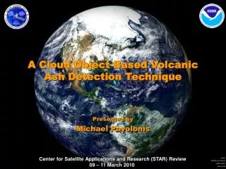
Volcanic Ash Detection Using GOES
Volcanic Ash Detection Using GOES. Ken Pryor NOAA/NESDIS/STAR. Outline. Introduction Volcanic Ash Detection Application of GOES IR channel data Explanation of detection technique Case studies/exercises Summary. Background. See VISIT lesson: “ The GOES 3.9 mm Channel”

Volcanic Ash Detection Using GOES
E N D
Presentation Transcript
Volcanic Ash Detection Using GOES Ken Pryor NOAA/NESDIS/STAR
Outline • Introduction • Volcanic Ash Detection • Application of GOES IR channel data • Explanation of detection technique • Case studies/exercises • Summary
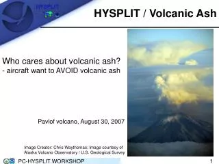
Background • See VISIT lesson: • “The GOES 3.9 mm Channel” • http://rammb.cira.colostate.edu/visit/3-9.html
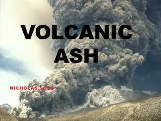
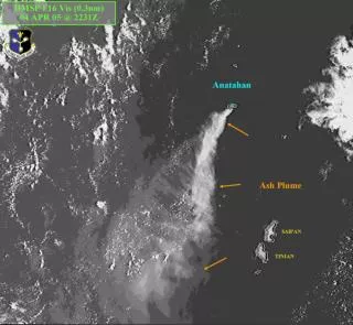
Introduction • Volcanic ash represents a serious hazard to high altitude jet aircraft along major air routes adjacent to active volcanoes. • In addition to damaging the leading edge surfaces of aircraft, ash ingested into jet engines results in loss of performance, and possibly complete shutdown. • The continued increase in international air traffic will lead to a higher likelihood of volcanic ash encounters.
From: FAA Aviation Safety Journal Vol. 2 (3) Introduction Mt. Redoubt, AK 1750 UTC 26 March 2009 Volcanic ash damage to aircraft Taken from Diamond Ridge near Homer, AK
Application of IR Data • Band 5 (12um) is not as transparent as band 4 (11um), with absorption due to low level moisture resulting in slightly cooler brightness temperatures than in band 4 (Ellrod and Connell 1999). • The reverse absorption effect has been found for volcanic aerosols and ash (Volz 1973), resulting in slightly warmer brightness temperatures in band 5 than in band 4. • Band 2 (3.9 um) is also a window channel with very little moisture absorption that is very sensitive to heat sources (such as fires or volcanoes), and can also provide information about cloud phase.
Application of IR Data • Even in bright daytime scenes, ash clouds stand out against the background if they are sufficiently dense (Ellrod and Schreiner 2004). • Volcanic ash is clearly distinguishable from cirrus, mid-level clouds, and oceans. • If only thermal IR data are used, the ash would be virtually indistinguishable from other cloud types in the region due to similar brightness temperatures.
Detection Technique • GOES-West Detection Algorithm (Ellrod and Connell 1999): • B = C + m (T5 - T4) + (T2 - T4) • where B is output brightness temperature (K), C is a constant, m is a scaling factor, and T2, T4, T5 are the brightness temperatures (K) for bands 2, 4 and 5 respectively. The T5 - T4 difference is used since it results in a positive value for volcanic ash.
Detection Technique • GOES-East Detection Algorithm (Ellrod and Schreiner 2004): • B=5(T2-1.5T4 + 1.5T6)-230 or • B=5(DT)-230 • where T6 is band 6 brightness temperature. DT values between 230 and 300 are scaled to output brightness counts between 0 and 255. Values of B that are large relative to surrounding clouds and terrain represent volcanic ash.
Detection Technique GOES-West Method GOES-West Method
Detection Technique GOES-East Method
Volcanic Ash Detection:GOES Products http://www.orbit.nesdis.noaa.gov/smcd/opdb/aviation/volc.html
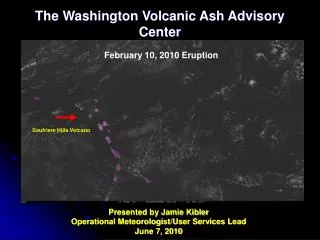
Limitations • Within hours of an eruption, the presence of copious amounts of water in the volcanic eruption cloud often results in non-discrimination of ash (Ellrod and Connell 1999). • Deep moist tropical conditions can mask the presence of volcanic ash, or prevent clear discrimination of the ash from meteorological clouds: • Especially applicable to eruptions of smaller volcanoes that emit ash into the lower and middle troposphere, such as the Soufriere Hills volcano.
Limitations • Loss of band 5(12um) with GOES-12 (Ellrod and Schreiner 2004): • An important modification to the GOES-12 Imager was the replacement of 4 km resolution, 12 um IR band 5 with lower resolution (8 km) IR band 6 centered near 13.3 um. • The 12 um band will not be restored until GOES-R becomes operational. • Some degradation of remote sensing of volcanic ash is likely, leading to both underdetection of thin ash, and an increase in the area of ‘‘false’’ ash, resulting in possible over-warning for aviation advisories.
Case 1: Redoubt, Alaska26 March 2009 • Daytime eruption • Explosive eruption at 1724 UTC (0924 AKDT). • Ash cloud height of 65,000 ft above MSL with pilot reports of a plume height of 60,000 ft. • Ashfall advisory was issued for the western Kenai Peninsula.
Case 2: Soufriere Hills,West Indies, 10 January 2009 • Nighttime eruption • Explosive eruption at 0530 UTC. • Ash cloud height was estimated as high as 22,000 ft above MSL. • Lower level ash emissions with height estimated near 8,000 ft above MSL.
Summary and Conclusions • GOES can effectively detect volcanic ash and show areal extent. • While the loss of the 12 um IR band is likely to degrade the overall volcanic ash detection capability somewhat, some case studies have shown that imagery from GOES-12 and its successors will prove to be an effective means of warning pilots of hazardous ash clouds in many situations. http://www.orbit.nesdis.noaa.gov/smcd/opdb/aviation/volc.html
References • Casadevall, T. J., 1992: Volcanic hazards and aviation safety: Lessons of the past decade. Aviation Safety Journal, Vol. 2, No. 3, Federal Aviation Administration, Washington, DC • Davies, M. A., and W. I. Rose, 1998: Evaluating GOES imagery for volcanic cloud observations at the Soufriere Hills volcano, Montserrat. Amer. Geophys. Union Proc., in press. • Dean, K., S. Bowling, G. Shaw, and H. Tanaka, 1994: Satellite analysis of movement and characteristics of the Redoubt Volcano plume, January 8, 1990. J. of Volcanology and Geothermal Research, 62, 339-352.
References • Ellrod, G.P. and B. Connell, 1999: Improvements in Volcanic Ash Detection Using GOES Multi-spectral Image Data. Preprints, Conf. on Aviation, Range and Aerospace Meteorology, 10-15 January, 1999, Dallas, Texas, Amer. Meteor. Soc., Boston. • Ellrod, G.P. and A.J. Schreiner, 2004: Volcanic ash detection and cloud top height estimates from the GOES-12 imager: Coping without a 12 micrometer infrared band. Geophys. Res. Letters, 31, L15110, 11 August 2004. • Volz, F. E., 1973: Infrared optical constants of ammonium sulfate, Sahara dust, volcanic pumice and flyash. Applied Optics,12, 564-568.