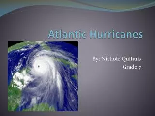
North Atlantic Hurricanes
This presentation by Jess Downing and Karen A. Kosiba explores the dynamics of North Atlantic hurricanes, detailing their classification as tropical cyclones and the complexities of their structure including the eye, eye wall, and feeder bands. The importance of warm sea surface temperatures and environmental conditions for hurricane development is discussed, alongside the hazards posed by storm surges, flooding, and wind damage. Gain insights into the hurricane season, storm naming conventions, and the Saffir-Simpson scale used to measure potential damage from these powerful storms.

North Atlantic Hurricanes
E N D
Presentation Transcript
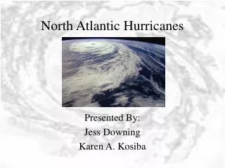
North Atlantic Hurricanes Presented By: Jess Downing Karen A. Kosiba
Hurricanes are: • Tropical cyclones. • Two-Celled Vortices (contain both upward and downward motions). • Cyclonic in the lower levels and anticyclonic in the upper levels. • Atlantic Hurricane Season: June-November
Classification • Tropical Cyclone: A tropical cyclone is the generic term for a non-frontal synoptic scale low-pressure system over tropical or sub-tropical waters with organized convection (i.e. thunderstorm activity) and definite cyclonic surface wind circulation. • Tropical Depression: TC with winds near the surface of less than 39 mph. • Tropical Storm: TC with winds 39 to 74 mph. • Hurricane: TC with winds of 74mph or greater. http://www.aoml.noaa.gov/hrd/tcfaq/tcfaqA.html#A2
Naming a Storm • Alphabetical, alternating female/male • Names of minor hurricanes are reused on a 6 yr. cycle. • The NHC retires a storm’s name if it incurred heavy losses of life or extensive property damage. • Ex: Hugo (89), Andrew (92)
Hurricane Structure • Eye • Eye Wall • Rain bands (Feeder bands)
Eye • Generally free of tall clouds. • Winds are light. • Air aloft is warm and dry. • Surface air pressures are lowest due to sinking and warming of air. • Diameter = 16-70 km Book: Hurricanes of the North Atlantic
Eye Wall • Ring of cumulonimbus clouds immediately surrounding the eye. • Contains strongest winds and heaviest rains. • Contains (the majority of) intense rising motions. Hurricanes of the North Atlantic
Spiral Feeder Bands • Appearance (from space) similar to a spiral galaxy. • Heavy rains and squalls (strong winds of short duration with sudden onset/dissipation). • Outermost bands can be 1000 km from hurricane center. Hurricanes of the North Atlantic
An Approaching Hurricane • With the arrival of the first spiral rain band—hard brief rain and sudden wind gusts. • Followed by partial clearing until the next rain band arrives and squally weather returns. • As the center of the hurricane approaches, frequency and intensity of the squall increases.
Approaching Hurricane Cont. • As the eye passes, winds become light before switching direction and gaining strength. • The largest winds occur in the right side of the vortex—the vector sum of the wind velocity and the storm velocity.
How Does a Hurricane Work?? • Hurricanes are heat engines. • Energy is provided by evaporation of warm water from oceans. • Water vapor carried up in cumulonimbus towers. • Rising air cooled by expansion leading to condensation. Hurricanes of the North Atlantic
Hurricanes Cont. • Condensation releases energy which maintains storm circulation. • This release of latent heat reduces the rate of adiabatic cooling (below that of dry air) thus providing a constant upward force on the air parcels. • As long as the upper level outflow is greater than the lower level inflow—the pressure will drop and the storm will intensify. Hurricanes of the North Atlantic
Favorable Environmental Conditions for Hurricane Development • SSTs of at least 26.5°C [80°F] throughout a depth of 50 m [150 ft]. Warm waters are necessary to fuel the heat engine of the tropical cyclone. • An atmosphere which cools fast enough with height such that it is potentially unstable to moist convection. • Relatively moist layers near the mid-troposphere 5 km [3 mi]. • A minimum distance of at least 500 km [300 mi] from the equator—Need the Coriolis Effect! • A pre-existing near-surface disturbance with sufficient vorticity and convergence. • Low values (less than about 10 m/s [20 kts 23 mph]) of vertical wind shear between the surface and the upper troposphere. Vertical wind shear is the magnitude of wind change with height. http://www.aoml.noaa.gov/hrd/tcfaq/tcfaqA.html#A10
Hurricane Movement • Hurricanes move with the air flow in which they are embedded. • Weaker storms are steered by low level winds. Strongest storms are moved by upper level winds. • Hurricanes of low latitudes track to the west—Pushed by NE trade winds. • Hurricanes of higher latitudes track more NW steered by the anticyclonic flow around subtropical high pressure system.
1999 Hurricane Season www.botany.hawaii.edu/faculty/ cm_smith/Dictyota.htm
Hurricane Damage • Storm Surge • Inland Flooding • Wind Damage • Tornadoes
Storm Surge • What is it? • Domes of water produced by the action of cyclonic winds during a hurricane, in which the sea level can be up to five meters higher than normal (Camille had a storm surge of 7m!) • Waves on top of the surge are especially damaging during high tide • Causes 90% of deaths (drowning) • Residents in low lying areas at greatest risk • Water can be pushed into bays and rivers (flooding) • Erosion • Sea water weighs 64 lbs per cubic foot!
Storm Surge Possibilities www.swfrpc.org/hurr.htm
Inland Flooding • Usually brought on by heavy, storm-induced rains that quickly swell rivers and streams • These flooding rains are most dangerous for people living inland • Hurricane Camille (69) killed 109 people in VA after making landfall in LA
Wind Damage • Ability to be most destructive to property • Wind driven flying debris • Erosion
Tornadoes • Cause most damage in local areas far removed from coastal regions. • Approximately one-fourth of landfall hurricanes produce tornadoes. • Tornadoes produced are usually F2 or below. • Tend to form in the front right quadrant of the hurricane—vertical wind shear is greatest.
Saffir/Simpson Scale and Property Damage • Cat 1: No damage to building structures. Minor damage to mobile homes, shrubbery, and trees. Some coastal road flooding and minor pier damage. Some roof, door, and window damage on buildings. • Cat 2: Considerable damage to vegetation, mobile homes, and piers. Coastal and low-lying escape routes flood 2-4 hours before arrival of eye wall. Small craft in open anchorage break moorings. Some structural damage to small residences. Hurricanes of the North Atlantic
Property Damage Con’t • Cat 3: Mobile homes are destroyed. Flooding near the coast destroys smaller structures with larger structures damaged by floating debris. Terrain lower than 5 ft ASL may be flooded inland 8 mi or more. More extensive wall failure with some complete roof structure failure on small residences. • Cat 4: Major erosion of beach. Major damage to lower floors of structures near shore. Terrain lower than 10 ft ASL may be flooded, requiring evacuation of residential areas inland to 6 miles. Complete roof failure on many homes and industrial buildings. Hurricanes of the North Atlantic
Property Damage Con’t • Cat 5: Some complete building failures with small buildings blown over or away. Major damage to lower floors of all structures located less than 15 ft ASL and within 500 yd of the shoreline. Evacuation of areas on low ground within 5 to 10 mi of shore may be required. Hurricanes of the North Atlantic
According to FEMA, Hurricane Georges cost them $2.5 billion alone. (http://www.fema.gov/library/df_7.htm) www.fema.gov/library/
Hurricane Warnings • Coastal communities are divided up into zones according to their susceptibility to damage (in order of severity): • 1. Barrier islands and beaches. • 2. Mainland surge areas exposed to over-wash flooding from the storm surge. • 3. Areas far enough inland to avoid the surge.
Hurricane Warnings Con’t • Coastal hurricane warnings are usually issued 18 to 24 hours prior to expected arrival of the hurricane. • This time interval is an optimized trade off between the desire to provide maximum warning lead time and the ability to keep the size of the warning area within reasonable limits. • Lead times are determined by how long it is expected to take to get people out of harm’s way.
Societal Vulnerability to Hurricanes • Dramatic rises in coastal populations • More people = higher property values • Approx 45 million live on coast (TX to ME) • More vacationers to coasts • Usually to the barrier islands or immediate shoreline • Problems with evacuating the crowded areas • FL keys can require up to 36 hrs to evacuate
Hurricane Deaths Have Decreased—Property Losses Have Increased www.usgcrp.gov/.../ overviewChangingNation.htm
Probability of a Named Storm http://www.aoml.noaa.gov/hrd/tcfaq/tcfaqG.html#G12
Picture Page • http://www.usgs.gov/themes/hurricane.gif • http://www.foe.co.uk/campaigns/climate/images/hurricane.jpg • http://jrscience.wcp.muohio.edu/coriolis/hurricanes.html
The Boys Who Know it All • Hurricane Hunters • Red Cross Safety Tips • Chris Landsea's FAQs