Center for Geographic Analysis: Advancing GIS Research and Education at Harvard
220 likes | 347 Vues
Established in May 2006, the Center for Geographic Analysis (CGA) at Harvard focuses on enhancing GIS infrastructure across the university. With a dedicated team, CGA provides services including consultation, training, and access to a wealth of geospatial data. They aim to foster interdisciplinary research and educational opportunities in spatial analysis. From aerial photography to satellite imagery, CGA's extensive map collection supports scholarly activities. Their monthly newsletter keeps the community informed of events, resources, and developments in GIS research.

Center for Geographic Analysis: Advancing GIS Research and Education at Harvard
E N D
Presentation Transcript
CGA Services and Harvard Map Collection Resources February 16, 2007
Center for Geographic Analysis • CGA was established in May 2006. • CGA has 3 full time staff and a few part time members (www.gis.harvard.edu). • CGA is a member organization of the Institute for Quantitative Social Science (IQSS www.iq.harvard.edu). • CGA services are available to all schools, departments and other organizations across Harvard.
CGA Goals • CGA focuses on research and education in the field of spatial analysis and geographic information. • The Center’s goal is to work with entities across the university to • strengthen university-wide GIS infrastructure and services; • provide a common platform for the integration of data from diverse sources and knowledge from multiple disciplines; • enable scholarly research that would use, improve or study geospatial analysis techniques; and • improve the ability to teach GIS and spatial analysis at all levels across the university.
CGA Services • GIS help desk - flyers available outside • University-wide GIS software site licenses - ESRI, Leica, FME. More in evaluation • Research Support - projects consultation and partnership • Courses and training - flyers available outside • Academic events - conference, workshop, colloquium, award, etc. • Monthly Newsletter - to subscribe, email contact@cga.harvard.edu • CGA website - http://www.gis.harvard.edu
CGA Governance The Center has a faculty steering committee of • Peter Bol, Faculty of Arts and Sciences, Charles H. Carswell Professor of East Asian Languages and Civilizations, Director of the Center for Geographic Analysis • Gary King, Faculty of Arts and Sciences, David Florence Professor of Government, Director of the Institute for Quantitative Social Science • Niall Kirkwood, Graduate School of Design, Professor of Landscape Architecture, Chair of Department of Landscape Architecture • Isaac Kohane, Harvard Medical School, Lawerence J. Henderson Associate Professor of Pediatrics and Health Sciences and Technology • Peter Rogers, Division of Engineering and Applied Sciences, Gordon McKay Professor of Environmental Engineering and Professor of City and Regional Planning • Louise Ryan, School of Public Health, Professor of Biostatistics • Robert Sampson, Faculty of Arts and Sciences, Henry Ford II Professor of the Social Sciences • Daniel Schrag, Faculty of Arts and Sciences, Professor of Earth and Planetary Sciences, Director of the Center for the Environment • Carl Steinitz, Graduate School of Design, Alexander and Victoria Wiley Professor of Landscape Architecture and Planning There is also a technical committee composed of professionals from across the university.
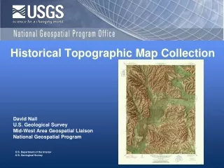
Oldest map collection in North America, founded in 1818 400,000 maps, 6,000 atlases, 1,000 reference books ~400 CD/DVD resources for in-house use
Available Image Data in the Map Collection • Film-Based Aerial Photography • Digital Aerial Photography • Satellite Imagery, Visible Wavelengths • MODIS (Moderate-resolution Imaging Spectroradiometer) • SRTM (Shuttle Radar Topography Mission) • AirSAR (Airborne Synthetic Aperture Radar) • AVHRR (Advanced Very High Resolution Radiometer)
Digital Imagery Chicago, 2002 .3 meters per pixel
Other Digital Aerial Photography • Los Angeles., 2003, pixel size: .65 meters • Providence, RI, 2002, pixel size: .3 meters • Boston, 2003, 2004, pixel size: 1 ft. • Cambridge, multiple years, pixel size: 1ft. • NYC, multiple years Providence, 2002
Satellite Imagery, Visible Wavelengths • Paris 2003 • Space Imaging • 1 meter resolution • Boston, 1997 • SpotImage Paris
MODIS Classified Land Cover MODIS (2000-2001) • Moderate Resolution Imaging Spectroradiometer • 30 Arc-second resolution • 17 land cover classes by IGBP (International Geosphere-Biosphere Programme) Classification
Remotely Sensed Elevation Data SRTM 30 • Shuttle Radar Topography Mission • 30 Arc-seconds • Elevation, derived slope & aspect SRTM Elevation
AirSAR • AirSAR, 2004 • Airborne Synthetic Aperture Radar • Imagery at three separate frequency bands • Partial coverage of Central America • Includes maximum normalized difference vegetation index (NVDI) data value for each pixel in each biweekly period • Measured radar backscatter is a function of surface roughness, surface structure, and electrical properties of the surface including soil moisture and salinity.
AVHRR • AVHRR (1981-1994) • Advanced Very High Resolution Radiometer • 1 km resolution • 14 land cover classes (UMD Classification) • AVHRR Biweekly Composites, 1995 • Conterminous U.S. only • Five channels • Includes NVDI (Normalized Difference Vegetation Index) for each pixel
Finding Remote Sensing Data at Harvard • HOLLIS: http://holliscatalog.harvard.edu • Use expanded search • Limit format to “digital” for only digital data sets • Limit location to Map Coll. (Pusey) • Harvard Geospatial Library: http://hgl.harvard.edu • More RS publications on line soon • Downloadable data • Clip large data sets to your area of interest
Finding Remote Sensing Data at Harvard • Harvard Map Collection: http://hcl.harvard.edu/libraries/#hmc • Assistance in finding data of all kinds • GIS and RS software & support by appointment • Email maps@harvard.edu or • Go to http://hcl.harvard.edu/research/ask/index.html and choose Cartography/GIS from the subject index.
Acknowledgement • Workshop Advisory Committee • John Brownstein (Medical School) • Bonnie Burns (College Library Map Collection) • Marcia Castro (School of Public Health) • Paul Cote (Graduate School of Design) • Stephen Ervin (Graduate School of Design) • Joseph Greene (Semitic Museum) • Wendy Guan (Center for Geographic Analysis) • Katherine Jones (Divinity School and Sigma Xi) • Steve Melly (School of Public Health) • Christopher Paciorek (School of Public Health) • Jason Ur (Dept of Anthropology) • Organizers for this event • Jenny MacGregor, Events and Publications Coordinator, Harvard University Center for the Environment • Kathy Johns, Assistant Dean, Office of Information Technology and Media Services, Harvard Divinity School, and President of the Sigma Xi Harvard Chapter • Kim Kriz, Assistant Director, Institute for Quantitative Social Science • All CGA staff
The Harvard University Center for the Environment (HUCE) • The Harvard University Center for the Environment (HUCE) encourages research and education about the environment and its many interactions with human society. • The Center draws its strength from faculty members and students across the University like yourselves who make up a remarkable intellectual community of scholars and researchers. • In this spirit, the Center for the Environment is delighted to be supporting this innovative, interdisciplinary workshop that will foster even stronger research, new academic collaborations and forward progress on some of the most challenging environmental issues facing society today. • HUCE home page is http://environment.harvard.edu/