Download
1 / 77
770 likes | 924 Vues
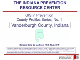
The Potential of Geographic Information Systems to Facilitate Data-Driven Prevention: The Case of Tobacco. Indiana Prevention Resource Center Barbara Seitz de Martinez, PhD, MLS, CPP Ruth Gassman, PhD Desiree Goetze, MPH. National Prevention Network Annual Conference Lexington, Kentucky

E N D
The Potential of Geographic Information Systems to Facilitate Data-Driven Prevention: The Case of Tobacco Indiana Prevention Resource Center Barbara Seitz de Martinez, PhD, MLS, CPP Ruth Gassman, PhD Desiree Goetze, MPH National Prevention Network Annual Conference Lexington, Kentucky August 28, 2006
What You Will Learn: • Components of GIS system and costs • How GIS Can Help You with Program Planning • Obtain Demographic Background • Profile Needs, Resources • Locate Problem Area or Target Audience • Inform Decisions about Strategy Selection • Enhance Cultural Competency • Obtain Funding • How GIS Can Help You with Program Evaluation • Create a Risk/Protection Surveillance System • Track Change • How GIS Can Help You Do Research • Conduct Research to identify relationships among environmental and health variables
I. Components of a GIS System Minimal Equipment and Personnel Skill Requirements
Stage One Objective: GIS to Inform Program Planning • Identify Problem Area or Find Target Audience • Obtain Demographic Background • Inform Decisions about Strategy Selection • Enhance Cultural Competency Equipment: Computer Hardware and Software • Standard Desktop/Laptop and Printer • GIS software: MapInfo and PCensus for MapInfo. Or ArcView equivalent Data: Purchased Databases • AGS Core Demographics, Consumer Spending, and MRI Lifestyle Variables or Claritas Equivalent Kinds of Skills (Capacity Building) • Computer Literacy and Intro to Microsoft Excel
Levels of Software Tools MapInfo, PCensus, Maploader (1)
Levels of Data Complexity Purchased GIS data (1)
Examples of Data AGS, Claritas™ Map files (1)
Levels of Skill Complexity Basic Computer And Printer (1)
Stage Two Objectives: GIS to Monitor Program Effectiveness • Create a Risk/Protection Surveillance System • Track Change Additional Equipment: Geocoding Software • MapMarker Geocoding Software • Color Printer Additional Data: • Local program and local geographic location data to be imported Additional Skills (Capacity Building) • Patience and precision • Microsoft Excel and some Microsoft Access preferable
Levels of Software Required MapInfo, PCensus, Maploader (1) Mapmarker Geocoding software, Excel & Access (2)
Levels of Data Complexity Purchased GIS data (1) Imported data (free or purchased) (2)
Examples of Data AGS, Claritas™, Map files (1) Program Data, Address Data, Health Data (public or purchased) (2)
Levels of Skills Required Basic Computer (1) Geocoding, Excel and Access (2)
Stage Three Objectives: GIS to Support Research • to study relationships among environmental and health variables Additional Equipment: Geocoding Software • SPSS Software Additional Data (to be imported): • Local data • Public data • Purchased data Additional Skills (Capacity Building) • Excellent Microsoft Excel and Access skills • Excellent statistical analysis and SPSS skills
Levels of Software Required MapInfo, PCensus, Maploader (1) Mapmarker Geocoding software, Excel & Access (2) SPSS (3)
Levels of Data Complexity Purchased GIS data (1) Imported data (free or purchased) (2) More compleximported data (free or purchased) (3)
Examples of Data AGS, Claritas™ (1) Program Data, Address Data, Health Data (public or purchased) (2) Mortality Report Data Morbidity Data (public or purchased) (3)
Levels of Skill Complexity Basic Computer (1) Geocoding, Excel and Access (2) Excel, Access, SPSS (3)
Examples of Data • AGS Core Demographics from Tetrad • Program Enrollment/Completion Numbers • Pre and Post- Test Scores • Addresses (e.g., of programs, outlets, agencies) • Data that needs cleaning, linking, reordering (e.g., Health Department Reports • Data that involves coding, joins, restructuring (e.g., Religent Planning 2 Morbidity Data • Data from analyses involving statistical calculations (e.g., importing data results from your analysis for mapping)
II. How GIS Can Help You with Program Planning Obtain Demographic Background Profile Needs, Resources Locate Problem Area or Target Audience Inform Decisions about Strategy Selection Enhance Cultural Competency Obtain Funding
Examples of Demographics • Population • Age • Race/Ethnicity • Marital Status • Income • Occupation • Health Insurance Status • Health Status • Behaviors: Spending, Drug Use • Behaviors: Crime
The Place: Neighborhood Forest Manor / Martindale-Brightwood Neighborhoods
Locate Problem Area: Child Poverty AGS Indiana Core Demographics [ Children in Poverty ] / [ Total Children ]
Locate Target Audience AGS Indiana Core Demographics Where are the 10-14 year olds in Marion County? They are in the areas that are darkest green.
Study a Place AGS Indiana Core Demographics
The Place: Government Boundaries AGS Indiana Core Demographics 46218
Risk/Protective Factors AGS Indiana Core Demographics AGS Indiana Core Demographics
Education, Less Than HS Diploma Indiana Prevention Resource Center AGS, Core Demographics, 2004 est., 2005 Source: GIS in Prevention, County Profile, Series 3 (Indiana Prevention Resource Center, 2006)
Less Than 9th Grade Education By Census Tract and w/in a 1 Mile Radius of John Marshall Middle School Data for addresses of retail tobacco outlets were contributed by the Indiana State Excise Police TRIP Inspection Program.
Insurance Coverage AGS Indiana Core Demographics, 2002 est. Insurance Coverage
Insurance Coverage Source: MRI Consumer Behavior
Single-Parent Families (#) 226 AGS Indiana Core Demographics 492 212 418 212 180 303
Combined Indicators: Single-Parent Families & Poverty AGS Indiana Core Demographics Number of Single Parent-Families in Poverty in Each Block Group in Blue Box
Working Parents Source: U.S. Census 2000, SF3
AGS Indiana, Crime Risk Personal Crime Indices
AGS Indiana, Crime Risk 2002 (2003) Property Crime Indices
AGS MRI Consumer Behavior 2002 (2003) Voting and Volunteerism
See Relationships between Data Income 10-17 Year Olds
6.6 Household Spending on Alcohol Source: GIS in Prevention, Hamilton County Profile, Series 3 (Indiana Prevention Resource Center, 2006)
Spending on Beer/Ale for Home Indiana Prevention Resource Center AGS, Consumer Spending, 2004 est., 2005 Source: GIS in Prevention, Hamilton County Profile, Series 3 (Indiana Prevention Resource Center, 2006)
6.7 Household Spending on Tobacco Source: GIS in Prevention, Morgan County Profile, Series 3 (Indiana Prevention Resource Center, 2006)
Race, Black Source: GIS in Prevention, County Profile, Series 3 (Indiana Prevention Resource Center, 2006)
Race, Black Source: GIS in Prevention, Dubois County Profile, Series 3 (Indiana Prevention Resource Center, 2006)
Ethnicity, Hispanic/Latino Source: GIS in Prevention, County Profile, Series 3 (Indiana Prevention Resource Center, 2006)
Ethnicity, Hispanic/Latino Source: GIS in Prevention, Dubois County Profile, Series 3 (Indiana Prevention Resource Center, 2006)
Ethnicity: Hispanic/Latino Source: GIS in Prevention, County Profile, Series 3 (Indiana Prevention Resource Center, 2006)
Inform Decision about Strategy • Which Curricula? For whom? Which problem? • Which Domain to focus on? Parent? Child? • Which Communication Strategy to use? Words or pictures? Phone Calls? Literacy level? • Where to Focus your efforts? Program location? • What Criteria to apply? Poverty? Working parents? • What Services to offer? Transportation? Food? • Extend of Need? Limit or expand service area?
Stage Two Enhancements Importing Local Data Geocoding Percentages, Rates and Rankings Analysis and Custom Mapping
Stage Two:Importing Local Data Methamphetamine Lab Seizures