Download
1 / 27
270 likes | 462 Vues
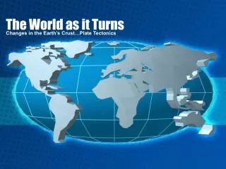
The World as it Turns. Changes in the Earth’s Crust…Plate Tectonics. Parts of the Earth…. There are 5 main layers, from surface to center: Lithosphere (crust) : solid outermost layer, about 5-50km deep;

E N D
The World as it Turns Changes in the Earth’s Crust…Plate Tectonics
Parts of the Earth… • There are 5 main layers, from surface to center: • Lithosphere (crust): solid outermost layer, about 5-50km deep; • Asthenosphere: the lower layer of the earth's crust; less rigid than the lithosphere—more slushy • Mantle: region below crust extending down to Earth's core; molten rock; flexible • Liquid Outer Core: made of molten iron/nickel; as it flows, it creates Earth’s magnetic field • Solid Inner Core: the solid iron/nickel center of the Earth; high temperatures & pressure; like a solid How do we know? Earthquakes
The Theory of Continental Drift Alfred Wegener, 1912
Continental Drift… • Alfred Wegenerproposed that the continents did not stay in one location, but instead slowly drift in relation to one another. He proposed that all of the continents were once joined into a single super-continent (Pangaea). Interactive Map of Pangaea
Continental Drift: The Evidence… • shape of the continents - could fit together like puzzle pieces • same animal fossils - found on opposite shores of Atlantic Ocean • same sequence of rock layers - including specific rocks found on opposite shores of Atlantic Ocean along coastlines • fossils of tropical plants are found in polar areas, suggests continents in polar areas were once near the equator • glacial deposits (which only could be created in cold polar areas) are found in tropical areas - suggests some continents now in tropical areas were once near the poles More on the evidence
Continental Drift: Lack of Support… • Wegener’s theory did not go over well in the scientific community… • There was no explanation as to why or how the continents drifted • difficult to believe something as big as continents plowing through the sea floor to move to new locations • What kind of forces could be strong enough to move such large masses of solid rock over such great distances? • To read an excellent historical account of Continental Drift with informative graphics, visit the U.S. Geological Survey.
Sea Floor Spreading More Evidence is Found
Sea Floor Spreading • In the 1940’s, scientists began to use sonar to map large areas of the ocean floor • series of ridges near the center of the Atlantic Ocean was discovered; • ridges extended the entire length (north to south) of the Atlantic Ocean • Ridges were also found in parts of the Indian and Pacific Ocean
Sea Floor Spreading: The Evidence… • 1968, scientists drill cores of rock from ocean floor • discovered the rock was the youngest at the mid-ocean rift & oldest at the shores of the continents • measured magnetic field recorded in the rock; discovered that Earth’s magnetic field is constantly shifting, • Based on collected data, Atlantic Ocean spreads about 1.25 cm a year, on average—about the same rate that your fingernail grows • Animation
Convection Currents Sea Floor Spreading: the How… • Occurs at MID-OCEAN RIDGES • Hot, less dense magma rises to surface, creating NEW ocean crust here • Flows sideways, due to CONVECTION in the mantle/asthenosphere • Ocean lithosphere (crust) is youngest NEAR the mid-ocean ridge Mid Ocean Ridge Oceanic Crust (lithosphere) Rising Magma
Sea Floor Spreading: The How… • Convection current: Boiling-like current of magma in the mantle (the layer below the crust). This current causes the plates to gradually move. • Seafloor Spreading: Magma below earth’s crust rises to the ocean surface through cracks and causes the ocean floor to slowly widen (example: mid-Atlantic ridge)
Where are we today? The Plate Tectonic Theory
The Plate Tectonics Theory • PlateTectonicsTheory combines continental drift and seafloor spreading • Earth’s crust & solid upper mantle, called the lithosphere, floats on top of the denser, liquid rock in the mantle called the asthenosphere. • Lithosphere is broken into large, continent-sized sections called tectonicplates. • Tectonic platesmove very slowly (about 1 to 8 cm per year). [This movement is the “continental drift” that Alfred Wegener discovered in 1912.]
The Plate Tectonics Theory • New plate area is added by rising magma at divergent boundaries, creating the mid-ocean ridges • An equal amount of plate area is destroyed at the subduction zones of convergent boundaries
Plate Tectonics: Boundaries They Move!
Plate Boundary Movements… • 3 types of plate boundary movements • Convergent: Boundary between two plates that are pushing together. • Divergent: Boundary between two plates that are moving apart. • Transform: Boundary between two plates that are sliding past one another. • Animations
When Boundaries Collide: Convergence… • Continental vs. oceanic • More dense oceanic plate dives under less dense; called subduction • dense, leading edge of the oceanic plate actually pulls the continental plate down forming a trench • Crust heats and melts as it is forced downward below the continental crust • Hot gases and magma forced upward creating a volcanic mountain range on the continent
When Boundaries Collide: Convergence… • Oceanic vs. Oceanic • the farther a plate gets from the mid-ocean ridge that created it, the colder and denser it gets • when two oceanic plates collide, the plate that is older, therefore colder and denser, is the one that will sink (subduct) • this subduction zone forms a curved volcanic mountain chain • Aleutian Peninsula of Alaska is an example of a very volcanically-active island arc
When Boundaries Collide: Convergence… • Continental vs. Continental • when two continental plates meet head-on, neither one can sink because both plates are too buoyant • at these boundaries solid rock is folded and faulted • huge chunks of rock many kilometers wide are thrust on top of one another, forming a towering mountain range
Himalayan Mtns. Taken by Satellite, 2004… Tibet (\Eurasian Continental Plate) Himalayan Mountain Range Nepal India(Indian Continental Plate) • * Himalayan mountain range is the perfect example of how the highest mountains in the world continue to grow
When Boundaries Collide: Divergence… • hot magma moves slowly upward, cooler magma near surface moves slowly downward forming convection currents within the asthenosphere • Rising convection currents diverge where they approach the surface pulling on the plate above it creating a divergent plate boundary • two sides move away in opposite directions, cracks between the diverging plates fill with molten rock which cools and quickly solidifies, forming new oceanic crust
When Boundaries Collide: Transform… • At transform plate boundaries plates grind past each other side by side. • This type of boundary separates the North American plate from the Pacific plate along the San Andreas fault, a famous transform plate boundary that’s responsible for many of California’s earthquakes
The World as it Turns In Closing…
Final Thoughts… • We can measure how fast tectonic plates are moving today, but how do scientists know what the rates of plate movement have been over geologic time? • The oceans hold one of the key pieces to the puzzle. Because of the ocean-floor magnetic striping records the flip-flops in the Earth's magnetic field & knowing the approximate duration of the reversal, we can calculate the average rate of plate movement during a given time span. • These average rates of plate separations can range widely. The slowest rates are less than 2.5 cm/yr; the fastest rates are more than 15 cm/yr • Current plate movement can be tracked directly by means of ground-based or space-based geodetic measurements; geodesy is the science of the size and shape of the Earth.
Review… • As plates move, the structure of the earth changes, creating volcanoes and building mountains
Review… • Alfred Wegener created a theory of Continental Drift based on fossil, rock formation, and puzzle-like fit of the continents • The advent of sonar allows us to map the ocean floor where mid-ocean ridges are discovered • Rock samples taken show the age of rock on either side of a mid-ocean ridge gets older the further away from the ridge • Sea floor spreading is explained by rock age and magnetic reversals being the same on either side of the ridge • theory of plate tectonics based on previous theories, sea floor spreading, and other observations such as volcanoes and earthquakes • Plate boundaries can move apart (diverge), move together or collide (converge), or move sideways past each other (transform) • Convergence can cause the creation of volcanic mountain ranges, volcanic island arcs, or continental mountains • Transform boundaries cause major earthquakes