Download
1 / 32
320 likes | 326 Vues
OpenInfRA : A Web-based Information System for Documentation and Publication of Archaeological Research Projects - Goals and C oncepts. Deutsches Archäologisches Institut Zentrale Berlin, IT Referat.

E N D
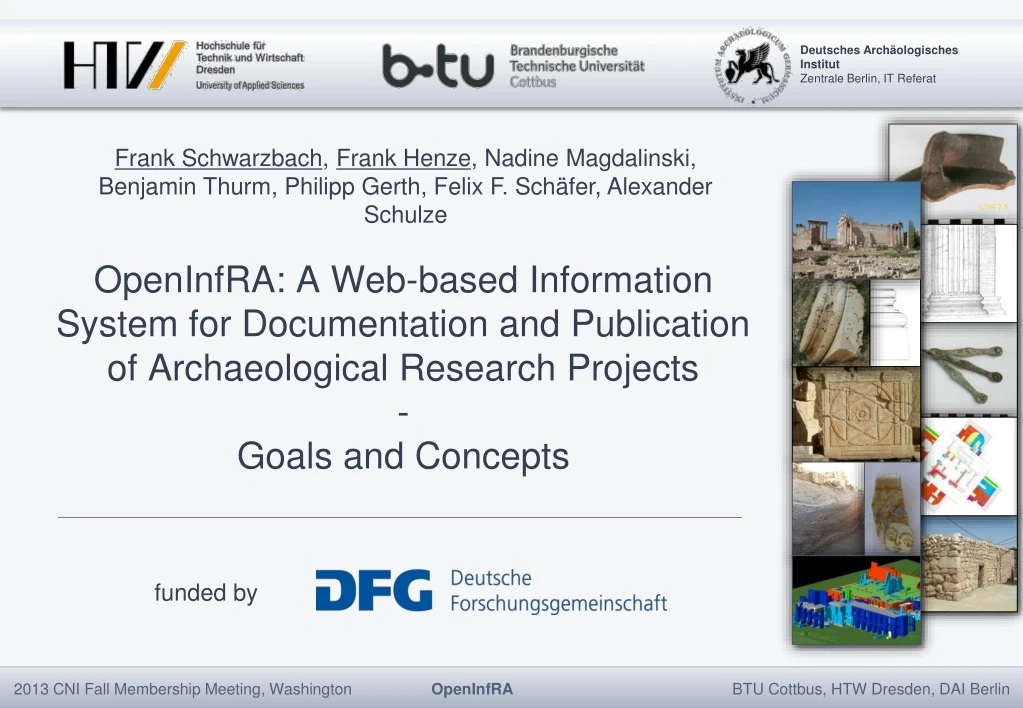
OpenInfRA: A Web-based Information System for Documentation and Publication of Archaeological Research Projects-Goals and Concepts Deutsches Archäologisches Institut Zentrale Berlin, IT Referat Frank Schwarzbach, Frank Henze, Nadine Magdalinski, Benjamin Thurm, Philipp Gerth, Felix F. Schäfer, Alexander Schulze fundedby
OUTLINE • Overview and motivation • Overall goals • Special issues
Overviewandmotivation OpenInfRA (Open Information System for Research in Archaeology) A web-based system for data capturing, storage, analysis and publication of fieldprojects in archaeology and neighboringdisciplines.
Overviewandmotivation • Main results of shortcoming analysis • Data are modeled, captured, processed, stored, analyzed and presented on a project-specific manner • high cost of building own IT solutions • use of the data only within the limits of the project • no sustainability of digital data after the project has ended • isolated, non-sustainable solutions • Improvement is both a technical and organizational challenge!
Overviewandmotivation userinterfaces interfaces to external web applications interfacesfor offline dataexchange Digital librarycatalog ZENON Data sheets, blank forms Photoandobjectdatabase ARACHNE Access, query, input, annotation, administration Structured data (XML,CSV) Gazetteer OpenInfRA Image and rasterdata (JPG,TIFF) Referencing, parametric request and query ancientplaces PLEIADES Import, export, offilesanddocuments Metadata (XML, XMP) Engraved printsarchive On-demand-Request Database (SQL, XML) Digital excavationarchives GIS (SHP,KML) Web-Services (WMS,WFS) Web-applications CAD (DXF,DWG) dataexchange via web services
Overall goals • Open regarding • projects of national and international institutions, universities and other organizations • all methods relevant for archaeological and historical fieldwork, such as excavations, surveys, building documentation, drilling cores, etc. • large amounts of data of different types, e.g. structured data, text, images, spatial data • free access for open datasets • integration/coupling with neighboring systems • cross-project analysis • implementation with Open-Source-Software • use of standards
Special issues • General data model • Multilingualism • Distributed datamanagement • Presentation and information retrieval
Special issues: A General datamodel • Use of an existing domain-specific conceptual schema (here e.g. CIDOC-Conceptual Reference Model) plus the associated implementation specifications? • savings of analysis and modelling effort • subsequent use of the available software • high level of semantic and syntactic interoperability • But • Users are determined to this particular application schema, the corresponding professional point of view on the “Universe of Discourse” and the underlying concepts.
Special issues: A General datamodel CIDOC-CRM?
Special issues: A General datamodel • Advantages • high level of flexibility is obtained • Newly added topics, attributes and relationships require no changes to the data model and the corresponding software components. • Data exchange with CIDOC-CRM based systems via XSL-Transformation (already implemented).
Special issues: Multilingualism ISO: Geographicinformation– Metadata – XML schemaimplementation (ISO/TS 19139:2007)
Special issues: distributeddatamanagement • At all instances the same software is implemented. • Data can be maintained in parallel in all instances. • Decentralized instances are mostly located in areas without permanent internet connection. Central Server ("OpenInfRA Server") Decentralized Project Server Mobile Computer Mobile Computer
Special issues: Presentationandinformationretrieval • textretrieval • SQL retrieval
Special issues: Presentationandinformationretrieval SQL-Extension (QSQL2) SELECT …FROM …WHERE …AND height ~ 1.80 WEIGHTED BY 0.5 “Find all sculptures which have the original height (preserved or reconstructed) of around 1.80 m (e.g. around life-size) and search not only in the actual database for stone finds but look also in the old excavations reports which have been attached as PDFs to the excavations datasets.” Alexander Schulze et al.: OpeninfRA– StoringandRetrieving Information in a HeterogeneousDocumentationSystem. CAA2012 Proceedings of the 40th Conference in Computer Applications and Quantitative Methods in Archaeology, Southampton, United Kingdom, 26-30 March 2012
CONTEXT userinterfaces interfaces to external web applications interfacesfor offline dataexchange Digital librarycatalog ZENON Data sheets, blank forms Photoandobjectdatabase ARACHNE Access, query, input, annotation, administration Structured data (XML,CSV) Gazetteer OpenInfRA Image and rasterdata (JPG,TIFF) Referencing, parametric request and query ancientplaces PLEIADES Import, export, offilesanddocuments Metadata (XML, XMP) Engraved printsarchive On-demand-Request Database (SQL, XML) Digital excavationarchives GIS (SHP,KML) Web-Services (WMS,WFS) Web-applications CAD (DXF,DWG) dataexchange via web services
USER INTERFACE userinterfaces userinterfaces interfaces to external web applications interfacesfor offline dataexchange Digital librarycatalog ZENON Data sheets, blank forms Photoandobjectdatabase ARACHNE Access, query, input, annotation, administration Access, query, input, annotation, administration Structured data (XML,CSV) Gazetteer OpenInfRA Image and rasterdata (JPG,TIFF) Referencing, parametric request and query ancientplaces PLEIADES Import, export, offilesanddocuments Metadata (XML, XMP) Engraved printsarchive On-demand-Request Database (SQL, XML) Digital excavationarchives GIS (SHP,KML) Web-Services (WMS,WF) Web-applications CAD (DXF,DWG) dataexchange via web services
USER INTERFACE Login List View Detail View WebGIS Context Browser
INTERFACES userinterfaces interfaces to external web applications interfaces to external web applications Digital librarycatalog ZENON interfacesfor offline dataexchange Digital librarycatalog ZENON Digital librarycatalog ZENON Data sheets, blank forms Photoandobjectdatabase ARACHNE Photoandobjectdatabase ARACHNE Photoandobjectdatabase ARACHNE Access, query, input, annotation, administration Structured data (XML,CSV) Gazetteer Gazetteer Gazetteer OpenInfRA Image and rasterdata (JPG,TIFF) Referencing, parametric request and query Referencing, parametric request and query ancientplaces PLEIADES ancientplaces PLEIADES ancientplaces PLEIADES Import, export, offilesanddocuments Metadata (XML, XMP) Engraved printsarchive Engraved printsarchive On-demand-Request Database (SQL, XML) Digital excavationarchives Digital excavationarchives GIS (SHP,KML) Web-Services (WMS,WF) Web-applications CAD (DXF,DWG) dataexchange via web services
WEB SERVICES userinterfaces interfaces to external web applications interfaces to external web applications interfacesfor offline dataexchange Digital librarycatalog ZENON Digital librarycatalog ZENON Data sheets, blank forms Photoandobjectdatabase ARACHNE Photoandobjectdatabase ARACHNE Access, query, input, annotation, administration Structured data (XML,CSV) Gazetteer Gazetteer OpenInfRA Image and rasterdata (JPG,TIFF) Referencing, parametric request and query Referencing, parametric request and query ancientplaces PLEIADES ancientplaces PLEIADES Import, export, offilesanddocuments Metadata (XML, XMP) Engraved printsarchive Engraved printsarchive On-demand-Request On-demand-Request Database (SQL, XML) Digital excavationarchives Digital excavationarchives GIS (SHP,KML) Web-Services (WMS,WF) Web-Services (WMS,WFS) Web-Services (WMS,WFS) Web-applications Web-applications CAD (DXF,DWG) dataexchange via web services dataexchange via web services
WEB SERVICES List ofmapservices integrateinto: WebGISclient Desktop GIS
DATA INTERFACES userinterfaces interfaces to external web applications interfaces to external web applications interfacesfor offline dataexchange interfacesfor offline dataexchange Digital librarycatalog ZENON Digital librarycatalog ZENON Data sheets, blank forms Data sheets, blank forms Structured data (XML,CSV) Photoandobjectdatabase ARACHNE Photoandobjectdatabase ARACHNE Access, query, input, annotation, administration Structured data (XML,CSV) Structured data (XML,CSV) Gazetteer Gazetteer Image and rasterdata (JPG,TIFF) OpenInfRA Image and rasterdata (JPG,TIFF) Image and rasterdata (JPG,TIFF) Referencing, parametric request and query Referencing, parametric request and query ancientplaces PLEIADES ancientplaces PLEIADES Import, export, offilesanddocuments Import, export, offilesanddocuments Metadata (XML, XMP) Metadata (XML, XMP) Engraved printsarchive Engraved printsarchive On-demand-Request Database (SQL, XML) Database (SQL, XML) Digital excavationarchives Digital excavationarchives GIS (SHP,KML) GIS (SHP,KML) Web-Services (WMS,WFS) CAD (DXF,DWG) Web-applications CAD (DXF,DWG) CAD (DXF,DWG) dataexchange via web services
Geo-data in archaeology • Vector data: • positionandgeometryoffindingsituations, structuralobjects, ... • topography, settlements, landuse, infrastructure, ... • current (measured) situationandreconstructions • ... • Raster data: • aerialimages / orthoimages • scannedmapsandplans • digital surfaceandelevationmodels • ...
WEB-GIS architecture browserwith 2D- and 3D-Client Internet Web-Server providing 2D / 3D client providinggeoservices(WMS, WFS, W3DS, ...) OGC-Server 3D Geo Data Base GISfiles datamanagement
Geo-data in archaeology 2D 2,5 D 3D
3D WEB-GIS – APPLICATION AREAS • 3D visualization, query and archiving of single (smaller) objects • small finds (e.g. ceramic) • architectural elements (e.g. capitals) • sculptures without breakdown into individual object parts • 3D visualization and analysis of complex objects or building models • divided into several building parts (walls, ceilings, floors, columns, capitals, stamped tiles, stone marks) • differentiation of the wall surfaces of a building structure • distinction of findings/features and reconstruction • 2.5D / 3D visualization and analysis of settlements and urban models • with different phases • distinction of findings/features and reconstruction • combined with classic 2D WebGIS • LOD • 3D visualization, query, storage/archiving of original measured 3D data • especially point clouds • possibly definition of sections / elevations
3D WEB-GIS – PROTOTYPICAL IMPLEMENTATION visualization ofstatic X3D filesvarious display options(transparency, color, ...) "MouseOver" for individual objects link todatabaseobjects via VRML/X3D anchor http://geoinformatik.htw-dresden.de/openinfra/3DWebGIS/
3D WEB-GIS – PROTOTYPICAL IMPLEMENTATION visualization ofstatic X3D filesvarious display options(transparency, color, ...) "MouseOver" for individual objects link todatabaseobjects via VRML/X3D anchor visualization ofpointclouds
3D WEB-GIS – PROTOTYPICAL IMPLEMENTATION visualization ofstatic X3D filesvarious display options(transparency, color, ...) "MouseOver" for individual objects link todatabaseobjects via VRML/X3D anchor visualization ofpointclouds 3D geometries via W3DS from PostGIS standardized "GetScene" request advanced display options combined 2D / 3D geometries from PostGIS http://geoinformatik.htw-dresden.de/openinfra/3DWebGIS/ Textured Terrain Models / Objects
OUTLOOK Towards a workingsystem Further information: www.tu-cottbus.de/openinfra • implementation of core system • definition of an initial “Topics Framework” • integration of search/retrieval, WebGIS and 3D • realization of online- / offline-concept • migration of project data from legacy systems • integration external systems via defined interfaces • test of implementation • system introduction