Download
1 / 34
340 likes | 452 Vues
The Role of IOC in Coordinating Tsunami Warning Systems. Tony Elliott Head of ICG/IOTWS Intergovernmental Oceanographic Commission IOC Regional Programme Office, Perth. Outline. Introduction to IOC Global Tsunami Information Establishment of ITSU/PTWS, IOTWS, NEAM and CARIBE

E N D
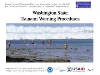
The Role of IOC in Coordinating Tsunami Warning Systems Tony Elliott Head of ICG/IOTWS Intergovernmental Oceanographic Commission IOC Regional Programme Office, Perth Page 1
Outline • Introduction to IOC • Global Tsunami Information • Establishment of ITSU/PTWS, IOTWS, NEAM and CARIBE • Elements of an Intergovernmental Regional Warning System • How Does IOC Facilitate? • Take Home Points Page 2
Founded in 1960 with 136 mainly coastal member states The General Assembly meets in odd years and the Executive Council in even years Page 3
To coordinate these issues among member states the IOC secretariat is divided into four units: Science and Marine Ecosystems OOS Capacity Building Tsunami Page 4
Tsunami Sources in the world (2180 events from 1628 BC to 2005) Source, ITDB, 2005 Page 5
7% 15% 33% Distribution of tsunamigenic events - Validity index 27% 4 (definite event) 18% 3 (probable event) 11% 2 (doubtful event) Distribution of tsunamigenic events - Type of source 2% 1 (verydoubtful event) 5% 0 (false entry) Tectonic Landslide 10% Volcanic Meteorological Unknown 72% Causes of Tsunamis Page 6
4% 12% Pacific Ocean and marginal seas Mediterranean Sea (including the BlackSea) Atlantic Ocean(including the Northernand the Baltic Seas) 4% 9% 25% 59% Indian Ocean 10% 77% Event Distribution – Tsunamigenic Regions Whole Historical Period 20th Century Page 7
In 1965 IOC established the ICG/ITSU International Coordination Group for the Tsunami Warning & Mitigation System in the Pacific (PTWS) • Recommends & coordinates tsunami programs, including timely ocean wide tsunami warnings • Successful & operational for more than 40 years • System is based on 26 national and 4 regional centres Page 8
26 December 2004 • c.230,000 Dead – Nations of the region react • IOC invited to lead TWS establishment 11 countries ~230,000 deaths 1 million displaced Page 9
March & April 2005: In the aftermath of greatest tsunami in recorded history, IOC held two International Coordination meetings on the development of an IOTWS in Paris and Mauritius July 2005:IOC established the International Coordination Group for the Tsunami Warning & Mitigation System in the Indian Ocean (ICG/IOTWS) Establishment of an Indian Ocean Tsunami Warning System Page 10
Global Network of TWS Page 11
The Indian Ocean Tsunami Warning & Mitigation System • (IOTWS) Page 12
What is the System? • Fully owned by Indian Ocean countries (28 Member States) • Based on international and multilateral cooperation, with governance provided by IOC • Based on open and free data exchange • Protect all countries in Indian Ocean • Transparent and accountable to all countries Page 13
How Does it Function? • Based on joint operation of international networks of detection connected with national tsunami warning centres • High-level commitment by countries with UN governance provided under the IOC • Each nation is responsible for issuing warnings in their territory and for protecting its own population. • National centres must have strong links with emergency preparedness authorities (national, provincial and local) Page 14
End-to-End System Page 15
IOTWS Working Groups • WG1: Seismic measurements, data collection and exchange • WG2: Sea level data collection and exchange, including tsunameters • WG3: Risk assessment • WG4: Modelling, forecasting and scenario development • WG5: System of interoperable advisory and warning centres • WG6: Mitigation, preparedness and response Page 16
Goals:- Core network of seismic stations, meeting instrument requirements, operational by 2010 and being maintained Ensure that all earthquakes >6 can be reliably located and quantified. Reduce time required for earthquake source characterisation to meet a local warning response of 5 to 10 minutes WG1 – Seismic Measurements, Data Collection and ExchangeChair: Dr Fauzi, Indonesia Page 17
38 operational seismic stations by end 2006 75 seismic stations planned by 2010 Core Seismic stations Operational Planned Page 18
WG2 – Sea Level Measurements, Data collection and ExchangeChair: Mr Prem Kumar, India • Goals:- • Regional core network of coastal sea level stations and deep ocean stations, meeting instrument requirements and standards, operational by 2010 and being maintained by countries in the region Page 19
Feb 2007 Kandla Kakinada Jul 06 24 stations in operation Feb 07 >41 stations in operation ~ 20 planned for remainder 2007 Chennai Mangalore Rangat Bay Vizhingam Teluk Dalam Panjang Sadeng Banten Feb 2007 Page 20
Malaysia – 1(3) India – 11 Indonesia – 12(22) Thailand – 3 Australia – 2 (4) USA – 3 - IO (Total) Proposed Deep Ocean Sea Level Measurement Network Page 21
Goals:- Standardised hazard risk assessment methods and products developed and employed to reduce vulnerability and strengthen coping capacity of coastal communities to tsunami hazards Assessment of environmental flashpoints at subnational level for use in preparedness and spatial planning and disaster risk reduction WG3 – Risk AssessmentChair: Dr Sam Hettiarachchi, Sri Lanka Page 23
Indian Ocean Hazard Maps Preparation of Indian Ocean Tsunami Hazard Maps (2nd Quarter 2008) The Hazard Maps will represent, at a regional scale, wave heights and return periods for tsunamis generated from major earthquakes and volcano sources. Page 24
Goals:- Provide benchmarked and validated numerical modelling methods and software applicable for the Indian Ocean Develop and sustain national and regional capacity to apply numerical modelling for tsunami source generation, wave propagation, and coastal inundation in the Indian Ocean WG4 – Modelling, Forecasting and Scenario DevelopmentChair: Dr Charitha Pattiaratchi, Sri Lanka Page 25
ComMIT Page 26
Goals:- Coordinated regional warning system for the entire Indian Ocean region composed of network of interoperable Regional Tsunami Watch Providers and National Tsunami Warning Centres. National tsunami warning centres established and operating as authoritative source for tsunami advice and warnings. Tsunami alerts disseminated to the “last mile” through effective communications programmes. WG5 – System of Interoperable Advisory and Warning CentresChair: Mr Geoff Crane, Australia Page 27
RTWP Initiative • Interim Advisory Service provided by PTWC and JMA • Potential RTWPs are Australia, India, Indonesia, Malaysia, Iran and Thailand/ ADPC • Implementation Plan to create an interoperable system of RTWPs. Plan to be completed by end 2007 • Working towards providing full regional coverage for Indian Ocean by end 2008 Page 28
TSUNAMI BULLETIN NUMBER 001 PACIFIC TSUNAMI WARNING CENTER/NOAA/NWS ISSUED AT 2055Z 01 APR 2007 THIS BULLETIN IS FOR ALL AREAS OF THE PACIFIC BASIN EXCEPT ALASKA – BRITISH COLUMBIA - WASHINGTON - OREGON - CALIFORNIA. A TSUNAMI WARNING IS IN EFFECT FOR SOLOMON IS. / PAPUA NEW GUINEA FOR ALL OTHER PACIFIC AREAS, THIS MESSAGE IS AN ADVISORY ONLY.AN EARTHQUAKE HAS OCCURRED WITH THESE PRELIMINARY PARAMETERS ORIGIN TIME - 2040Z 01 APR 2007 COORDINATES - 8.6 SOUTH 157.2 EAST LOCATION - SOLOMON ISLANDS MAGNITUDE - 7.8 EVALUATION IT IS NOT KNOWN THAT A TSUNAMI WAS GENERATED. THIS WARNING IS BASED ONLY ON THE EARTHQUAKE EVALUATION. AN EARTHQUAKE OF THIS SIZE HAS THE POTENTIAL TO GENERATE A DESTRUCTIVE TSUNAMI THAT CAN STRIKE COASTLINES IN THE REGION NEAR THE EPICENTER WITHIN MINUTES TO HOURS. AUTHORITIES IN THE REGION SHOULD TAKE APPROPRIATE ACTION IN RESPONSE TO THIS POSSIBILITY. THIS CENTER WILL MONITOR SEA LEVEL GAUGES NEAREST THE REGION AND REPORT IF ANY TSUNAMI WAVE ACTIVITY IS OBSERVED. Page 29
A perfect warning will be useless if people do not know what to do in case of an emergency Awareness and preparedness at the country level is essential Page 30
Goals:- Promote, share, and develop tsunami good practice examples, tools, and best practice information for capacity and resilience building and emergency management. Mainstream tsunami warning and mitigation systems into development planning and practice. Prepare national and local emergency response plans for coastal regions and undertake regular preparedness exercises and drills. Undertake education and outreach campaigns on tsunami risks, warning systems, and response in coastal region WG6 – Mitigation, Preparedness and ResponseChair: Mr Michel Vielle, Seychelles Page 31
Outstanding Issues • Maintenance • Communications • Data Sharing • Bathymetric/topographic data • Training, capacity building, technology transfer, training and training • Preparedness, Mitigation & Response • Research Page 32
Take Home Points • IOTWS is a complex, multi-national, multi agency, multi-donor system • Many players, coordination is the IOC’s role but is a major challenge • Pace of implementation • Regional – national – local • Regional cooperation very important • Multi hazard integration Page 33
Thank You! Page 34