Download
1 / 35
350 likes | 373 Vues
The President's plan to expand the U.S. tsunami detection and warning system, including deploying advanced buoys, enhancing seismic monitoring, improving forecasting, and increasing international collaboration. This will improve U.S. preparedness for tsunamis and enhance the ability to protect coastal communities.

E N D
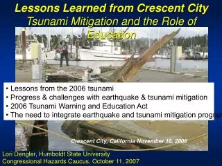
President’s Proposed Expansion of Tsunami Warning System Eddie Bernard Director, Pacific Marine Environmental Laboratory (PMEL)/NOAA Member, National Tsunami Hazard Mitigation Program
Improving U.S. preparedness for tsunamis: • The Administration will commit $37.5 million over the next two years to expand U.S. tsunami detection and monitoring capabilities (NOAA-$24M: USGS-$13.5M) • The National Oceanic and Atmospheric Administration (NOAA) will deploy 32 new advanced-technology Deep-ocean Assessment and Reporting of Tsunami (DART) buoys for a fully operational enhanced tsunami warning system by mid-2007. • The United States Geological Survey (USGS) will enhance its seismic monitoring and information delivery from the Global Seismic Network, a partnership with the National Science Foundation.
Adding deep-sea buoys and other sensors to enhance tsunami detection along the U.S. coast (Pacific, Atlantic, Caribbean, and the Gulf of Mexico). • Working internationally to build a global warning system, including in the Indian Ocean. • Improving seismic sensor data and infrastructure for better earthquake detection and warning, including in the Caribbean. • Expanding research on tsunami forecasting. • Improving response capacity with enhanced emergency warning systems community response plans, and public education.
U.S. PLAN FOR AN IMPROVED TSUNAMI DETECTION AND WARNING SYSTEMImprove Warnings and Forecasts
Existing Stations New Stations Proposed U.S. Tide Gauge Network New Tsunami-Equipped Tide Stations (FY 05-06)
DART Concept • BPR measures small changes in pressure at the seafloor. Data sent acoustically to surface buoy, then via satellite to the Warning Centers. • Normal transmissions: Hourly reporting of 15 minute data to confirm system readiness. • Two Event Modes: • - Automatic: Triggered by seismic or tsunami wave • - Request: Warning Center triggers data stream Animation
Operational Tsunami Forecasting • Essential to Improve Warning Speed and Reliability • Vast Ocean Areas with No Tsunami Measurements • Must Integrate Real-time Measurement and Modeling - Measurement: DART Network - Modeling: Tsunami Forecast Model
Tsunami ForecastingMeasurement Requirements 1. Measurement type - tsunami amplitude over time for input into forecast models 2. Measurement accuracy - 0.5 cm 3. Measurement sample rate – 1 min or less 4. Measurement processing – within 2 min 5. Measurement availability – within 5 minutes to assimilate into forecast models
Elements of Tsunami Forecasting • Use propagation models to generate a simulation database • When tsunami occurs, select from database as “first estimate” • Assimilate deep ocean data to update database from “first estimate” to “offshore tsunami forecast” • Use “offshore tsunami forecast” as input for inundation model at specific site • Inundation model produces tsunami forecast at specific site
Model database Unit sources for pre-computed tsunami propagation scenarios
November 17, 2003 Tsunami: DART Data Used to Update Simulation
Real Time Detection of November 17, 2003 Tsunami Tsunami Tsunami Seismic Tsunami
Model Standards Paper Progress in National Tsunami Hazard Mitigation Program Hazard Assessment F.I. Gonzalez, V.V. Titov, H.O. Mofjeld, A.J. Venturato, R.S. Simmons, R.Hansen, R.Combellick, R.K.Eisner, D.F. Hoirup, B.S. Yanagi, S.Young, M.Darienzo, G.R. Priest, G.L. Crawford, T. J. Walsh
Forecast Model to Hazard Mapping Plan • Combine real time seismic, sea level monitoring networks coupled with numerical models to produce tsunami forecast products for 74 sites • Make models available to states to produce inundation maps
International Modeling NetworkTransfer, Maintain, and Improve Tsunami Forecast Models Under Development Network Nodes Share: Models, R&D Tools, Databases, …
Location of DART buoys (deployed along subduction zones: 1000 km spacing) 29 - Pacific Basin (excludes 3 redundant Alaska Buoys) 6 - Atlantic/Caribbean 1 - Mid-Atlantic Ridge
Credit: Dr. Jose Borrero USC,USA
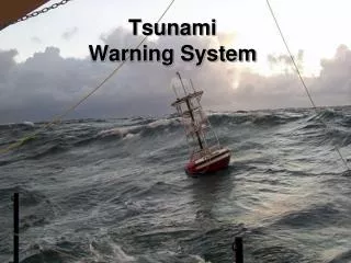
NOAA Tsunami Warning Centers • OPERATIONAL ACTIVITIES • SEISMIC DATA COLLECTION & ANALYSES • SEA LEVEL MEASUREMENTS • DECISION-MAKING PROCESSES • MESSAGE CREATION & DISSEMINATION
1000 km 1000 km Cascadia Credit: Lori Dengler Sumatra
U.S. PLAN FOR AN IMPROVED TSUNAMI DETECTION AND WARNING SYSTEM