Accuracy and Regulatory Requirements in Site Survey | NSMA 2008 Conference Presentation
380 likes | 403 Vues
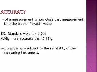
Understand accuracy requirements for structures by FCC and FAA, FCC application, coordinates, elevations, minor/major changes, FAA filing and survey letters. Learn about engineering specifications for antennas.

Accuracy and Regulatory Requirements in Site Survey | NSMA 2008 Conference Presentation
E N D
Presentation Transcript
Site Survey Accuracy Regulatory and Engineering Requirements
PresentedbyJames C. Wolfson President of X-DOT, Inc. NSMA 2008 Conference
Regulatory • FCC • FAA Engineering
Who determines the accuracy requirements for new structures? Structure owner? FCC? FAA?
Antenna Structure Registration 854R FCC will not process a registration for a tower if it differs from the FAA final determination by more than one (1) second in latitude and longitude or .3 meters in height
The FCC Specifies Accuracies for Other Purposes The Technical Content Of Applications FCC Part 101.21(e) Frequency Coordination Procedures FCC Part 101.103(d)(2)(ii) Antenna Locations FCC Part 1.923(c)
Two FCC Parts Have Exactly the Same Accuracy Requirements • FCC Part 101.21(e) • FCC Part 101.103(d)(2)(ii) “The position location of antenna sites shall be determined to an accuracy of no less than ±1 second in the horizontal dimensions (latitude and longitude) and ±1 meter in the vertical dimension (ground elevation) with respect to the National Spacial Reference System.”
FCC Part 1.923(c) Antenna Locations Applications for stations at fixed locations must describe each transmitting antenna site by its geographical coordinates and also by its street address, or by reference to a nearby landmark. Geographical coordinates, referenced to NAD83, must be specified in degrees, minutes, and seconds to the nearest second of latitude and longitude.
FCC Part 1.923(c) Antenna LocationsElevation? • In this section of part one the FCC does not specify an accuracy parameter for the elevation of an antenna location.
111 Therefore, unless the FAA requires more stringent accuracies, the FCC requires the accuracy of a microwave site to have coordinates determined to no less than ±1 second in the horizontal dimensions (latitude and longitude) and ±1 meter in the vertical dimension (ground elevation) ± 1 Second Latitude ± 1 Second Longitude ± 1 Meter Elevations Just Remember 111
Other FCC Accuracy Requirements There are other accuracy requirements when a company files an application for a microwave license using the FCC 601 Form Schedule I
Other FCC Accuracy Requirements - Form 601 ApplicationCoordinates The FCC considers the coordinates of a tower inconsistent and will reject the 601 application for a license if the coordinates differ by more than one second from that shown in the ASR database
Other FCC Accuracy Requirements - Form 601 ApplicationElevation The FCC considers the height or elevation of a tower to be inconsistent if it is more than 0.5 meters (1.5 feet) greater than or 3 meters (9.8 feet) less than the elevation listed in the ASR database
Classification of Filings as Major or Minor- Coordinates Major Change – Any change in transmit antenna location by more than 5 seconds in latitude or longitude for fixed point-to-point facilities would be a major change FCC Part 1.929(d)(1)(i) – Pertains to Position Minor Change – A 5 second change in latitude, longitude, or both would be minor
Classification of Filings as Major or Minor – Antenna Height Any increase in transmit antenna height (above mean sea level) more than 3 meters…. FCC Part 1.929(d)(1)(vi) – Pertains to Antenna Height • Decrease in Antenna Height – As far as Major and Minor changes are concerned, lowering the antenna height is “OK”
FAA Accuracy RequirementsCoordinates FAA Form 7460-1 Notice of Proposed Construction or Alteration instructions states: ”latitude and longitude must be geographic coordinates, accurate to within the nearest second or the nearest hundredth of a second if known….”
FAA Accuracy RequirementsElevation • The elevation accuracy is not specifically stated except that it should match the contour elevations shown on an accompanying map of Item #20 of the FAA Form 7460-1. • The FAA does ask that the elevation be rounded to the next highest foot.
May the FAA Accuracy Requirements be Determined on a Case by Case Basis? Yes, the FAA Processor has the authority to determine the coordinate requirements when he processes the FAA Form 7460‑1 • VFR +50 to Height +200 Radius around coordinates • ILS, GPS, Radar; Survey letter will be required This information was obtained from a retired FAA Processor
FAA Accuracy Codes • HorizontalVertical • CodeToleranceCodeTolerance • 1 20’ A 3’ • 2 50’ B 10’ • 3 100’ C 20’ • 4 250’ D 50’ • 5 500’ E 125’ • 6 1000’ F 250’ • 7 ½ NM G 500’ • 8 1 NM H 1000’ • 9 Unknown I Unknown
FAA Filing Requirement • The FAA requires an FAA Form 7460-1 to be filed for all structures over 200 feet in height • A tower/structure 200 feet or less could require an FAA filing, i.e. near an airport, heliport, etc
FAA Survey Letter In general the FAA does not require an FAA Form 7460-1 to be filed for structures 200 feet or less • Then, why are so many FAA 2-C, 1-A letters requested by companies?
Engineering Requirements • The answer is usually yes, 1 second variation in latitude and longitude and 1 meter variation in elevation is usually adequate • 1 second of latitude in Key West Florida is • approximately 92 feet • 1 second of latitude in Far Northern Minnesota is approximately 66 feet • 1 meter is approximately 3.28084 feet or 3’ 3.37008”
Example – Three Different Sites Site1 Could be confusing May affect frequency coordination 33 17 37.37 110 50 10.74 50.4 Feet 70.126 Degrees 37.98 Feet Site 2 33 17 37.2 110 50 11.3 57.96 Feet 110.411 Degrees Site 3 33 17 37.00 110 50 10.66
Example – Same Site Site1 Coordinates are all different but they are for the same site and are FCC legal Elevations are also FCC legal 33 17 37.37 110 50 10.74 7798.7’ AMSL 50.4 Feet 70.126 Degrees 37.98 Feet Site 2 33 17 37.2 110 50 11.3 7799.8’ AMSL 57.96 Feet 110.411 Degrees Site 3 33 17 37.00 110 50 10.66 7799’ AMSL
Path Partially Blocked Receive Site
Blocked Path Receive Site
Very small movement, much less than 1 second makes a difference Receive site could be seen from here Receive site could NOT be seen from here 8’ approx Penthouse is not in center of the building
Engineering Requirements • How are the coordinates and elevations obtained in order to meet the ±1 second and ±1 meter requirement? • Standard professional surveying techniques – non Global Positioning System (GPS)
Survey Plats Astronomic TN
GPS Correction signal antenna integrated with the GPS antenna Single frequency GPS receiver
GPS Hand held GPS with WAAS capability 95% of the time it is accurate enough for coordinates Never accurate enough for elevation
GPS GPS Antenna Dual frequency GPS receiver
GPS Correction Services • Private • There are numerous private company differential correction services available • Works with single frequency receivers if a separate antenna is connected to the GPS receiver to receive the correction signal • Sub meter horizontal accuracy – Meets FCC latitude and longitude requirements • Two times the horizontal accuracy for Vertical • Implies two meter accuracy – Does not meet FCC ground elevation requirements Correction signal antenna integrated with the GPS antenna Single frequency GPS receiver
GPS Correction Services • Government • WAAS • GPS receiver must be WAAS capable • Horizontal accuracy will meet the latitude and longitude requirement of ±1 second 95% of the time • Will not meet the vertical requirement of ±1 meter • OPUS • Requires dual frequency receivers, the ones used by professional surveyors • Requires the collection of at least 15 minutes of data or the data set will not be processed (Rapid Static) • Real Time Kinematic (RTK) • Requires government, state or other static monument • Static • Requires government, state or other static monument • Post process the data • Other
Professional Surveyor GPS Procedure Tower Center The GPS data is usually post processed also may be RTK GPS at Triangulation Station RTK Distance Distance Distance Determine angles and distance from each GPS position to the tower – usually with a total station The difference in elevation is also measured GPS 1 GPS 2
Critical Point Looking down path Dual Freq GPS Contour interval on map was 10 feet Slope was steep therefore couldn’t determine elevation within 10 feet Determined path line with differential GPS unit Then set up dual frequency unit at the position on the ground that was on the path line Accurate elevation was determined to be higher than what would have been picked from the map or DEM Towers were not tall enough to allow the path to clear the ridge vertically or horizontally Path failed
Roof Top Location Measurement Determining the coordinates of a site location on the roof of a building is done by gathering GPS data on the roof at the location of the proposed microwave antenna Elevation of the roof may be determined by obtaining a copy of the architects elevation profile of the building or measuring the height of the roof using acceptable survey techniques GPS elevations using single frequency receivers will not meet FCC requirements Determining the coordinates of a building by this method is not accurate Antennas are rarely mounted in the exact center of a building GPS data taken at
Ground Elevation Dual Frequency GPS 289 feet Using digital altimeter and averaging several measurements, determined building ground elevations was 1 foot higher than GPS Ground elevation Measured= 997.032 feet FAA 1-A Survey letter = 997.26 feet Difference =.228 feet Dropped tape over side of building to obtain height of building = 31 feet Digital altimeter Note: Path surveyor was not aware that a 1-A survey letter was available when these measurements were taken and as a result of these measurements it was determined that the original 1-A survey letter elevation was in error by 20 feet Professional surveyor corrected the letter and resubmitted to the customer