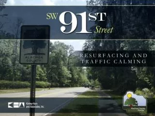
Traffic Calming Project for SW 91st Street
This project aims to enhance traffic safety on SW 91st Street by implementing medians and chicanes. Public involvement, proposed designs, citizen feedback, and project specifics are included in the presentation.

Traffic Calming Project for SW 91st Street
E N D
Presentation Transcript
Presentation Outline • Recommendation • Project Background • Public Involvement • Proposed Design • Citizen Comments/Questions • Summary and Recommendation • Questions
Recommendation • Approve the plans as proposed based on the need to provide traffic calming and the consistency of the plans with the Corridor Design Manual and direct staff to continue with the design and permitting phase to be immediately followed by the bid phase.
Issues • 91st Street is a County Scenic Road • There is a documented history of speeding on the roadway and a history of complaints by residents • The County is required to bring the roadway up to current standards to the extent that it is economically and environmentally feasible where there are no conflicts with existing development
Project Background • Project limits are from SW 8th Avenue to SR 26 • Designated as a County Scenic Roadway in 1987 • Speed limit reduced to 30 mph in 2002 • Field meeting in 2005 with residents to discuss continued speeding problems • County approved gas tax bonds for resurfacing in 2005 • Corridor Study conducted by Kimley-Horn and Associates during the Fall of 2007
Corridor Study Recommendation • Construct a center island median approximately 1,100 feet south of Newberry Road • Construct a center island median approximately 200 feet north of SW 1st Place • Construct a chicane approximately 1,100 feet south of SW 1st Place
Public Involvement • Corridor Study Workshop – Sept 2007 • Design Kick-off Meeting – July 2008 • Public Meeting – 30% plans – Sept 2008 • Citizen Advisory Committee – Oct 2008 • Scenic Road Advisory Committee – Oct 2008 • Resident Field Review – Oct 2008 • Public Meeting – 60% plans – Nov 2008 • Scenic Road Advisory Committee – Dec 2008
Corridor Study Workshop • Over 30 people in attendance • Presented results of traffic study • Discussed traffic calming options • Recommended resurface sidewalk • Participants broken into five groups
Workshop Results • Three groups recommended a combination of medians and chicanes • One group recommended a series of medians down the entire roadway • One group recommended doing nothing between SW 8th Avenue and SR 26 • Three groups recommended a roundabout at SW 8th Avenue • All groups did not want a roundabout at SW 1st Place
Design Kick-off Meeting • Over 30 people in attendance • Presented results of corridor study • Provided schedule for project completion • Citizens concerned about speeding, width of medians, impacts to trees, conflicts with driveways
Advisory Committee Meetings • Citizen’s Advisory Committee • Recommendations • Use all native vegetation • Present to Scenic Road Advisory Committee • Bring the sidewalk to 8’ wide wherever feasible • Present to Bicycle/Pedestrian Advisory Committee • Scenic Road Advisory Committee
Public Meeting – 60% Plans • Presented 60% plans to the public • Over 30 people in attendance • Provided scaled renderings of proposed traffic calming features • Residents concerned about pedestrian safety, speeding, impacts to trees, drainage, driveways, and emergency response
Existing Conditions • Scenic roadway w/residential character • 2-Lane Major Collector Roadway • Lane widths between 10’ and 11’ • Existing shoulder does not meet current standards • Severely deteriorated pavement condition
Proposed Modifications • Milling and resurfacing of existing pavement • 10’ travel lanes • Correct deficiencies in sidewalk along west side • Curb and gutter to minimize tree impacts (east side) • 2’ paved shoulder or curb and gutter on west side • Traffic calming features
SW 91st Street Design Typical Cross-section No curb
SW 91st Street Design Typical Cross-section Curb
Proposed Traffic Calming • Two (2) Center Island Medians: - Approximately 1,100 feet south of Newberry Road - Approximately 200 feet north of SW 1st Place • One (1) Chicane: - Approximately 1,100 feet south of SW 1st Place
Proposed Traffic Calming Cross-section – Median Island
Center Island Median Insert Picture
Chicane Insert Picture
Frequent Comments/Questions • Concern: Speed has been identified as a problem on this road. Widening travel lanes would increase speed. Public Works Response: We acknowledge that speeding is a problem, which is why we are proposing traffic calming. The lanes are not being widened with this project. The lanes are currently 10-11ft wide and the design proposes 10 ft lanes. Additionally, the data concerning a potential correlation between lane widths and rate of speed is inconclusive.
Frequent Comments/Questions • Concern: There have been historical flooding problems in this area. These problems should be addressed in this design as well. Public Works Response: We recognize that there are flooding problems in the area of 91st Street. The flooding is not substantially attributable to the roadway. Solving these historic flooding issues is an expensive process and in a separate project from a roadway resurfacing project, like this one. A project that would solve those issues is better managed through the future stormwater management program that we are pursuing. The design plans on 91st Street are not anticipated to exacerbate the flooding issues in this area. The final design plans for 91st corridor will meet or exceed all stormwater requirements of the St. John’s River Water Management District (SJRWMD).
Frequent Comments/Questions • Concern: The proposed medians would push traffic closer to the sidewalk, decreasing safety for pedestrians. Public Works Response: The proposed modifications will not move cars closer to the sidewalk except in the locations of the medians. At these closest points, approximately 6 feet of space will be maintained between the edge of the travel lane and the sidewalk. Six feet of separation between vehicles and pedestrians/bicyclists is more than enough separation to address safety concerns. These areas will be also protected with curb and gutter to prevent vehicles from going off the road and into the pedestrian/bicyclist path. Vehicles will also be traveling at a lower rate of speed through these medians reducing the potential for pedestrian/bicyclist fatalities.
Frequent Comments/Questions • Concern: The modifications would result in the removal of scenic trees and foliage. Public Works Response: If the project proceeds as currently planned, we do not anticipate that any trees will be removed. It is proposed to place curbing on the entire east side of the road and on the west side in isolated areas to protect trees. Without this curbing a six feet wide unpaved shoulder would have to be provided. This shoulder would require regrading of the ditch and would definitely impact the trees. Additionally, the proposed modifications will allow for a reduction in the design speed which means fewer power poles will have to be relocated to meet clear zone requirements.
Frequent Comments/Questions • Concern: Is there sufficient right-of-way? Will the County be acquiring additional right-of-way for this project? Public Works Response: The county has sufficient right-of-way and will not be acquiring additional right-of-way for this project. The right-of-way on SW 91st Street varies. The majority of the right-of-way is 80-90 feet. The right-of-way narrows to about 66 feet in one area and widens to 100 feet in another area. This information was collected and confirmed from various recorded subdivision plats, deeds and a maintenance map that was filed in 1988. All proposed modifications are within the right-of-way.
Frequent Comments/Questions • Concern: The overhead utilities should be buried to let the tree canopy grow. GRU provided a cost estimate in 2007 to bury the lines at a cost of $118,000. • Public Works Response: The County does not own the utilities and cannot bury utility lines that it does not own. The County cannot require already existing lines (like the lines on 91st Street) to be relocated below ground. The cost to place the utilities underground would have to be borne by the County. Staff has discussed with Gainesville Regional Utilities (GRU) the possibility of relocating below ground some of the utility lines along 91st Street. GRU’s cost estimate only included the lines from SW 8th Avenue to SW 1st Place (1/2 the project length). It would cost considerably more to place the lines north of SW 1st Place underground because these lines are newer and still have appreciable value.
Summary • Proposed plans provides a context sensitive design that addresses all issues related to scenic road, speeding and design standards • Proposed design will not exacerbate the historical flooding problems and will improve safety
Recommendation Approve the plans as proposed based on the need to provide traffic calming and the consistency of the plans with the Corridor Design Manual and direct staff to continue with the design and permitting phase to be immediately followed by the bid phase.