Warfighting Support Center
Warfighting Support Center. R apid E nvironmental A ssessment C hart - T actical. Naval Oceanographic Office. What is REACT ?. Digital geographic information systems (GIS) product that allows METOC data to be viewed using a free COTS GIS browser (Arc Explorer) on WIN95/98/NT box
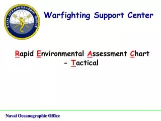

Warfighting Support Center
E N D
Presentation Transcript
Warfighting Support Center Rapid Environmental Assessment Chart - Tactical Naval Oceanographic Office
What is REACT ? • Digital geographic information systems (GIS) product that allows METOC data to be viewed using a free COTS GIS browser (Arc Explorer) on WIN95/98/NT box • Custom-tailored environmental displays to support mission planning and operational requirements • Provides the customer with the capability to display and manipulate imagery/oceanographic models/near-real time oceanographic data/meteorological data in a GIS format Naval Oceanographic Office
What makes up REACT? • Static Data Sets • Raster • - LandSat, SPOT, DTED, ADRG, TARPS, acoustic imagery, aerial photography • Vector • - bathymetry (contours/soundings), NIMA wrecks/obstructions, bottom sediments, World Vector Shoreline (WVS), slope analysis Naval Oceanographic Office
What makes up REACT? • Dynamic Data Sets • Raster • - AVHRR • Vector • - Sea surface temperature, scatterometry, acoustic properties of seawater, wave direction and height, current speed and direction, wind speed and direction at various levels, surface pressure, surface precipitation Naval Oceanographic Office
Raster Examples LandSat Imagery Naval Oceanographic Office
Raster Examples AVHRR Image Naval Oceanographic Office
Raster Examples Different types of imagery viewed at the same time LandSatImage (30m resolution) SPOT Image (10m resolution) Side Scan Sonar Image (1m resolution) Naval Oceanographic Office
Vector Examples NOAA Bathymetry and NIMA World Vector Shoreline Naval Oceanographic Office
Vector Examples NIMA Wrecks and Obstructions Naval Oceanographic Office
Vector Examples Surface Winds and Air Temperature from FNMOC Naval Oceanographic Office
Vector Examples Wave Models from NAVO N2 Naval Oceanographic Office
Static Themes (imagery, bathymetry, • land, wrecks) activated … user selects other themes to display such as surface winds and significant wave directions
Surface Winds at 48HR Forecast with 00HR and 24HR Runs
Identifying Features … user can find out what information is available concerning any front … and the same could be done with any other theme
Building a Data Query … user creates a query on a selected theme, such as MODAS in this case
… user zooms to area of interest