Download
1 / 73
730 likes | 844 Vues
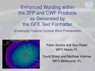
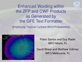
Enhanced Wording within the ZFP and CWF Products as Generated by the GFE Text Formatter (Employing Tropical Cyclone Wind Probabilities). Pablo Santos and Guy Rader WFO Miami, FL David Sharp and Matthew Volkmer WFO Melbourne, FL. EXAMPLE. TC Wind Speed Probabilities on AWIPS-D2D

E N D
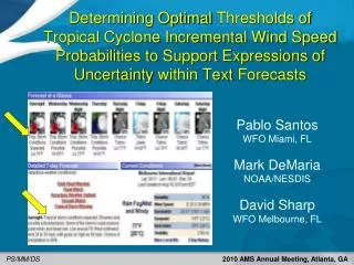
Enhanced Wording withinthe ZFP and CWF Productsas Generated bythe GFE Text Formatter(Employing Tropical Cyclone Wind Probabilities) Pablo Santos and Guy Rader WFO Miami, FL David Sharp and Matthew Volkmer WFO Melbourne, FL
EXAMPLE TC Wind Speed Probabilities on AWIPS-D2D (Incremental-form) Probability of Tropical Storm Conditions Hurricane Charley 2004 34 knot / 36 hour
EXAMPLE TC Wind Speed Probabilities on AWIPS-D2D (Incremental-form) Probability of Tropical Storm Conditions Hurricane Charley 2004 34 knot / 48 hour
EXAMPLE TC Wind Speed Probabilities on AWIPS-D2D (Incremental-form) Probability of Tropical Storm Conditions Hurricane Charley 2004 34 knot / 60 hour
EXAMPLE TC Wind Speed Probabilities on AWIPS-D2D (Incremental-form) Probability of Hurricane Conditions Hurricane Charley 2004 64 knot / 36 hour
EXAMPLE TC Wind Speed Probabilities on AWIPS-D2D (Incremental-form) Probability of Hurricane Conditions Hurricane Charley 2004 64 knot / 48 hour
EXAMPLE TC Wind Speed Probabilities on AWIPS-D2D (Incremental-form) • For more information about tropical • cyclone wind probabilities, please see: • Knaff and DeMaria (2005) • Gross et al. (2004) Probability of Hurricane Conditions Hurricane Charley 2004 64 knot / 60 hour
Proposed WFO Use • During potential high impact weather events such as tropical cyclones, users want our ‘best forecast’, but also accompanied with an expression of uncertainty (or confidence) of that forecast. • Therefore, we are exploring the use of TC Wind Probabilities to improve official text/tabular products: • To include situational expressions of uncertainty within the Zone Forecast Product (ZFP) and the Coastal Waters Forecast (CWF). • In the future, with success, then explore situational inclusion of tropical cyclone wind probability elements within the Point Forecast Matrices (PFM).
Improve ZFP & CWF Products • The intent is to establish a set of rules for triggering enhanced wording which responsibly convey wind speed uncertainties within text forecasts according to the temporal period. • This is accomplished through GFE automated formatters by making appropriate use of the following grids sets: • Hazard Grids • Wind Grids • Tropical Cyclone Wind 34 kt Probability Grids • Tropical Cyclone Wind 64 kt Probability Grids • Initial development and testing was done off-line during the 2005 season; an aggressive examination is underway for the 2006 season.
Grid Set Descriptions • Hazard Grids include Hurricane/Tropical Storm Warning/Watch grids as issued: • For coastal zones by TPC • For inland zones by WFO • For marine zones by WFO • Wind Grids represent the post-processed wind grids as generated by the TCM Wind tool, with WFO value added contributions for local effects (e.g., higher altitude terrain, gap winds, over inland lakes, etc.). • The Tropical Cyclone Wind Probability Grids (as obtained through TPC) are the incremental-based (not cumulative) probabilities for 34 knot and 64 knot winds. • The incremental probabilities for 50 knot winds are not needed for this application.
Series of Situation Rules According to the Forecast Period • Forecast Periods • 00-48 hours (~ Warning/Watch period) • 00-12 hours • 13-24 hours • 25-48 hours • 49-120 hours (extended period) • Deterministic vs. Probabilistic Information • Deterministic wind speeds have the most value during the 00-24 hour period, and have decreasing value with increasing time. • Probabilistic wind speeds have increasing value with increasing time.
Message Sensitivity Text Formatters: Logic Hierarchy for Sensitivity Note: Forecast Error implies appreciation for the inherent uncertainties regarding the track, intensity, and size of the tropical cyclone.
Baseline Phraseology Text Formatters: Baseline Phraseology • Note: • The word IMMINENT may be used only within the 00-12 hour period and when • conditions are simultaneously met within the hazard, wind, and probability grids. • The word EXPECTED may be used in situations mainly during the Warning period, • but may be selectively used in the Watch period (e.g., Day 1 & 2). • The word POSSIBLE may be used during the extended period (e.g., Day 3 - 5), • but may also be used in specific circumstances within Watch/Warning period. • Also, certain situations may require compound phrases (e.g., Tropical Storm • Warning with a Hurricane Watch).
Probability Thresholds Text Formatters: Probability Thresholds (Initial) Note: Initial thresholds were empirically-determined; future refinements are likely.
Probability Thresholds Text Formatters: Probability Thresholds (Initial) Note: Initial thresholds were empirically-determined; future refinements are likely.
For Example - An incremental-form 64-knot tropical cyclone wind probability depiction associated with Hurricane Wilma (2005) is used here to trigger the phrase ‘HURRICANE CONDITIONS POSSIBLE’ in a later period of the ZFP and CWF. Valid time is 96 hours on 24 October 2005, 0000 UTC (from a start time on 20 October 2005, 0000 UTC). Note that values shown only range from 0 to 5%. 96 hour forecast
For Example – ZFP Extended WESTERN COLLIER-EASTERN COLLIER-MAINLAND MONROE- INCLUDING THE CITIES OF…NAPLES…IMMOKALEE…FLAMINGO 1130 PM EDT WED OCT 19 2005 .TONIGHT… .THURSDAY… .THURSDAY NIGHT… .FRIDAY… .FRIDAY NIGHT…BREEZY. .SATURDAY…WINDY. .SATURDAY NIGHT…TROPICAL STORM CONDITIONS POSSIBLE. .SUNDAY…HURRICANE CONDITIONS POSSIBLE. .SUNDAY NIGHT…TROPICAL STORM CONDITIONS POSSIBLE. .MONDAY…BREEZY. Note: From the Hurricane Wilma (2005) test case, the experimental formatter output for the ZFP indicated POSSIBLE tropical cyclone conditions in the extended periods of the forecast. For brevity, only the descriptive wind elements are shown here. Formatter Output
Charley Example of How Algorithm works Advisory Time: 20040813_0900 (0-12 Hours – First Period)
Charley Example of How Algorithm works Advisory Time: 20040813_0900 (0-12 Hours – First Period)
Charley Example of How Algorithm works Advisory Time: 20040813_0900 (13-24 Hours – Second Period)
Charley Example of How Algorithm works Advisory Time: 20040813_0900 (13-24 Hours – Second Period)
Charley Example of How Algorithm works Advisory Time: 20040813_1500 (0-12 Hours – First Period)
Charley Example of How Algorithm works Advisory Time: 20040813_1500 (0-12 Hours – First Period)
Frances Example of How Algorithm works Advisory Time: 20040902_1500 (25-36 Hours – Third Period)
Frances Example of How Algorithm works Advisory Time: 20040902_1500 (37-48 Hours – Fourth Period and Extended)
Frances Example of How Algorithm works Advisory Time: 20040902_1500 (37-48 Hours – Fourth Period and Extended)
Frances Example of How Algorithm works Advisory Time: 20040902_1500 (37-48 Hours – Fourth Period and Extended)
Frances Example of How Algorithm works Advisory Time: 20040902_1500 (37-48 Hours – Fourth Period and Extended)
Katrina Example of How Algorithm works Advisory Time: 20050824_2100 (Second – Fifth Periods)
Katrina Example of How Algorithm works Advisory Time: 20050824_2100 (Second – Fifth Periods)
Katrina Example of How Algorithm works Advisory Time: 20050824_2100 (Second – Fifth Periods)
Katrina Example of How Algorithm works Advisory Time: 20050824_2100 (Second – Fifth Periods)
Katrina Example of How Algorithm works Advisory Time: 20050824_2100 (Second – Fifth Periods)
Wilma Example of How Algorithm works Advisory Time: 20051023_2100 (First through Third Periods)
Wilma Example of How Algorithm works Advisory Time: 20051023_2100 (First through Third Periods)
Wilma Example of How Algorithm works Advisory Time: 20051023_2100 (First through Third Periods)
Wilma Example of How Algorithm works Advisory Time: 20051023_2100 (First through Third Periods)
Wilma Example of How Algorithm works Advisory Time: 20051023_2100 (First through Third Periods)
Wilma Example of How Algorithm works Advisory Time: 20051023_2100 (First through Third Periods)
Charley Example of How Algorithm works Advisory Time: 20040813_0900 (0-12 Hours – First Period)
Charley Example of How Algorithm works Advisory Time: 20040813_0900 (0-12 Hours – First Period)
Charley Example of How Algorithm works Advisory Time: 20040813_0900 (13-24 Hours – Second Period)
Charley Example of How Algorithm works Advisory Time: 20040813_0900 (13-24 Hours – Second Period)
Frances Example of How Algorithm works Advisory Time: 20040902_1500 (25-36 Hours – Third Period)
Frances Example of How Algorithm works Advisory Time: 20040902_1500 (37-48 Hours – Fourth Period and Extended)
Frances Example of How Algorithm works Advisory Time: 20040902_1500 (37-48 Hours – Fourth Period and Extended)
Frances Example of How Algorithm works Advisory Time: 20040902_1500 (37-48 Hours – Fourth Period and Extended)
Frances Example of How Algorithm works Advisory Time: 20040902_1500 (37-48 Hours – Fourth Period and Extended)