Download
1 / 11
110 likes | 283 Vues
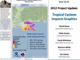
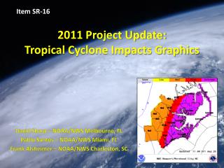
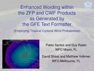
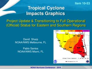
Item 10-53. Project Update & Transitioning to Full Operational (Official) Status for Eastern and Southern Regions. Tropical Cyclone Impacts Graphics. David Sharp NOAA/NWS Melbourne, FL Pablo Santos NOAA/NWS Miami, FL. NOAA Hurricane Conference – 2010.

E N D
Item 10-53 Project Update & Transitioning to Full Operational (Official) Status for Eastern and Southern Regions Tropical Cyclone Impacts Graphics David Sharp NOAA/NWS Melbourne, FL Pablo Santos NOAA/NWS Miami, FL NOAA Hurricane Conference – 2010
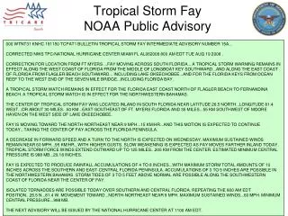
Assessing Threat & Potential Impactfor Local Areas Starting with the official forecast from the national center (NHC) for wind or surge… wind • Deterministic Assessment • “Best Forecast” • Local weather inputs; magnitude-only • Expected impacts if forecast was perfect • Probabilistic Assessment • “Spectrum of Plausible Forecasts” • Accounts for uncertainty; percent exceedance • Potential impacts knowing forecast isn’t perfect • Combined Assessments • “What You Should Prepare For” • Includes forecaster refinements • Composite Maximums of Combined Assessments Over Event Time • Potential impacts for decision assistance surge flood tornado
Developmental &Experimental Periods • Under development for over 10 years • Since Hurricane Floyd • Limited experimental status for ~4 years • More comprehensive status for ~2 years • Nearly all coastal offices from Brownsville to Caribou, to include San Juan • WFOs acquiring experience • Wide-audience feedback
It’s Decision-Time • Propose to transition the Tropical Cyclone Impacts Graphics to operational (official) status for 2012 • Eastern & Southern Regions • at that time • Pacific & Western Regions • phased-in
What Will It Take • Final Testing for 2011 Season • Operational Best Practices • Operational Support • Back-up Services Capability • Operating Versions of the Tools • Threat/Impact Definitions Audit • Web Pages Functionality Audit • Training Updates • Supporting Policies/Directives • Others ???
Issues & Experiences • Overall … Past Seasons • Need to update graphics with each HLS issuance • Run Coastal Flood Threat Tool before HLS formatter • Consider this for all tools • “Voodoo” tool configurations • Settle on Approach (which is it?) • Common thresholds with locally unique descriptions • Locally unique thresholds with common descriptions • Sliding scale of common thresholds with locally unique descriptions • Impact descriptions re-assessed • NDFD (from discrete to scalar grid?)
Issues & Experiences • Overall • Consistency between number of graphic levels vs. the number of impact description levels • Auto-update for the web site • For situational awareness monitoring • KML files for GIS systems
Issues & Experiences • High Wind Threat Tool • Code for local variations • Coastal Flood Threat Tool • Availability of Psurge for tropical storms • Availability of deterministic SLOSH • Upgrade Topo with better land/sea mask • Inland Flooding Threat Tool • Gridded FFG • HPC PQPF • Tornado Threat Tool • Coordinate with gHWO tool logic
Again, Will It Take • Final Testing for 2011 Season • Operational Best Practices • Operational Support • Back-up Services Capability • Operating Versions of the Tools • Threat/Impact Definitions Audit • Web Pages Functionality Audit • Training Updates • Supporting Policies/Directives • Others ???
Recommendations • Reconvene the Tropical Cyclone Impacts Graphics team to completely identify the list of required steps for operational transition (for 2012). The team will develop a prioritized tasking list and execute the steps according to timeline. • Some technical assistance from outside the team will be needed