Download
1 / 25
250 likes | 428 Vues
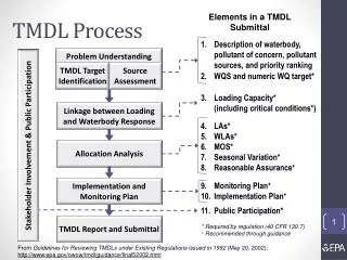
Phelps Branch Sediment TMDL. Technical Advisory Committee Meeting Gene Yagow April 17, 2013. Overview. Watershed characterization GWLF sediment modeling Reference Watershed Approach TMDL equation Allocation Scenarios. Watershed characterization. Watershed characterization.

E N D
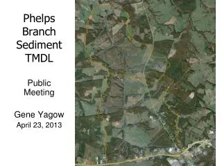
Phelps Branch Sediment TMDL Technical Advisory Committee Meeting Gene Yagow April 17, 2013
Overview • Watershed characterization • GWLF sediment modeling • Reference Watershed Approach • TMDL equation • Allocation Scenarios
Watershed characterization • Land Use refinements • Distribution of pasture and hay acreages • Definition of disturbed acreage • Simulation of land uses for a “future” condition • Watershed segmentation • BMP representation
Land use refinements • Distribution of pasture / hay acreages • NASS 2009 cropland data layer • 48% pasture/hay; 2% shifted to cropland • Used 2006 DCR distribution for NPSA • Lower Phelps Branch: 75% pasture; 25% hay • Upper Phelps Branch: 50% pasture; 50% hay • Added 1 category from CBWM modeling • Riparian pasture ≈ 1.5% of pasture • Remaining pasture: 10% good condition; 65% fair condition; 25% poor condition
Land use refinements (cont.) • Assignment of disturbed acreage • Calculated construction permit area as 5% of developed land uses
Land use refinements (cont.) • Simulation of a “future” land use condition • Assume growth is limited to the upper portion of the watershed • Developed land use increased by 15% (30 acres) • 1/3 of reduced acreage from Agricultural land use categories (10 acres) • 2/3 of reduced acreage from Forest categories (20 acres)
BMP representation DCR data downloaded by 6th order watersheds and filtered for unique records and for those BMPs relevant to sediment removal None in Phelps Branch, but many in reference watershed BMPs are land use-specific BMPs were credited as an efficiency either applied to the applicable land use or to the upland area benefitted
TMDL Target Load Reducing load in the impaired watershed to the target TMDL load is expected to restore the benthic community Example Reference Watershed TMDL Impaired Load Non-impaired Phelps Branch Watershed TMDL Reference Watershed
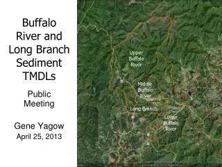
Reference Watershed Selection • Wreck Island Creek • Most similar land use distribution • Encompasses Phelps Branch watershed
HYSadj 4,252 ha Reference Watershed Area-adjustment Example HYS 20,789 ha TMB 4,252 ha
GWLF Sediment Loads LDI = low intensity developed; MDI = medium intensity developed; HDI = high intensity developed TMDL
Permitted Sediment Loads General Concrete Permit *Average annual runoff simulated for the HDI land use category. General Single-Family Household Permit SFH Load = .001 MGD * 1.5472 cfs/MGD * 30 mg/L * 2.445 (kg/day)/(cfs*mg/L) * 365.25 days/yr * 0.001 t/kg = 0.041 t/yr Construction Permits
Phelps Branch Sediment TMDL Components • TMDL = WLA + LA + MOS • TMDL = area-adjusted load from reference watershed • WLA = permitted loads • MOS = margin of safety (10%) • LA = remaining load allocated for non-point sources
Allocation Scenarios • Sediment load reductions are required • from “Future” Conditions in Phelps Branch • To the target allocation load Target Allocation Load = TMDL - MOS = 1,973.8 – 197.4 = 1,776.4 tons/yr
Potential Sediment Reduction Targets Pastures with stream access Unstabilized field roads Localized disturbed areas Construction sites Hydraulic effects of road crossings Urban storm water runoff
Next Steps • Incorporate comments from TAC • Final Public Meeting – April 23rd • Public comment open for 30 days • Finalize report and submit to EPA
Contact Information Gene Yagow Biological Systems Engr. Dept. 306 Seitz Hall (0303)Virginia TechBlacksburg, VA 24061 eyagow@vt.edu540-231-2538