Download

1 / 22
220 likes | 402 Vues
Teaching with Google Earth and Other Geographic Resources . Stephen Titchenal, Program Specialist - Technology Stephanie Myers, Program Specialist - Math Cleveland Heights – University Heights City School District.

E N D
Teaching with Google Earth and Other Geographic Resources Stephen Titchenal, Program Specialist - Technology Stephanie Myers, Program Specialist - Math Cleveland Heights – University Heights City School District Learn to use free online resources that view the world using aerial photos, maps and overlays. The most interactive of these free resources, Google Earth, allows users to share descriptive placemarks, create trips, measure distances, add overlays and place 3-D objects. A community of users has created many useful additions to teach objectives in science, social studies, math and other subjects.
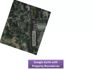
Map Content Examples • Political Boundaries • Land Forms • Transportation Routes • Topography • Property Ownership • Scientific data with geographic content • Social data with geographic content
Ohio Social Studies Content Standards • GrK: Distinguish between land and water on maps and globes.
Ohio Social Studies Content Standards • Gr1: Identify and describe the physical features (lake, river, hill, mountain, forest) and human features (town, city, farm, park, playground, house, traffic signs/signals) of places in the community.
Ohio Social Studies Content Standards • Gr3: Identify and use symbols to locate places of significance on maps and globes.
Ohio Social Studies Content Standards • Gr3: Use political maps, physical maps and aerial photographs to ask and answer questions about the local community.
Ohio Social Studies Content Standards • Gr3: Describe changes in the community over time…
Ohio Social Studies Content Standards • Gr4: Locate the local community, state and the United States on maps or globes.
Ohio Social Studies Content Standards • Gr4: Use a linear scale to measure the distance between places on a map.
Ohio Math Content Standards • Gr4: Identify and select appropriate units to measure: perimeter
Ohio Social Studies Content Standards • Gr6: Use coordinates of latitude and longitude to locate points on a world map.
Ohio Science Content Standards • Gr8: Use models to analyze the size and shape of Earth, its surface and its interior (e.g., globes, topographic maps, satellite images).
Ohio Science Content Standards • Gr9: Explain the results of plate tectonic activity (e.g., magma generation, igneous intrusion, metamorphism, volcanic action, earthquakes, faulting and folding).
Recent Scanned Maps • Microsoft Terraserver (USA) • Terraserver.com (Wordwide) • Topozone
Historic Scanned Maps • Library of Congress (MrSID) • David Rumsey (Insight) • RailsandTrails.com (DjVu) • MapTech Historical Topographic Maps
Interactive Maps • Google Maps – Panoramio - Quckmaps • Yahoo Maps – New Features • Microsoft Live Local • 3D Virtual Earth – 3D buildings, tilt • Birds Eye Views – High Resolution Photos in 4 directions • Microsoft APIs • MapCruncher Mashupshow to
Google Earth • Finding locations • Navigating • Viewing layers • Measuring Distances • Tips: • Tools/Options->Set Disk Cache to 2000MB (2Gig) • Go to the sites once before presentation • Keep other programs to a minimum
Creating content in Google Earth • Placemarks • Trips • Image Overlays (Superoverlay) • 3D Objects (SketchUp)
Student Projects • Local Placemarks • World Placemarks • Measuring Distances • Tours • Latitude/Longitude • Community Changes Over Time
Saving Content • “Save As” to shared location Tip: Have students use their first name in the title of the object • Email • Combining objects into folders • Websites (set up mime type) • Network Links (can be updated on server)
Google Earth Community • Keyhole BBSEducation(Google Earth Community) • American Embassy School Movies (India) • EarthWandering (share placemarks in real time) • Blogs • Map Room A Weblog about Maps • Topographic Map Archive (Matt Fox) • KML Reference
Contacts • http://resources.chuh.org/GoogleEarth/ • S_Titchenal@chuh.org (216-320-2340) • S_Myers@chuh.org Cleveland Heights / University HeightsCity School District2155 Miramar DriveUniversity Heights, OH 44118