Discover and Create: The Power of Maps
Explore the importance of maps in geography education, learn how to interpret and create maps, and discover the world through visual representations.

Discover and Create: The Power of Maps
E N D
Presentation Transcript
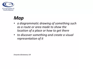
Map • a diagrammatic drawing of something such as a route or area made to show the location of a place or how to get there • to discover something and create a visual representation of it Encarta dictionary UK
Geography Curriculum 2014 The national curriculum for geography aims to ensure that all pupils are competent in the geographical skills needed to: • interpret a range of sources of geographical information, including maps, diagrams, globes, aerial photographs and Geographical Information Systems (GIS) • communicate geographical information in a variety of ways, including through maps, numerical and quantitative skills and writing at length. AND - There is a specific mention of OS mapping in NC 2014: ‘... use the eight points of a compass, four and six-figure grid references, symbols and key (including the use of Ordnance Survey maps) to build ... knowledge of the United Kingdom and the wider world’. (DfE 2013) (DfE 2013)
Why use Maps? • Maps help geographers to enquire about, describe and explain what places are like and why, how and why they are changing and how they compare to other places. • Maps communicate • Maps help geographers ‘zoom’ in and out of different scales of enquiry. • Maps can highlight patterns, similarities and differences • Maps are tools for explaining the world • Maps are only ever imperfect models: variable in design and interpretation
Where do I hang out? CHILD Supported map Start with your own house. Draw lines to show places you go to. Design symbols for different types of places. Use colours /patterns to show different types of landscapes Nanny and Granddad's house Sheerness Beach Eastchurch School LLLLLLLLLLL LLLLLLLLLLL Cliffs xxxxxxxxxxxxxxxxx LLLLLLLLLLL LLLLLLLLLLL Local shop LLLLLLLLLLL Nanny and Granddad's house Daddy’s shop Sittingbourne What does this tell you about this child’s range and freedom to explore? How might this range develop in the next few years? xxxxxx Bus LLLLLLLLLLL Walk Town Car House School Shops
Starting out – with us Maps help tell stories about who we are and where we live Where I live and types of housing Where my school is and how I get there.
Talking about the immediate locality Add a star to all the places you go to at least once a week...
Talking about the wider locality Add a different symbol star to show places you go to at least once a month ..
Talking about Great Britain What places in Great Britain have you visited? Zoom in on one and add a holiday snap.
Range and scale I’m allowed to play out in the street and can walk to the shop and back with my friends. I mustn’t go anywhere else. (Boy aged 8)
Text courtesy Wikipedia Graphic courtesy Tagxedo http://www.tagxedo.com/app.html Ask children to brainstorm words that signify the UK. Paste into Tagxedo to show Thought Shower. Could do for the ‘world’ and for other continent shapes.
Starting out- through stories • Little Red Riding Hood’s journey through the woods – sequence and recall, • features, symbols and way marks, • emotions e.g. danger! • Best routes? • Drama to act out the journey and ‘read’ the map • OR be subversive! • http://www.geography.org.uk/projects/younggeographers/resources/southborough/
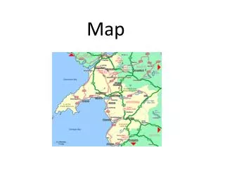
Patterns & Comparisons Fraserburgh Weymouth Simple land use comparisons: 1:25 000 scale. What do you notice? New Quay Ullapool
Transport Patterns • Why and how are these places connected? • Why does that motorway go around London and not through it? • What came first the cities or the motorways? • Where do you think airports are situated? On A roads, B roads or Motorways? • Can you name these cities? • Can you add ... www.digimapforschools.edina.ac.uk
Sounds around us London Sounds http://www.soundsurvey.org.uk/index.php/survey/soundmaps/more/81/35/ Grid 20 has sounds from Kings Cross Station and Regent’s Park Sound Cities http://soundcities.com/ A woman singing in her house, Bangkok City
Talking about Changes over Time What did it look like before the Olympic Park was built? Toggling between current and 1890s historical map views
Me in the World www.scribblemaps.com What everyday items do you use each day? How do they connect you to the world? Breakfast items? Clothes? Toys? Compare your map to others – what do you notice?
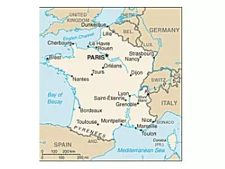
Country Connections I live in England, UK. China Canada Australia Malaysia France Spain ME Wales Iran Ireland Scotland What categories could you add? Cultural links? Food, clothes etc? Email links? Music TV and other media? Family links Visited Friends Lived
Children and ‘Messy Mapping’ Photos Nell Seal Pupils from Hillside Avenue Primary School doing fieldwork at Wells – next - Sea
Useful Links OS Digimap for Schools www.digimapforschools.edina.ac.uk Geographical Association www.geography.org.uk Geography Champions http://geographychampions.ning.com London Mapper http://www.londonmapper.org.uk/ Mapping our Globe http://www.geography.org.uk/resources/mappingourglobe/ Go Local http://www.geography.org.uk/cpdevents/onlinecpd/younggeographersgolocal/ Some online resources http://www.geography.org.uk/resources/onlineresources/#15331 Think Maps http://www.geography.org.uk/projects/valuingplaces/cpdunits/thinkmaps/ Making Maps http://www.geography.org.uk/gtip/thinkpieces/makingmaps/#787 Maps to help you make sense of the World http://twistedsifter.com/2013/08/maps-that-will-help-you-make-sense-of-the-world/ Do you know Europe? http://stephanmendler.de/thinkmaps/puzzle/index_en.html How well do you know the world? http://www.theguardian.com/global-development/interactive/2012/dec/20/geography-game-how-well-know-world Global wind and weather http://earth.nullschool.net/#current/wind/isobaric/1000hPa/orthographic=-1.37,52.87,1070 World Hunger Map http://cdn.wfp.org/hungermap/#ES Life Expectancy http://www.mapsofworld.com/africa/thematic/life-expectancy-at-birth.html Interactive London Map http://www.mylondonmap.com/ Street map http://www.streetmap.co.uk/ London Toilet Map http://www.cityoflondon.gov.uk/services/transport-and-streets/clean-streets/Pages/toilet-map.aspx Googlemaps www.maps.google.com Jane Whittle takes her Y1/2class out to do Journey Sticks London Profiler http://www.londonprofiler.org London Sounds http://www.soundsurvey.org.uk/index.php/survey/soundmaps/more/81/35/ powens@geography.org.uk
Where is Matt? http://www.youtube.com/watch?v=Pwe-pA6TaZk&feature=youtube_gdata_player