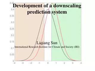
DEFINITION
DEFINITION. Ecological restoration is the process of assisting the recovery of an ecosystem that has been degraded, damaged, or destroyed. Monthly Average CO 2 PPM Concentration Mauna Loa Observatory. CO 2 ppm. 600. After 45 More Years of current energy use patterns. 500. 400.

DEFINITION
E N D
Presentation Transcript
DEFINITION • Ecological restoration is the process of assisting the recovery of an ecosystem that has been degraded, damaged, or destroyed.
Monthly Average CO2 PPM Concentration Mauna Loa Observatory CO2 ppm
600 After 45 More Years of current energy use patterns 500 400 Today’s CO2 Concentration 300 280 260 240 CO2 Concentration CO2 [ppmv] 220 200 180 Temp. in F° 600,000 500,000 400,000 300,000 200,000 100,000 0 Age (yr BP)
Temperature from Greenland Ice Cores Temperature 50,000 25,000 0 Years Before Present
Temperature from Greenland Ice Cores Temperature 50,000 25,000 0 Years Before Present
Fertile Crescent Development of Agriculture & Complex Societies China Andes Temperature oC Meso Amer. East U.S. Years Before Present Sources: Alley, R.B. 2004. GISP2 Ice Core Temperature and Accumulation Data; Diamond, J. 1997. Guns, Germs & Steel
Median Actual Sea Ice, September, 2005 National Snow and Ice Data Center, Boulder, CO
Median Actual Record Breaking Loss of Sea Ice, September 16, 2007 National Snow and Ice Data Center, Boulder, CO
Sea levels are rising 2.8 cm/decade
Climate Change in the U.S. NortheastInitial Findings of the Northeast Climate Impacts AssessmentUnion of Concerned Scientists
Start with scenarios of future emissions from human activities HIGHER A1FI End-of-century emissions range from 1x to 5x 1990 levels • jlhgjhjh;hjkj LOWER B1
Annual temperatures (avg.) have warmed almost 2ºF since 1970 Winters have been warming fastest, at 1.3ºF per decade since 1970 Winter snowpack is decreasing Plants are flowering earlier in spring Extreme heat in summer is more frequent The Northeast’s climate is already changing
Rising Temperatures(annual average) Source: NECIA/UCS, 2007 (see: www.climatechoices.org/ne/) The result of today’s emissions choices Unavoidable warming (yesterday’s choices)
Source: NECIA / UCS (see: www.climatechoices.org/ne/) The Changing Winter Landscape
Summer heat index Change in how climate feels Who wants to move to Virginia? Lower emissions scenario – 3.5º to 6.5 º F by 2100 1961-1990 1961-1990 2040-2069 2070-2090 2040-2069 How about Southern Georgia? Higher emissions scenario – 6.5º to 12.5º F by 2100 2070-2090 Source – USDOE: National Renewable Energy Laboratory
Carbon Gains from Varying Forest Management Activities from a Study of Douglas Fir Tons of Carbon/Acre
Total Sequestration via Land Use MMT CO2e
2 -40°F through -50°F 3 -30°F through -40°F 4 -20°F through -30°F 5 -10°F through -30°F 6 0°F through -10°F 7 10°F through 0°F 8 20°F through 10°F 9 30°F through 20°F 10 40°F through 30°F 1990 Hardiness Zone Map (USDA)
1990 Hardiness Zone Map (USDA)
2006 Hardiness Zone Map (National Arbor Day Foundation)
5 + 6 7 Old
+ 5 + 6 7 New
US Forest Service Climate Change Atlas www.nrs.fs.fed.us/atlas/
Current range www.nrs.fs.fed.us/atlas/
Current range Willow OakQuercus Phellos www.nrs.fs.fed.us/atlas/
Current range Modeled Future Range Willow OakQuercus Phellos
Warming • Drying • Greater fluctuations, severe weather • Need to model change to anticipate composition of future forest • Need for planting? Dimensions of Global Change
New Arrivals Southern red oak Water oak Willow oak Extirpated Sugar maple Yellow birch Scarlet oak Decreasers Tulip poplar Chestnut oak Northern red oak Black birch Black cherry Increasers Red maple:large White oak, Black oak, Bur oak, Blackjack oak, Post oak: moderate Black gum:slight
Effects on Management • Favor increasers? • Plant new arrivals? • Anticipate changes caused by new management regime and how that will favor/disfavor certain species • Effect of fire (for oak regeneration) most pronounced
Birds arrive earlier - Europe Chaffinch Julian date Spotted Flycatcher Julian date Hüppop & Hüppop 2003
Many land trust are just starting to do research and understand what they might do - they are trying to get their minds around it. • Limited recognition of technical details, especially additionality.