Ice Jam Data Collection
350 likes | 560 Vues
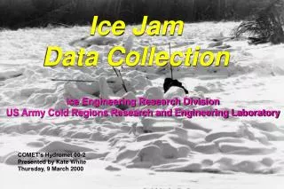
Ice Jam Data Collection. Ice Engineering Research Division US Army Cold Regions Research and Engineering Laboratory. COMET’s Hydromet 00-2 Presented by Kate White Thursday, 9 March 2000. Background data collection historical or archived records Field data collection. Data Collection.

Ice Jam Data Collection
E N D
Presentation Transcript
Ice Jam Data Collection Ice Engineering Research Division US Army Cold Regions Research and Engineering Laboratory COMET’s Hydromet 00-2 Presented by Kate White Thursday, 9 March 2000
Background data collection historical or archived records Field data collection Data Collection
Ice records • Historical ice and stage data • River geometry • River hydraulics • Hydrology • Meteorology • Flooded areas • Past flood-fighting measures • Potential flow control Background Data Collection
CRREL and Corps reports CRREL Ice Jam Database NWS forecasts USGS gage data Historical ice jam and open water flood data (stages, flooded areas) Topographic/GIS mapping Local Civil Defense/Emergency Management Agency reports Other technical reports Newspaper/TV accounts Photographic/videotape records Anecdotal records Sources of background information
Database available on web http://www.crrel.usace.army.mil/products/products.html Archive contains paper copies/photos/video CRREL Ice Jam Database/Archive
461 RWUS32 KCTP 171602 FFSCTP PAZ017-024-172200- FLOOD STATEMENT NATIONAL WEATHER SERVICE STATE COLLEGE PA 1100 AM EST THU FEB 17 2000 ICE JAM CONTINUES ON CLEARFIELD CREEK NEAR DIMELING. SCRIBNERS ROAD IS STILL CLOSED. AT 1030 AM THIS MORNING...CLEARFIELD COUNTY EMERGENCY MANAGEMENT OFFICIALS REPORT SOME MINOR CHANGES TAKING PLACE. WATER ALONG THE CLEARFIELD CREEK IS STILL FLOWING ONTO SCRIBNERS ROAD. THE WATER IS ALSO PUSHING ICE ONTO THE ROAD. THE CHANGE IS IN THE CHARACTER OF ICE THAT IS JAMMING. THE ICE THAT IS JAMMING IS NOW LARGER SHEETS OF ICE THAT ARE STACKING VERTICALLY. THE HIGHER STACKS OF ICE IN THE JAM MAY BACK WATER TO EVEN HIGHER LEVELS DURING THE NEXT THAW. SO FAR THE WATER LEVEL BEHIND THE JAM REMAINS UNCHANGED FROM YESTERDAY. AND NO HOMES ARE BEING AFFECTED. THE ROAD IS COVERED WITH ICE AND WATER FOR A DISTANCE OF ONE TO TWO MILES...DOWNSTREAM OF THE DIMELING BRIDGE. ANOTHER ICE JAM IS OCCURRING UPSTREAM ON CLEARFIELD CREEK...BETWEEN IRVONA AND COALPORT IN BECCARIA TOWNSHIP. THERE ARE AT LEAST 7 HOMES THREATENED BY THIS JAM BUT NO FLOODING IS OCCURRING AT THIS TIME. FURTHER UPSTREAM...IN CAMBRIA COUNTY...YET ANOTHER ICE JAM ON CLEARFIELD CREEK IN WHITE TOWNSHIP...HAS BACKED ICE UP FOR 3 QUARTERS OF A MILE. THE ICE FROM THIS JAM IS BACKED UP AGAINST THE FOSTER ROAD BRIDGE...BUT NO FLOODING IS BEING REPORTED AT THIS TIME. ADDITIONAL ICE JAMS ARE STILL POSSIBLE THIS AFTERNOON AND TONIGHT ALONG CLEARFIELD CREEK...WHICH COULD RESULT IN ADDITIONAL FLOODING. ICE JAMS CAUSE RAPID FLUCTUATIONS IN WATER LEVELS. IF YOU LIVE NEAR A RIVER OR STREAM...BE READY TO ACT QUICKLY IF ICE JAMS FORM OR A WARNING IS ISSUED. DO NOT DRIVE YOUR VEHICLE INTO AREAS WHERE THE WATER COVERS THE ROADWAY. VEHICLES CAUGHT IN RISING WATER SHOULD BE ABANDONED.MOVE TO HIGHER GROUND. .END/ HEAD LAT...LON 4033 7895 4031 7872 4113 7817 4117 7873
Topographic mapping Jam Toe
SAFETY Volunteer observers should not attempt to make measurements or other observations from the surface of the ice - The thickness and stability of ice covers and ice jams can vary widely in a very short distance Volunteer observers should not collect data alone. - Always let someone know where you are going and when you expect to return.
Type of ice jam Freezeup Breakup Predominant ice type Scope of jam Length Thickness Stages Likelihood of progression or failure Upstream ice supply Downstream ice conditions Field Data Collection
Location and extent of jam, jam progression Jam toe Head of jam
Upstream ice supply • Volume of ice (length, thickness) high frazil concentrations vs. low frazil concentrations
Upstream ice supply • Condition of ice (e.g., competent, weak, jam)
Length • Thickness • Condition • Open water areas • Likelihood of jamming downstream Downstream ice conditions
Event discharge • Antecedent • Present and forecast discharge • Present • Potential for flow control • Forecast Discharge Air and Water Temperature
Ice thickness • Seasonal USGS measurements available? • Direct measurements • Indirect measurement (e.g., ice blocks left • on shore, tree scars, ice collars, high • water marks) • Estimate thermal ice growth from modified • Stefan equation
Victor Hom, NERFC hard at work Kennebec River, ME
Present stage • Rate of change in stage • Potential flooded areas • Direct measurements • Indirect • (e.g., high-water marks, ice collars, tree scars) Water / ice stage
Tree scars, old and new
Last But Not Least Remember to send your ice event information to CRREL for inclusion in the Ice Jam Database and Ice Jam Archives! lourieh@crrel.usace.army.mil