Download
1 / 14
Télécharger la présentation 
Map Projections: Types and Uses
An Image/Link below is provided (as is) to download presentation
Download Policy: Content on the Website is provided to you AS IS for your information and personal use and may not be sold / licensed / shared on other websites without getting consent from its author.
Content is provided to you AS IS for your information and personal use only.
Download presentation by click this link.
While downloading, if for some reason you are not able to download a presentation, the publisher may have deleted the file from their server.
During download, if you can't get a presentation, the file might be deleted by the publisher.
E N D
Presentation Transcript
Azimuthal • Shows direction accurately • Distorts shape • Often used for polar regions
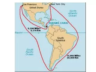
Mercator • Gives true direction • Land shapes fairly accurate • Size and distance are distorted-polar areas
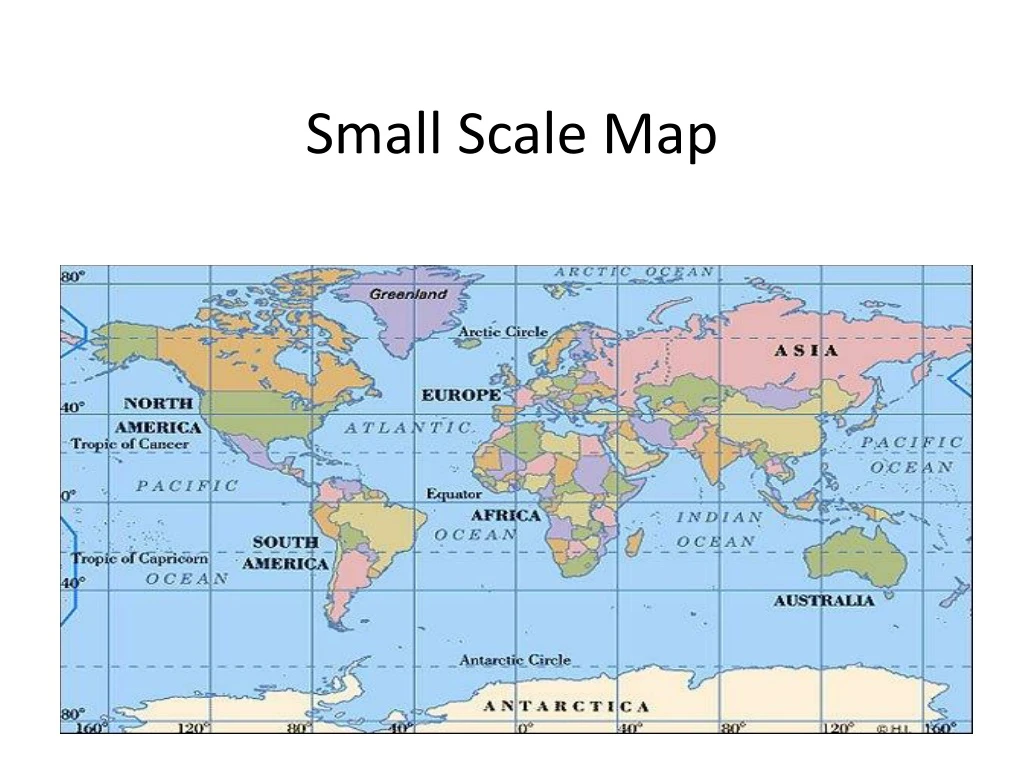
Robinson • Minor distortions at north and south poles • Shape and area of continents and oceans is fairly accurate
Homolosine • Continents close to their true sizes and shapes • Distances are not accurate
Winkel-Tripel • Modified Robinson projection • Less distortion of area and shape


More Related