Download
1 / 50
500 likes | 589 Vues
Explore THMP for analyzing hazard occurrences, detailed risk data by categories, and base maps overlay, with available GIS data layers. Enhance your risk assessment and emergency planning.

E N D
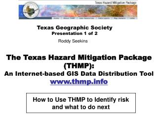
The Texas Hazard Mitigation Package (THMP): An Internet-based GIS Data Distribution Tool www.thmp.info Texas Geographic Society Presentation 1 of 2 Roddy Seekins How to Use THMP to Identify risk and what to do next
THMP Map Viewers [ Internet Mapping ]
SUMMARY DATA: Number of hazard occurrences (frequency)over reported period of time, summarized by county – and mapped into 4 classes (5 counting “0”) • Summary data is provided for 10 different hazards: • Hurricanes & Tropical Storms • Tornadoes • Floods • Other Storms • Drought • Outdoor Fires • Extreme Temperatures • Earthquakes • Hazardous Materials • Subsidence
DETAIL DATA: Hazard occurrences by actual location of event (if available), hazard risk zones, and other significant data used in identification and quantification of hazard risk Detail data is provided for the same 10 hazard categories, separated into Weather-related and Non Weather-related: • Weather-related Hazards • Hurricanes & Tropical Storms • Tornadoes • Floods • Other Storms • Drought • Outdoor Fires • Extreme Temperatures • Non Weather-related Hazards • Earthquakes • Hazardous Materials • Subsidence
BASE MAPS: Reference geography to overlay with hazards • Base maps are provided for 6 different categories: • Administrative Boundaries • Transportation • Hydrography • Landscape • Population • Weather-base data
THMP 1.0 Data Layers Currently, there are 59 GIS data layers available to map online, download or stream into your own GIS/mapping system • Hazards: Weather-related • Hurricanes & Tropical Storms • Hurricanes: 1851-2001 • Tropical/Subtropical Storms: 1851-2001 • Hurricane Tracks: 1851-2001 • Tropical/Subtropical Storms: 1851-2001 • Hurricane Risk Zones • Hurricane Evacuation Routes • Tornadoes • Tornadoes (F3-F5): 1950-2003 • Tornadoes (F1-F5): 1950-2003 • Tornado Risk Zones • Tornado Events (F3-F5): 1950-2003 • Tornado Events (F1-F5): 1950-2003 • 3. Floods • Floods: 1961-1999 • Flood Events (Major): 1905-2001 • Flood Events: 1993-2003 • Flood Risk Zones • 4. Other Storms • Other Storms: 1955-2003 • Wind Risk Zones • Other Storm Events: 1994-2003 • Outdoor Fires • Outdoor Fires: 2000-2003 • Outdoor Fire Risk Zones • Drought • Drought (Months): 1976-2003 • Drought Events: 1996-2003 • Extreme Temperatures • Extreme Heat (Days): 1980-2003 • Extreme Cold (Days): 1980-2003
Data Layer List …continued • Hazards: Non Weather-related • 8. Earthquakes • Earthquakes: 1882-1985 • Earthquake Epicenters: 1882-1985 • Earthquake Risk Zones • 9. Hazardous Materials • Hazardous Materials (All): 2004 • Hazardous Waste Sites: 2004 • Radioactive Waste Sites: 2004 • Superfund Sites: 2004 • Hazardous Cargo Routes • 10. Subsidence • Subsidence (Feet): 1918-1975 • Subsidence Risk Zones
Data Layer List …continued • Base Maps • Administrative Boundaries • U.S. • Mexico • Council of Government Districts • Counties • Cities • GDEM Disaster Districts • Parks • Transportation • Interstate Highways • Major Highways • Hydrography • River Basins • Lakes & Reservoirs (Large-scale) • Lakes & Reservoirs (Small-scale) • Rivers and Streams • Major Aquifers • Minor Aquifers • 4. Landscape • Elevation • Soils • 5. Population • Population (County): 2000 • Population (Tract): 2000 • Population (Block Group): 2000 • Population (Block): 2000 • Population (County): 2005 Estimate • Population (County): 2010 Projection • 6. Weather-base data • Average Annual Precipitation • Average Annual Temperature
Other THMP Pages • User Resources • Quick Start Tutorial • Training • Support Groups • Presentations • Links • Reference Materials • Other Maps & Data • Real-Time Data
Using THMP DataOutside of THMP Map Viewers Download (data layers) Shapefile (.shp)* format compatible with many Geographic Information Systems ZIP file includes Metadata, user notes and other valuable info Stream (data layers) Internet Server connection THMP-ArcGIS
Streaming THMP data from Map Viewers using ArcGIS: Connecting to www.tnris.org
Streaming THMP data from Map Viewers using ArcGIS: Population (County): 2010 Estimate
Texas Geographic Society Phase 2 of the Grant 1. Enhancing and expanding www.thmp.info Adding information on other Hazards Adding Population and Property Value vulnerability maps 2. Training Providing THMP and HAZUS courses around the state. 3. Coordination and Outreach Supporting key organizations Working through related organizations Building and Umbrella Group (HAMMER-TECH)
1. Enhancing and expanding www.thmp.info A. Additional/Updated Hazards Coastal Erosion Dam Failure Flood Risk Zones B. Adding Asset Vulnerability Population Vulnerability to Hazards Property Value Vulnerability to Hazards
Additional Hazards: Coastal Erosion Gulf of Mexico Overview: part of Texas coastline
Coastal Erosion Zoom: Meters/Feet per year of erosion
Additional/Updated Hazards: Flood Risk Zones: Completing statewide coverage 80 available Counties in THMP; 174 to go!
Hazard Risk Zone B. Asset Vulnerability: Vulnerability = Exposure / Hazard Risk Zone Vulnerable areas are displayed and classified by census geography (Block or Census Tract) where Hazard Risk Zones intersect Exposed Assets (Population, Property Value) Exposure (ex. Population) THMP Data Layers: • Population Vulnerability (Total Pop, Total Pop Density) • Property Value Vulnerability (Total Property Value, Total Property Value Density) …for 5 Hazards [Hurricane, Floods, Tornadoes, Earthquakes, Subsidence]
Population Vulnerability to Hurricanes Corpus Christi Bay Gulf of Mexico Overview: Corpus Christi area
Population Vulnerability to Hurricanes Risk Zone 1 Risk Zone 2 Risk Zone 3 Several vulnerable areas; None-to-Low vulnerability in downtown area
Population Vulnerability to Floods Overview: Austin area
Population Vulnerability to Floods vulnerable area! …may need further investigation
THMP to HAZUS • THMP Provides easy-to-use, online application (free) to: • Identify historical hazard occurrences • actual hazard event locations • summarized by county • Identify hazard risk areas • Determine relative vulnerability (to population and property value) • HAZUS Provides a complex, desktop application (at a cost?) to: • Quantify the impact of a specified hazard event • Perform damage assessment and loss estimation analysis …Study case may be identified in HAZUS, pre-determined by local experts and related information or by vulnerable areas previously determined in THMP
What is HAZUS-MH? HAZUS-MH is a planning tool that estimates damage and losses from natural hazards • It is a planning tool, NOT an engineering tool • Engineering-level data (i.e. Hydrology & Hydraulic studies for Flood modeling) can be input to increase accuracy, but results still produce planning-level estimations • It estimates physical damage & economic losses • It assesses population needs related to emergency management • It allows users to compare results from different study case scenarios, including those that result from specific mitigation actions (useful for benefits analysis)
HAZUS-MH: Technical Components • Software: Custom GIS (geographic information system) • Runs on ESRI products; ArcGIS and Spatial Analyst • ESRI products must be acquired separately • Spatial Analyst required for Flood Model only • HAZUS-MH is free from FEMA <www.fema.gov/hazus> • Current HAZUS-MH version (MR1) runs on ArcGIS 9.x • Previous HAZUS-MH version runs on ArcGIS 8.x • Data: National data sets • Inventory of assets (buildings, infrastructure, population/demographics, etc.) • Users may modify data sets or model factors • Users may add their own data
Applications in Mitigation Planning & Emergency Management Emergency Preparedness Response & Recovery HAZUS-MH Loss Reduction (Mitigation)
Emergency Preparedness • Develop emergency response plans • Temporary housing • Debris removal • Emergency power and water • Emergency medical services • Evacuation/emergency route clearance • Organize response exercises
Loss Reduction (Mitigation) • Mitigation Assessment • Identify ‘at-risk’ communities • Mitigation Measures • Strengthen existing structures • Strengthen window/door openings and siding • Mitigation Programs • Adopt and enforce hazard-resistant building codes • Land use planning
Response and Recovery • Post-disaster damage assessment and ground-truthing • Response planning for critical transportation outages • Identify critical infrastructure • Recovery action planning • Long-term economic recovery planning
HAZUS-MH: Digital Elevation Model & Stream Generation Ex. Travis County being prepared for Hydrologic and Hydraulic analysis
HAZUS-MH: Compute Hydrology & Hydraulics Flood area polygon (100-yr return) & Flood depth grid for selected stream This is our Study Case; same area identified in THMP
HAZUS-MH: Analysis Damage Assessment: (ex. Residential Buildings) Number of Residential Buildings in each Census Block (of Study Area) with 1 – 10% structural damage
HAZUS-MH: Damage Assessment: (ex. Residential Buildings) Mapped Although damage was light (1-10%) for most residential buildings, many were impacted – particularly in one Census Block. The previous THMP population vulnerability map indicated this potential
HAZUS-MH: Analysis: ex. General Building Stock / Loss Estimate Total economic loss can calculated for impacted area or single Census Block The previously identified Block totals 10,530,000 economic loss
HAZUS-MH: Other Notes • Results can be viewed & mapped many different ways • Including running mitigation scenarios to compare results • Inventory includes many different classifications of general building stock (by occupancy, by building type), essential facilities (several types), transportation systems (several types), demographics and more… • Local data and more sophisticated HAZUS techniques enhance the analysis
FEMA Resources • HAZUS-MH Overview • Resources • Conference Information • FAQs www.fema.gov/hazus
2. Training Training courses in 2005, include: THMP HAZUS-MH Custom & FEMA standardized Intro to GIS for THMP & HAZUS Users …Other FEMA-based courses (coming soon) Methods of delivery include: Instructor-led, Computer-based training Online Tutorials Demonstrations / Presentations Note: When appropriate, courses will coincide with other related conferences and training programs
Texas Geographic Society TRAINING PROGRAM Instructor-led, Computer-based Training for Hazard Mitigation & Emergency Managers Professionals • Training Options: • THMP [www.thmp.info] • Texas Hazard Mitigation Package (THMP; pronounced “thump”) is an online mapping system from TXGS for displaying historical hazard occurrences, identifying relative risk areas and assessing vulnerabilities to population and property. THMP is also a geographic data distribution tool for other mapping/GIS systems. • Course is designed to introduce all people to an easy-to-use, free application • HAZUS • HAZUS-MH is a custom GIS planning tool from FEMA used for damage assessment and loss estimation from real or potential disasters Introductory and advanced courses focused on Flood and Hurricane modules (*ArcGIS required) • Intro to GIS [for THMP & HAZUS Users] • ArcGIS 9.0 is a geographic information system (GIS) from ESRI used for a multitude of applications, including • hazard mitigation and emergency response • Course is designed at an introductory level for THMP & HAZUS Users The Texas Geographic Society is pleased to announce a new Training Program aimed at professionals that need to more effectively mitigate, manage and respond to hazards using application-specific information and mapping technology. The courses are intended to be free or provided at a minimal cost. 2005 Schedule Texas GIS Forum (April) Texas Hurricane Conference (May) …Stay tuned for many new training workshops held at hazard-related venues (June – Dec) For more information or registration, please contact the Texas Geographic Society at: contactTXGS@texasgs.org or 512-912-9695.
Texas Geographic Society Executive Director Roddy Seekins 512-507-8515 roddy@texasgs.org Education Coordinator Craig Eissler 512-912-9695 craig@texasgs.org Technical Support (at TNRIS) Miguel Pavón 512-463-8399 miguel.pavon@twdb.state.tx.us