Download
1 / 30
300 likes | 461 Vues
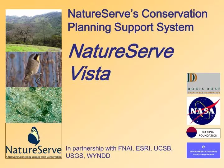
SURDNA FOUNDATION. NatureServe’s Conservation Planning Support System NatureServe Vista. In partnership with FNAI, ESRI, UCSB, USGS, WYNDD. Connecting Science with Conservation. Guiding Conservation Action. The NatureServe value chain of science expertise and technology tools.

E N D
SURDNA FOUNDATION NatureServe’s Conservation Planning Support SystemNatureServeVista In partnership with FNAI, ESRI, UCSB, USGS, WYNDD
Connecting Science with Conservation Guiding Conservation Action The NatureServe value chain of science expertise and technology tools Decision-support systems (Vista) Information access and delivery (web tools) Tools to understand and display information (GIS) Conservation expertise and analysis Data management and analysis (Biotics 4.0) Data collection (field inventory); data recording (field-based mapping tool) Scientific standards and methods
DSS are useful when… • Conducting large, complex, and lengthy projects where the pre-programmed functionality can save lots of time and document key decisions along the way. • Frequently conducted analyses for same reasons. DSS are not as useful when… • Options for solutions are few enough to identify with existing knowledge. • The extent of the planning region is small enough to readily identify the solution. • The requirements for precision are greater than the tool can provide.
Current Challenges in Conservation Planning • Planning is done with one-off databases and analyses and is poorly documented • Plans have no direct link to parcel-level decisions • Regional plans are not properly rolled out for local implementation and local decisions are not aggregated to assess progress or priorities • Plans are static, represent single stakeholder values, limited to one or a few solutions • Development community receives biodiversity information too late in development process
NatureServe Vista Objectives Mission context: facilitate biodiversity conservation planning by all those making decisions that affect biodiversity • Make conservation science available to a wide range of organizations whether or not they have conservation science expertise on staff. • Integrate biological data with geophysical data, socioeconomic data and analytical models. • Deliver a professional quality software application that can work with other planning and management tools.
NatureServe Vista: the basics • A combination of software and services that support a conservation planning process. • Software: Fully documented ArcView 9 extension with beta release June 1, 2004 • Basic beta package: license, onsite training, tech support $7500 • Science services can be obtained from NatureServe, Natural Heritage Programs, and environmental consultants • The software will be extended to automate more of the conservation planning functions • Over 50 potential clients in the pipeline, likely beta implementations: • DE, FL, VA heritage programs • MI or WI NRCS/natural heritage programs: ED grant • Potlatch Corporation & AR natural heritage program • Shoshone Natl Forest, WY: NASA grant • Ventura County, CA
Conservation Planning Experts End User Regulator Land Use Planner NGO Expert & End User Roles Conservation planning experts deal with data, knowledge, and expert opinion: • select elements and create the database from best available data. • Establish all of the “default” settings for conservation elements. • at request of end-user, reviews results of analyses and does additional analyses and planning. Data Sources Vista Utilities Custom Conservation Database The end user brings in local values and policy considerations • modifies the weights and goals to reflect community values • generates analytical products and iterates through to an acceptable outcome Vista user application toexplore, integrate, evaluate
What Questions Can Vista Answer? Important Conservation Areas • Where are they? • What is the relative importance of a particular place and why? Land Use Policies & Goals • How compatible are my land use policies with important elements? • Do my policies offer enough long-term protection? • Which among a set of alternatives provide the most progress toward my goals? Conservation Solutions • What set of places can most efficiently meet my conservation goals?
Building Element Information Each element has: • A name • A weight • A conservation unit • A quantitative goal • Compatibility to land use types • A spatial distribution map
Element Conservation Layers Spatial distribution maps of each element come from: • Heritage data • land cover maps • USGS maps • predicted distributions • museum collections • local information sources • Each element occurrence has: • A viability/integrity score • A confidence score Ecological systems Species and community occurrences Modeled distributions See more
Element:Viability/integrity Sources • Field survey: biologist captured on site • Alternative: landscape integrity • Based on road density, land cover, land-use, and pollution sources… • Customizable for an element or set of elements
Element Information (cont.) UI for general information about element and its conservation unit UI for categorizing the element
Vista provides a default land-use categorization system which can be customized Compatibility is assigned by element Compatibility indicated by checking land use types within which the element is expected to be viable Element/Land-Use Compatibility
Element Weighting System “Default” weights can be provided by the database development team or any user. Weights can be used throughout the process to emphasize areas containing those elements.
Goal Set Creation & Management Establish goals for protection Used in scenario evaluation Users may define multiple, potentially competing goalsets representing different values A single scenario can be evaluated against multiple goalsets Goals based on % of habitat, % of occurrences, absolute amount of habitat, or absolute # of occurrences
Element Report Shows all attributes of an individual element • Written in XML • Presented in browser using HTML
Conservation Value Summary Allows the user to: • Select elements to be included. • Select the factors to be included such as quality, confidence, and weight. • Each combination reveals different information (e.g.) • Integrated Cons. Value • Element richness • Viability • Ave. confidence
Querying Tools: Identify Applied to any analysis Shows ‘contents’ of a given place Content options will be added in new releases
Scenario Evaluation • Objective: Analyze compatibility and protection of elements to any type of scenario: • Land use • Land management • Conservation • Inputs to an evaluation: • Scenario (defines land use and protection of use) • Elements to be evaluated (filter) • Element compatibility with land-use types • Goal set (goals against which scenario is evaluated) • Results: report and maps
1) Converted Land 2) Fixed Status 3) Policy 1 4) Baseline Zoning Scenario Import Scenarios are a collection of separate layers that comprise the land-use policy landscape of the planning area. They are imported into Vista and placed in order of policy dominance.
Scenario Translations Zoning Each policy layer is translated to std land-use intent and protection type categories Categories come w/Vista or custom ones can be created Translations are saved to apply to scenario updates ** Land-use Type Policy Type
Reports can compare scenarios to baseline conditions and to goals. How much of my goal is met by any scenario? Where is compatibility insufficient Where is protection type insufficient Scenario Evaluation Report
Version 2 Planned Functions • “Blur” difference between conservation elements and land use/management practices • More detailed element descriptions (spatial reqs., connectivity reqs) • Modifying scenarios for better element compatibility • Generating optimized conservation solutions • Integrating marginal value concept (threat/economics) • Integrating management practices and disturbance types evaluation
Modifying Scenarios Marginal Value Analysis This map will identify areas where the scenario is in greatest conflict with conservation goals. Consequently it identifies places where conservation will have the greatest benefit based on: • Their ability to contribute toward goals. • The threat to them based on expected change in condition from current. • Their net cost (acquisition, incentives, lost economic activity, etc.) • Confidence values can be applied to determine the confidence that altering the land use in a planning unit will have the desired effect.
Evaluate Goals: by Element - Legally-Protected Current Proposed Achieved No. Spotted Owl Bald Eagle Peregrin Falcon Vernal Pools Add to scenario? 43 % 45 % 58 % 58 % 37 % 43 % 11 % 31 % YES NO Modifying Scenarios: Increase Compatibility v1.5 After a parcel is selected, its “land-use intent” can be changed either to conservation or some level of land use. The result on conservation goals is then calculated and displayed. Change land-use intent Current Proposed Conservation Working landscape Low-intensity use High-intensity use
Scenario Generation:Goal Based Model This model identifies the full suite of parcels required to meet all conservation goals. It does not prioritize them. Advantage is low data requirements and fast calculation.
Scenario Generation:Marginal Value Prioritization This method offers greater utility for incremental and/or opportunistic conservation where relative importance of units changes with each decision.
Economics Objectives Hierarchy • Determine the approx cost of an existing conservation scenario • Develop a conservation scenario optimized for least cost (using single measure of cost) • Use cost of conservation to prioritize sites in conjunction with threat and goals (marginal value) • Develop a cost allocation plan among multiple funding sources (e.g., the Farm Bill problem) • Conduct trade-off analyses with competing land uses
Economics in Planned Functions • Export/import w/SPOT utilizing a single cost surface • Integrate marginal value concept (threat/economics) to prioritize planning units • Modifying scenarios for better element compatibility • Prioritize units within a SPOT solution • Incorporate restoration and cost estimate or a budget for activities • Much later: trade-off analyses between competing land uses
Rollout • Beta program through 2004 • Customized packages ~$7500 • License • Onsite training • Tech support • Implementation support • Integrated methodology/functional extension projects e.g., GYE, Potlatch, NRCS