Download
1 / 19
190 likes | 243 Vues
Learn about historical developments and operating principles of passive microwave sensors for sea ice monitoring. Understand the significance of remote sensing in assessing climate change impacts in the Arctic region.

E N D
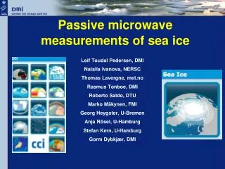
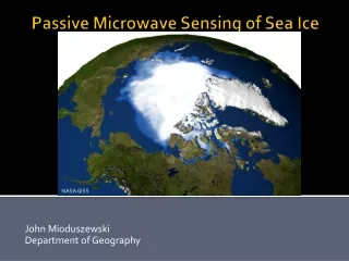
John Mioduszewski Department of Geography Passive Microwave Sensing of Sea Ice NASA GISS
Abstract Sea ice monitoring is critical to the ability to assess climate change in the Arctic, where it is changing most rapidly. Arctic Sea ice is declining at a rate of almost 6%/decade (NSIDC) which greatly impacts surface heat flux, large-scale energy transport, and ecological and human interests. Additionally, sea ice dynamics contribute to a disproportional amount of uncertainty in IPCC climate projections. Passive microwave sensing of sea ice is the primary method by which sea ice data is acquired. This is due to the long record of observations as well as this method’s ability to penetrate cloud cover and darkness to provide daily data. Passive microwave sensors detect radiation emitted from the surface depending on the emissivity properties of the surface. This radiation is converted to a brightness temperature, Tb, which is used to differentiate among open water and ice, or even different types of ice. Multiple channels and polarization allow for detection of a variety of ice characteristics while simultaneously minimizing sources of error. Integration with visible imagery and active sensing is advised to best take advantage of the strengths of each technique.
What do we want to know about sea ice? • Concentration and extent • Location of small-scale features (e.g. ice leads) • These have a major impact on latent and sensible heat fluxes • Ice type (first year vs. multiyear), thickness, and surface roughness • Snow on ice • Reduces surface roughness, acts as a thermal blanket, facilitates the transfer of brine, and can even submerge or flood the surface of thin ice • Movement • Divergence is conducive to polynya formation, convergence forms pressure ridges, net transport is needed for heat flux calculations regionally
History • Electrically Scanning Microwave Radiometer (ESMR): 1972-1977 • Made a single frequency measurement (19GHZ) that discriminated between ice and open water • Orbited on Nimbus-5 • Not typically used in data sets www.icsu-scope.org
History • Scanning Multichannel Microwave Radiometer (SMMR):1978-1987 on Nimbus 7 • 5 different bands allowed for mapping of ice concentration and distinction between first year and multiyear ice • For practical purposes, concentration and ice extent records began with SMMR http://www.fas.org/irp/imint/docs/rst/Sect14/originals/Fig14_21.jpg
History • Special Sensor Microwave Imager (SSM/I): 1987-present • 25km spatial resolution (12.5km in the high frequency band) • onboard Defense Meteorological Satellite Program (DMSP) satellites • Currently onboard F15 and F17 http://gpcp-pspdc.gmu.edu/images/SSMI.pic.gif
History • Advanced Microwave Scanning Radiometer (AMSR) on Aqua: 2002-present • 12 channels at 6 frequencies • Resolution improves with frequency (from 56 to 5.4 km) • Beam width from 2.2° to 0.18° • Oversight by NASA http://nsidc.org/data/docs/daac/images/amsrecraft1.gif
Operating Principles – Brightness Temperature • Has a linear relationship with emissivity, approximated in the Raleigh-Jean Law • Tb = εT • Tb is impacted by ice and surface characteristics • e.g., decreased by brine drainage and melt ponds/drainage • Increased by snow loading and other properties of first-year ice
Raleigh-Jean Law Lλ= (2kcT)/λ4 • Useful way to describe the relationship between emission and wavelength when λ >> λmax (i.e. microwave) • Since very little radiation is emitted in the microwave by terrestrial bodies, Planck’s Law is difficult to apply • This is a good approximation for λ > 0.15 cm • Also why resolution is so poor: must sample a large area to register an emissivity • Resolution improves at higher frequencies (smaller λ’s) because more radiation is emitted by ice at these λ’s; don’t need to sample such a large area http://www.mikroninfrared.com/images/fig4radintensity.gif
Operating Principles - Emissivity • Microwave emissivity is a function of dielectric constant • This is mostly dependent on temperature and moisture characteristics • Most materials have a dielectric constant between 1 and 4 (ice is 3.2), but water’s is 80 • This makes passive microwave sensing extremely good for detection of melt onset, but creates problems afterwards as water and ice exist together • Snowpack also complicates this, scattering the ice’s emitted radiance • Emissivity of everything in the direction of the ice is measured, which adds error • Emissivity also depends on the frequency measured
Operating Principles – Emissivity https://bora.uib.no/bitstream/1956/1135/1/MRS_Chapter8-proof.pdf As with many imaging sensors, radiation from the atmosphere, reflected from the surface, transmitted through the surface, etc. is all measured in addition to what is desired
Operating Principles - Emissivity • Microwave emissivity is a function of dielectric constant • Most materials have a dielectric constant between 1 and 4 (ice is 3.2), but water’s is 80 • This makes passive sensing extremely good for the melt season, including detection of melt onset • Snowpack complicates this though, scattering the ice’s emitted radiance • Emissivity of everything in the direction of the ice is measured, which adds error • Emissivity also depends on the frequency measured
Operating Principles - Emissivity • Lower frequencies (19-22 GHZ) are best for determining melt onset • Spatial resolution is better at higher frequencies • Cloud and atmospheric effects reduced below about 50 GHz • Each band has its strengths and weaknesses http://topex.ucsd.edu/rs/Lec11.pdf
Seasonal Variability in Emissivity http://topex.ucsd.edu/rs/Lec11.pdf The seasonal variation in microwave signature also depends on whether first year or multiyear ice is being detected
Complications and Shortcomings • Snow on ice and melt ponds are the biggest • Inaccurate during the melt season due to meltwater-related emission and scattering (up to 50% error) (Drobot and Anderson 2000) • Different layers of snow and ice cause different dielectric signals • Different frequencies are better at detecting different properties • Very poor spatial resolution • Difficult to integrate with higher resolution data • Difficult to locate smaller scale phenomena such as ice movement and lead structure
What has passive sensing given us? • A relatively long, continuous record of sea ice • Daily data regardless of cloud cover or time of day (From NSIDC)
Passive-derived Arctic Sea ice decline http://nsidc.org/images/arcticseaicenews/20091005_Figure3.png Passive microwave sensing has allowed the remarkable decline in Arctic sea ice to be documented
Conclusion • Passive microwave sensing has allowed us to monitor sea ice for over 3 decades and document the Arctic decline • Remote sensing is the only way this could be done in the vast, harsh polar environments • Best way to combat the shortcomings are to use multiple sensors to synthesize their strengths
References Anderson, M. R., S. D. Drobot, Arctic Ocean Snow Melt Onset Dates, Derived from Passive Microwave, A New Data Set. Proc. Monitoring an Evolving Cryosphere, American Geophysical Union Fall Meeting, Boulder, CO, . Carleton, A. M., 1991: Satellite Remote Sensing in Climatology. Studies in Climatology Series, Belhaven Press, 291 pp. Drobot, S. D., M. R. Anderson, 2000: Spaceborne Microwave Remote Sensing of Arctic Sea Ice During Spring. Prof.Geogr., 52, 315. Hall, D. K., J. Martinec, 1985: Remote Sensing of Ice and Snow. Chapman and Hall, 189 pp. Haykin, S., E. O. Lewis, K. R. Raney, and J. R. Rossiter, 1994: Remote Sensing of Sea Ice and Icebergs. John Wiley & Sons, Inc., 686 pp. Langlois, A., D. G. Barber, 2007: Passive microwave remote sensing of seasonal snow-covered sea ice. Prog.Phys.Geogr., 31, 539-573, doi:10.1177/0309133307087082. NSIDC, 2009: Sea Ice Index. [Available online at http://nsidc.org/data/seaice_index/]. NSIDC, 2009: Scanning Multi-channel Microwave Radiometer: Instrument Guide Document. [Available online at http://nsidc.org/data/docs/daac/smmr_instrument.gd.html]. Sandven, S. and O.M. Johannesen, 2006: “Sea Ice Monitoring in Remote Sensing” in Manual of Remote Sensing: Remote Sensing of the Marine Environment. American Society for Photogrammetry & Remote Sensing, pp 241-243. Sandwell, D. and H. Fricker, 2009: Satellite Remote Sensing, Chapter 11. [Available online at http://topex.ucsd.edu/rs/Lec11.pdf]. Slaymaker, O., R. E.J. Kelly, 2007: The Cryosphere and Global Environmental Change. Blackwell Publishing, 272 pp.