GIS for Disaster Preparedness and Emergency Shelter Mapping
Learn how to utilize GIS for emergency shelter mapping during disasters. Discover primary data collection methods and use GPS for accurate positioning.

GIS for Disaster Preparedness and Emergency Shelter Mapping
E N D
Presentation Transcript
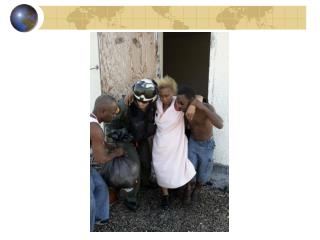
Message from Emergency Command!! • “We are being asked to shelter evacuees from the path of a major hurricane. I need a map of all structures in the area that can shelter evacuees; providing shelter, food, and comfort facilities for at least 7 days…and I need it today!”
How do we handle this? • At the point that this statement is made, it would be a difficult feat to accomplish… if the data exists. • Disaster Preparedness • Preparation through knowledge of assets • Shelters
Is this data available? • In some cases, this data has been collected. • Held by the County Emergency Operations Center and/or the local Red Cross Chapter • Secondary Data Collection (Knowing where the data exists) • Pirates and Bob • Important to read the data documentation (Metadata) if you plan to use. • Know the limitations of your data
What do we do if data is NOT available? • In order to complete a project where data is not available, we must CREATE the data. • Primary Data Collection • More time intensive • Preparedness • You are more familiar with the limitations of data that you collect yourself.
Primary Data Collection • Have you ever: • Collected Bug Samples? • Read a Thermometer? • Measured length with a ruler? • These are all examples of Primary Data Collection. • Geospatial Context
What are some tools for Primary Geospatial Data Collection? • GPS • High Degree of accuracy • Comparatively quick compared to field measurement. • Field Measurement • Highly Accurate and Dependable • Time Consuming • Remote Sensing • Extremely Useful • Used to create massive amounts of data • Not really primary collection
What Is GPS? • GPS can pinpoint your position anywhere on the globe, usually within a few yards or meters. • GPS is available to everyone, everywhere, day and night, and best of all, at no cost for use of the navigational data.
Uses of GPS • GPS operates 24 hours a day, • in all weather conditions, • on land, • on water • and even in the air. • Current applications include: • boating, fishing, hiking, camping, biking, rafting, pack trips by horseback, hot air ballooning, general aviation, search and rescue, emergency vehicle tracking, highway driving and a host of other outdoor activities where accurate positioning is required, including shelter location mapping!!
Three Components of GPS Satellite (Radio Transmitter) Clock (time) Receiver
How GPS Determines Your Position ? GPS uses 28 satellites orbiting at 11,000 nautical miles above earth to TRIANGULATE your position. • Continuously monitored by ground stations located worldwide. • The satellites transmit signals that can be detected by anyone • with a GPS receiver. • Using the receiver, you can determine your location with great precision.
So, what is Triangulation/Trilateration Anyway ? 625 miles 625 miles 625 miles 690 miles 690 miles 615 miles Trilateration is a basic geometric principle that allows you to find one location If you know its distance from other, already known locations. The geometry behind this is very easy to understand in two dimensional space.
How about a 3-Dimensional world?? Satellite #1 Satellite #3 Satellite #2 s1 s2 x s3 s4 Satellite #4
What does a Standard Database do for our data collection? • Provides added value to data • Allows additional users to understand data quickly • Standard usage with other data. • Aids in transportation of information compared to hard copy documents
What does this database look like? • Takes on many forms
More About the Shelter Database • Currently is in Microsoft Access • Holds 250+ fields of data • Our training version will not contain as much data as the full version for your local project • Adapted from the Red Cross Shelter Inventory Information Sheet
Why are we collecting all of this information? Don’t we just need locations? • No, No, No • The power of GIS is that it incorporates data with its appropriate Geographic context and promotes analysis of different types of data that otherwise would not be relatable. • Topic for tomorrow
Database Exercises • Entering Information into a Database • Importing Database with locations • Importing Database with associated information
The zoom Buttons The find button
GPS Exercises • Setting Coordinate System and Datum • Setting a waypoint
Once a waypoint has been saved, you can navigate to it by using the GOTOnavigation function. A GOTO is a straight line course from your current location to any selected waypoint.
To Find or “GOTO” a Waypoint • From the Main Menu, use the CLICK STICK • to select “Find”. 2. 3. 4. 5.
GPS Exercises • Deleting a waypoint • Deleting all waypoints
An important fact to remember is that the eTrex Legend GPS is accurate only to a distance of roughly 10-60 ft.