Latitude and Longitude
780 likes | 2.1k Vues
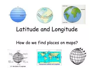
How do we find places on maps?. Latitude and Longitude. The earth has a grid system for locating the addresses of cities around the world. The “streets” running east-west are called lines of latitude , or parallels, and the “streets” running north-

Latitude and Longitude
E N D
Presentation Transcript
How do we find places on maps? Latitude and Longitude
The earth has a grid system for locating the addresses of cities around the world. The “streets” running east-west are called lines of latitude, or parallels, and the “streets” running north- south are called lines of longitude, or meridians. These are imaginary lines.
Latitude • The Equator divides the Earth into the Northern Hemisphere and the Southern Hemisphere. http://nationalatlas.gov/articles/mapping/IMAGES/latlong2.gif
Latitude • Latitude is defined as imaginary lines that run east to west above (or below) the equator. • The zero line for latitude is the equator which circles the earth midway between the poles. • The equator is at 0° and the poles are at 90°. http://webhelp.esri.com/arcgisdesktop/9.2/published_images/LatLong%20from%20Globe%20Center.gif
Latitude • If the location point is north of the equator an N is added to the degrees. • If the point is to the south of the equator an S is added to the degree. 52°N 24°S
Latitude • On the earth, lines of latitude are parallel lines. http://www.lakelandsd.com/tutorial/latitude2.jpg
Longitude • The Prime Meridian divides the Earth into the Western Hemisphere and the Eastern Hemisphere. • Hemisphere is half of the earth, hemi meaning half and sphere meaning circle. http://www.arcticice.org/images/long.gif
Longitude • Longitude is defined as imaginary lines that run north to south • The zero line for longitude is the prime meridian which runs from the north pole to the south pole. • The Prime Meridian is at 0° .
Longitude • If the point is located to the west of the Prime Meridian we add a W to the value. • If the point is located east of the Prime Meridian we add an E after the value. 30°W 80°E
Longitude • On the Earth, lines of longitude are called meridians. • The Prime Meridian has a value of 0° and no E or W. The longitude values increase up to 180° in both directions. • The International Date Line is opposite the prime meridian and has a value of 180° and no E or W. http://www.lakelandsd.com/tutorial/latitude2.jpg
The Prime Meridian passes through the Royal Observatory in Greenwich, England. • The International Date Line passes through the Pacific Ocean • Note: Longitude lines ARE NOT parallel because they all run through the North and South Poles.
To find a location on the earth, we use coordinates • Latitude is written first and longitude is written last. • For example, the location of Honolulu, Hawaii on a map is 21°N , 157° W • 21°N is the coordinate representing LATITUDE. • 157° W is the coordinate representing LONGITUDE
Using an Atlas, find the approximate coordinates of: • 35°N, 139°E • 48°N, 2°E • 37°N, 122°W • 33°S, 151°E Tokyo, Japan Paris, France San Francisco, CA Sydney, Australia
Geography Vocabulary Review • Which imaginary lines run parallel? • Lines of Latitude
Geography Vocabulary Review • Which imaginary lines run through the North and South Poles? • Lines of Longitude
Geography Vocabulary Review • Which geography vocabulary word means “ half circle”? • hemishpere
Geography Vocabulary Review • What is the zero line for latitude? • equator
Geography Vocabulary Review • What is the zero line for longitude? • Prime Meridian
Geography Vocabulary Review • What degree is the International Date Line? • 180°
Longitude and Time • If you place meridians 15° apart starting with the Prime Meridian, you will divide the Earth into 24 zones. These correspond to the 24 hours in a day. http://www.mapsofworld.com/time-zone-map/maps/world-time-zone.jpg
Longitude and Time • As you travel around the world to the east, you gain an hour in time for each zone you cross. If you travel to the west you lose an hour. http://www.astro.ufl.edu/~oliver/ast3722/lectures/CoordsNtime/timezon2.gif
But… • If you traveled around the world to the east fast enough you would be a day older in a short time! • If you traveled west you could go back in the past! • To solve this problem it was agreed that the 180° meridian would signal the change of date point. • Travel east and the date goes back one day; travel west and you advance a day when crossing this meridian.
But… • To keep all of a country in the same time zone, the International Date Line does not follow the 180° meridian exactly. • Other time zones make the same accommodations for country or state boundaries.