Download
1 / 47
560 likes | 1.24k Vues
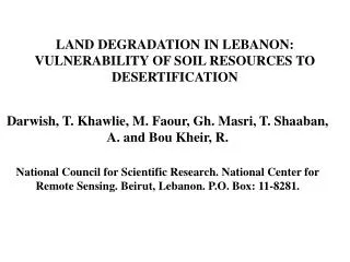
LAND DEGRADATION IN LEBANON: VULNERABILITY OF SOIL RESOURCES TO DESERTIFICATION. Darwish, T. Khawlie, M. Faour, Gh. Masri, T. Shaaban, A. and Bou Kheir, R. National Council for Scientific Research. National Center for Remote Sensing. Beirut, Lebanon. P.O. Box: 11-8281. Introduction.

E N D
LAND DEGRADATION IN LEBANON: VULNERABILITY OF SOIL RESOURCES TO DESERTIFICATION Darwish, T. Khawlie, M. Faour, Gh. Masri, T. Shaaban, A. and Bou Kheir, R. National Council for Scientific Research. National Center for Remote Sensing. Beirut, Lebanon. P.O. Box: 11-8281.
Introduction • Lebanon is an eastern Mediterranean country lying in the midst of a tectonically active region. • Structurally, Lebanon consists of three units, two of them constitute the uplifted steep mountain ranges (Mount Lebanon and Anti-Lebanon), separated by the Bekaa depression. • Land resources of the Mediterranean region, with a long history of civilization, have been put under pressure for several centuries. United Nations/Islamic Republic of Iran Regional Workshop 8-12 May 2004
Location United Nations/Islamic Republic of Iran Regional Workshop 8-12 May 2004
Therefore Lebanon is distinguished by: • Complex geomorphology • Diverse Climate • Biodiversity in land cover including vegetation and soil types. • Land use in Lebanon date to the old Phoenician times. United Nations/Islamic Republic of Iran Regional Workshop 8-12 May 2004
Human interference and mismanagement together with climate change created increasing pressure on the limited natural resources. • This lead to increasing risks of erosion, deforestation, soil and water pollution, and a reduction of soil quality and productivity. • Landscape changes have not been always associated neither with rehabilitation nor with remediation measures. United Nations/Islamic Republic of Iran Regional Workshop 8-12 May 2004
There are no exact estimates of the extent and severity of this historical damage. • The presence of large areas of very shallow soils, and rock outcrops points to periods of serve erosion and land degradation. • Is land degradation, which reduces the natural beauty and harmony of landscapes an irreversible fact? United Nations/Islamic Republic of Iran Regional Workshop 8-12 May 2004
Did scientists develop and do decision-makers use appropriate early warning indicators of land quality to be able to monitor and prevent land deterioration? • What is the role of research bodies and NGOs in the bottom up approach to tackle land degradation? • What is the level of our knowledge on soil resilience and how regional and international organizations can contribute to protect this non renewable resource? United Nations/Islamic Republic of Iran Regional Workshop 8-12 May 2004
Geomorphology of Lebanon in relation to environmental risk hazards: • The major faults of the Lebanese tectonic regime are the Yammouneh fault and Roum Fault. • These are the northern continuation of the Jordan fault and are continued North word by the Ghab fault. • This setting and fracturing system are a structural result of the major tectonic framework of the Dead Sea fault system. • This makes Lebanon vulnerable to earthquakes. United Nations/Islamic Republic of Iran Regional Workshop 8-12 May 2004
United Nations/Islamic Republic of Iran Regional Workshop 8-12 May 2004
Geology: Can be grouped into: • Quaternary marine deposits • Quaternary colluvial deposits • Fluvial deposits • Tertiary sedimentary rocks • Clastic mesozoic rocks • Non-clastic sedimentary rocks • Volcanic rocks United Nations/Islamic Republic of Iran Regional Workshop 8-12 May 2004
Geology United Nations/Islamic Republic of Iran Regional Workshop 8-12 May 2004
All mentioned peculiarities lie behind the complex orography of Lebanon with >75% of its territory consisting of sloping and steep lands that adds to the fragility of the ecosystems. • The coastal area and inner Bekaa plain represent level lands with a slope gradient <8%. • The mountains and hills represent mainly slopping and steep lands with gradient between 20 and 60%. • Small intermountain plains are always present filled by tertiary and quaternary sediments. United Nations/Islamic Republic of Iran Regional Workshop 8-12 May 2004
United Nations/Islamic Republic of Iran Regional Workshop 8-12 May 2004
Mean annual precipitation ranges from 700 mm on the coastal area to 1200 mm on the high mountain (with a snow cover for 2-3 months). • It drops down until 500mm in Central Bekaa and 150 mm in the North east Bakaa. United Nations/Islamic Republic of Iran Regional Workshop 8-12 May 2004
Mean annual precipi-tation United Nations/Islamic Republic of Iran Regional Workshop 8-12 May 2004
Land cover/use • Mountain • Pine and oak forests and copies, shrubs and grasslands alternating with rock outcrops. • Apple, Olive and Grape production. • Plains • Cash field crops, vegetable inland • Citrus and banana cultivation on the coast. • Greenhouses: tomatoes, cucumber and flowers. United Nations/Islamic Republic of Iran Regional Workshop 8-12 May 2004
United Nations/Islamic Republic of Iran Regional Workshop 8-12 May 2004
Soilcover • 1. Petric Calcisols in the northeastern Bekaa • 2. Eutric Fluvisols, Vertic Cambisols and Vertisols in the Central Bekaa. • 3. Eutric Luvisols, Rendzic Leptosols and Lithic Leptosols in the Lebanese Mountains. • 4.Calcaric Cambisols, Eutric Vertisols, Calcaric Arenosols and Eutric Fluvisolson the coast. United Nations/Islamic Republic of Iran Regional Workshop 8-12 May 2004
The new soil map of Lebanon United Nations/Islamic Republic of Iran Regional Workshop 8-12 May 2004
Soil Vulnerability to desertification • The contribution to the framework of the “National Action Program to Combat Desertification” was to analysis factors leading to soil desertification in Lebanon. • The approach used RS and GIS to identify, classify and produce the layers related to soil genesis and evolution within the context of main characteristics. United Nations/Islamic Republic of Iran Regional Workshop 8-12 May 2004
Because the dry climate, with few exceptions, is dominant in Lebanon. The soil temperature regime is mainly hyperthermic. • Rainfall distribution, characteristic for the Mediterranean Sea, promotes a “xeric soil moisture regime”. United Nations/Islamic Republic of Iran Regional Workshop 8-12 May 2004
United Nations/Islamic Republic of Iran Regional Workshop 8-12 May 2004
1. Soil related data • 1.1. Soil depth. Five classes: 1. <10 cm; 2.10-50 cm; 3. 50-100; 4. 100-150; 5. >150 cm. • 1.2. Soil texture. Five classes: 1. Coarse, 2-medium; 3. Medium fine; 4. Fine; 5. Very fine. • 1.3. Organic matter content: Five classes: 1. <0.5%; 2. 0.5-1.0%; 3. 1.0-2.0%; 4. 2.0-3.0%; 5. >3.0%. • 1.4. Water reserve: Five classes: 1. Very low; 2. Low; intermediate; 4-relatively high; 5. High. • 1.5. Structural stability: 1. Unstable; 2. Very low stability; 3. Low stability; 4. Intermediate stability; 5. Stable. • 1.6. Soil index (combination of layers 1.1-1.5). United Nations/Islamic Republic of Iran Regional Workshop 8-12 May 2004
Therefore, soil characteristics like depth, organic matter content and texture are important factors for water storage capacity. • These and others were the basis for the creation of soil index. • 1. Soil depth affecting root penetration and nutrient and water reserve • 2. Organic matter content influencing aggregate stability, porosity and fertility United Nations/Islamic Republic of Iran Regional Workshop 8-12 May 2004
3. Soil texture that is responsible for soil water retention capacity, aeration and infiltration rate • 4. Aggregate stability characterizing the resistance of soil aggregate to disintegration as a result of rain drops, promoting soil coherence against erosion and • 5. Water storage capacity responsible to maintain natural vegetation during the dry season, which limits forest fires and affects irrigation scheduling. United Nations/Islamic Republic of Iran Regional Workshop 8-12 May 2004
United Nations/Islamic Republic of Iran Regional Workshop 8-12 May 2004
United Nations/Islamic Republic of Iran Regional Workshop 8-12 May 2004
2. Climatic data • 2.1. Annual precipitation • 2.2. Potential evapotranspiration (ET0) • 2.3. Ratio precipitation/ET0. Two classes 1. Vulnerable <0.65 of the ratio; 2. Not vulnerable >0.65 of the ratio. • 2.4. Climatic index: Four classes: 1. Very high; 2. High; 3. Moderate; 5. Low. United Nations/Islamic Republic of Iran Regional Workshop 8-12 May 2004
3. Vegetation data • NDVI. Five classes: : 1. None; 2. Low; 3. Moderate; 4. High; 5. Very high. • 4. Desertification prone areas. Five classes: 1. Very low; 2. Low; 3. Moderate; 4. High; 5. Very high. • Combination of layers 1.6, 2.3 and 3.1. United Nations/Islamic Republic of Iran Regional Workshop 8-12 May 2004
Classification using these factors, merged with information on climate and land cover revealed several hot spots. • The climatic index revealed more than 50% of the Lebanese territory to be highly prone to desertification. • The final classified layer indicated the more vulnerable to desertification areas to be distributed in the underdeveloped Baalbek-Hermel area. United Nations/Islamic Republic of Iran Regional Workshop 8-12 May 2004
United Nations/Islamic Republic of Iran Regional Workshop 8-12 May 2004
United Nations/Islamic Republic of Iran Regional Workshop 8-12 May 2004
The moderate vulnerable areas are spread in Central and West Bekaa Valley and along the coastal plains. • The low vulnerability areas are located in the Central Mount Lebanon. • These categories of land degradation are subject to change with time if mismanagement of natural resources continues unchecked: first of all water erosion. United Nations/Islamic Republic of Iran Regional Workshop 8-12 May 2004
United Nations/Islamic Republic of Iran Regional Workshop 8-12 May 2004
The assessment of water erosion using remote sensing (Landsat and Spot images) in the central Lebanese karstic Mountains (Qartaba- Jbeil area, 200 km2) showed that 6% of the territory is very high erosion risk, 88% as moderate and 6% as low erosion risk. • This indicates the extent of the problem and pressure put on land resources leading to ecosystem degradation in Lebanon. • This process commences with soil erosion and ends with soil degradation and desertification. United Nations/Islamic Republic of Iran Regional Workshop 8-12 May 2004
Image Landsat TM september 1997 MOUNTAIN OF SANNINE BEIRUT MOUNT LEBANON PIEDMONTS OF THE BEKAA CHOUF BEKAA United Nations/Islamic Republic of Iran Regional Workshop 8-12 May 2004
Soil vulnerability to erosion in the Central Lebanese Mountains United Nations/Islamic Republic of Iran Regional Workshop 8-12 May 2004
The western aspects of the Central mountain chain, which were distinguished by a low vulnerability to desertification are expected to become the most populated area. • A proper settlement policy and a gradual introduction of more tolerant wood species, which are less susceptible to dryness, and • The improvement of water harvesting practices appear to be prominent in view of greening efforts combating soil sealing, pollution and desertification. United Nations/Islamic Republic of Iran Regional Workshop 8-12 May 2004
Urban expansion detected from Landsat on the Northern Lebanese coast1984 1997 United Nations/Islamic Republic of Iran Regional Workshop 8-12 May 2004
United Nations/Islamic Republic of Iran Regional Workshop 8-12 May 2004
United Nations/Islamic Republic of Iran Regional Workshop 8-12 May 2004
Recent detailed soil information for Lebanon United Nations/Islamic Republic of Iran Regional Workshop 8-12 May 2004
Risks of soil pollution • Heavy metals in the soil • 1. Pedogenesis: release of metals from the parent material by weathering • 2. Anthropogenic sources: agricultural activity, manures, paints, mining activities, batteries, medical usages, and automobile aerosols… United Nations/Islamic Republic of Iran Regional Workshop 8-12 May 2004
United Nations/Islamic Republic of Iran Regional Workshop 8-12 May 2004
United Nations/Islamic Republic of Iran Regional Workshop 8-12 May 2004
United Nations/Islamic Republic of Iran Regional Workshop 8-12 May 2004
Conclusion • Implementing appropriate land use planning based on soil capability and land suitability is important for soil and water conservation. • Limiting the risks of desertification and ensuring economic and social development based on sustainable production and safe environment. United Nations/Islamic Republic of Iran Regional Workshop 8-12 May 2004