Download
1 / 36
370 likes | 520 Vues
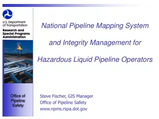
The National Pipeline Mapping System -- Identifying Pipeline Segments that can Impact HCAs www.npms.rspa.dot.gov. Steve Fischer Sam Hall GIS Manager GIS Analyst US DOT/Office of Pipeline Safety US DOT/Office of Pipeline Safety DPS - 11 DPS - 11

E N D
The National Pipeline Mapping System -- Identifying Pipeline Segments that can Impact HCAswww.npms.rspa.dot.gov Steve Fischer Sam Hall GIS Manager GIS Analyst US DOT/Office of Pipeline Safety US DOT/Office of Pipeline Safety DPS - 11 DPS - 11 400 7th Street, S.W. 400 7th Street, S.W Washington, DC 20590 Washington, DC 20590 202.366.6267 202.493.0591 steven.fischer@rspa.dot.gov samuel.hall@rspa.dot.gov
What is the NPMS? • A GIS created by OPS in cooperation with government and industry • Natural gas transmission and hazardous liquid pipelines; LNG facilities • Geospatial data, attribute data, and metadata • A voluntary initiative
The NPMS Model • Repositories • National Repository in Alexandria, Virginia • 14 state repositories: • Alabama, California, Connecticut, Illinois, Kansas, Kentucky, Louisiana, Maine, Minnesota, New Jersey, Oklahoma, Texas, Virginia, Washington • New repositories are solicited through the Commerce Business Daily (CBD)
NPMS Repositories ME WA ME MN CT NJ IL National Repository KS VA CA KY OK AL TX TX LA
NPMS Repositories (cont.) • State repositories collect data for pipelines within their state boundaries. • The National Repository collects data for states without repositories and incorporates state repository data into a seamless national dataset.
The NPMS Model (cont.) • Standards • Operator Standards • describe how operators can participate in the NPMS • Repository Standards • describe the operations of the National Repository and the state repositories • Both sets of standards may be downloaded from the NPMS website.
Status of the NPMS As of July 1, 2001, the NPMS contains: • 86% of hazardous liquid pipelines • 42% of natural gas transmission pipelines • 56% of all pipelines being collected
Integrity Management Program IMP - Rulemaking Pipeline Integrity Management in High Consequence Areas [Hazardous Liquid Operators with 500 or More Miles] • Objective: To improve pipeline safety through new requirements for testing, integrated evaluation of risk information, improved federal/state oversight of integrity management plans, and enhanced communication to communities.
High Consequence Areas • Key Feature: IMP provides protection for OPS-defined High Consequence Areas (HCA’s). • HCA’s are geographic areas where the consequences of a pipeline release would be most adverse.
High Consequence Areas (cont.) HCA’s are defined as: • Environmentally Unusually Sensitive Areas (USA’s) • Drinking Water and Ecological • Populated Areas • High Population Areas and Other Populated Areas • Commercially Navigable Waterways
HCA Data • Unusually Sensitive Areas • Drinking Water -- current states -- CA, IL, KS, LA, MO, MT, NM, OK, TX, and WY • Current states contain approximately 70-75% of hazardous liquid pipeline mileage • Goal to complete Drinking Water USAs by February 2002 • Available for download from the NPMS Web site
HCA Data (con’t) • Unusually Sensitive Areas • Ecological -- current states -- CA, CO, DE, IA, IL, IN, KS, KY, LA, MI, MN, MO, MS, MT, ND, NE, NM, OH, OK, SD, TX, VT, and WY • Current states contain approximately 85-90% of hazardous liquid pipeline mileage • Goal to complete Drinking Water USAs by February 2002 • Operator must request the data through OPS
HCA Data (con’t) • Populated Areas • High Population Areas (HPAs) • 1990 US Census defined Urbanized Areas • 2000 US Census Urbanized Areas available in 3rd quarter 2001 • HPAs updated by January 2002 (if Census completes Urbanized Areas by anticipated date) • Available for download from the NPMS Web site
HCA Data (con’t) • Populated Areas • Other Populated Areas (OPAs) • 1990 US Census defined Census Designated Places (CDPs) • 2000 US Census CDPs available in 3rd quarter 2001 (if Census completes CDPs by anticipated date) • OPAs updated by January 2002 • Available for download from the NPMS Web site
HCA Data (con’t) • Commercially Navigable Waterways (CNWs) • National Waterway Network created by various agencies including US Coast Guard and US Army Corps of Engineers • Identifies only waterways that support large commercial traffic • Available for download from the NPMS Web site
Additional Data Layers (non-IMP) Additional data currently available: • Earthquake, hurricane, flood, and landslide hazard indexes • State/County boundaries • U.S. DOT BTS National Transportation Atlas Data
Data Analysis Optionswww.npms.rspa.dot.gov • Data download for use with operator in-house GIS • GIS-lite - an alternative solution for operators without GIS capabilities • OPS developed Internet mapping application
GIS-Lite • System Requirements • Windows Edition • ArcExplorer 2 works on Windows 98/2000/NT operating systems. • Java Edition • ArcExplorer 3.1 can be installed on a Windows NT, Windows 98, Windows 2000, Solaris, or AIX operating system. ArcExplorer 3.1 works with ArcSDE 3.x, ArcSDE 8.0.2, and ArcSDE 8.1.