GEOGRAPHICal
GEOGRAPHICal. Informations. System. GIS???. What is it? How does it work? How does it relate to Ocean Technology? Examples. GIS IS. An organized collection of Computer: . Designed to Efficiently: . C apture Store U pdate M anipulate , Analyze Display . -hardware


GEOGRAPHICal
E N D
Presentation Transcript
GEOGRAPHICal Informations System
GIS??? • What is it? • How does it work? • How does it relate to Ocean Technology? • Examples
GIS IS.... An organized collection of Computer: Designed to Efficiently: Capture Store Update Manipulate, Analyze Display -hardware -software -geographic data, -personnel All forms of geographically referenced information in order to make find a solution to proposed questions Geographicalinformatins system
GIS allows any spatial data to be added and visualized. Not just a regular map. “Smart Map” Has data base behind it that allows for easy interpretation. • Raster and Vector Files • Data Types: Attribute, Feature,
Benefits of Utilizing GIS Unified Modeling Language-faster, easier to upload, don’t have to make a new one from scratch each timeProduce, share, and exchange data in similar formats
Easily understood Relate directly to map Can turn layers on or off Layers can be overlapped to see a combination of layers and how they interact.
Oil Spill Response in Australia (OSRA) • GIS to assist in oil and chemical pollution response in marine environment. -Quick and efficient to determine environmental, economic, and strategic sensitivities to utilize.
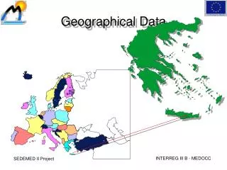
OSRA’s Goal: All encompassing data from all companies, organizations, etc. Existing Layers • Habitats • High-definition coastlines • Bathymetry for all Australian waters • Nautical charts • Topogaphical charts for all Austriallia • Marine and national parks and other reserves • Biological resources and conservation status • Fisheries and aquaculture • Coastal and marine wildlife resources • Recreational resources • National Plan equipment stockpiles • Aerial photography • Landmarks and features • Shoreline acess and boat ramps • Emergancy logistic
Location of ship grounding in Great Barrier Reef overlayed on bathymetry and topogrphic data. Orange Triangle represents spill
GIS • GIS is a collection of data • very resourceful tool • Can be applied to any situation as long as spatial data can be inputted.