Download
1 / 13
130 likes | 270 Vues
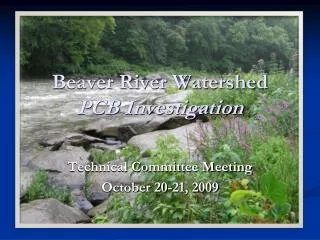
Beaver River Watershed PCB Investigation. Technical Committee Meeting October 20-21, 2009. PCB TMDL Background. Completed Ohio River PCB TMDL in 2002 Entire WV border (277 river miles) Mainstem TMDL only

E N D
Beaver River Watershed PCB Investigation Technical Committee Meeting October 20-21, 2009
PCB TMDL Background • Completed Ohio River PCB TMDL in 2002 • Entire WV border (277 river miles) • Mainstem TMDL only • Basin is too large and data is too limited to address issue with a single TMDL for entire watershed • Assigned allowable loadings to major tributaries • Follow-up tributary TMDLs/source reductions necessary to meet WQS in the Ohio River
Current Challenge • The contamination is wide-spread • TMDL required for the entire Ohio River • Identifying specific sources has been difficult • Sampling indicates POTWs and numerous types of industrial facilities may discharge PCBs • Thousands of potential sources spread over basin • Need to focus on a smaller scale • Select tributary sub-basin to focus efforts
Allegheny Monongahela Beaver Muskingum Kanawha Guyandotte Scioto Great Miami Green Wabash Identified tributaries of concern based on high-volume sample results Ranked according to yield and load Tributaries of Concern
Why the Beaver River Watershed? • Needed smaller area to focus source identification effort • 3,130 square miles (Ranks 14th of Ohio R. tribs) • Beaver River has elevated PCB levels • Highest single sample concentration (19,300 pg/L) • Highest average concentration (11,700 pg/L) • Fourth highest load • Highest PCB yield • Interstate tributary
Beaver Basin Impairments • Beaver River (Main stem) • Entire 21.49 miles listed as impaired by PCBs • TMDL completed 2001 for lower 3.8 miles • Mahoning • Lower 82 miles listed as impaired by PCBs • Shenango • Lower 33.1 miles listed as impaired by PCBs • TMDL completed in 2001 • Connoquenessing • Not listed as impaired by PCBs
Inventory of Potential Sources • National Priority List (Superfund) • 6 NPL sites • Toxics Release Inventory • 2 facilities • 267 potential sources based on SIC • These are facility types which were found by DRBC to discharge significant levels of PCBs • Met with Ohio EPA and PA DEP personnel to discuss sources and sampling approach
Phased sampling approach Conduct initial round of sampling Subsequent rounds based on previous results Focus in on hot-spots First round of sampling Sample each tributary near mouth Beaver, Mahoning, Shenango, Connoquenessing Add additional sites based on sources and impaired segments Following rounds would allow for bracketing of potential sources Proposed Sampling Approach
Use high-volume water sampling May only need to filter 250 to 500 liters Would allow for 2 samples to be collected each day Sampling Schedule Begin sampling in November 2009 Takes 4 weeks for preliminary results Select round 2 sites based on results Round 2 in early 2010 Repeat as budget allows Must be completed by June 30, 2010 Sampling (continued)