Download
1 / 20
200 likes | 372 Vues
Assimilation of Lightning Data Using a Newtonian Nudging Method Involving Low-Level Warming. Max R. Marchand Henry E. Fuelberg Florida State University

E N D
Assimilation of Lightning Data Using a Newtonian Nudging Method Involving Low-Level Warming Max R. Marchand Henry E. Fuelberg Florida State University Email contact: mrm06j@my.fsu.eduAcknowledgements: Drs. I. M. Navon and R. Stefanescu, FSUand Joint Center for Satellite Data Assimilation (JCSDA)
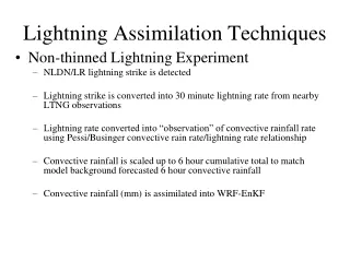
Past Lightning Data Assimilation • Mostly nudging methods at coarse resolutions • Generally two categories of nudging: • Modification of mid and upper-level convective heating rates (Alexander et al. 1999; Chang et al. 2001; Pessi and Businger 2009; Weygandt 2008) • Increasing humidity to initiate convection(Papadopoulos et al. 2005; Mansell et al. 2007; Fierro et al. 2012)
Our New Warming Method • Applicable for cloud-permitting scales (i.e., ≤ 4 km) • Appropriate for forthcoming GOES-R Geostationary Lightning Mapper (i.e., ≈ 9 km grid spacing, total lightning) • Instead of moistening, our method warms to initiate convection where lightning is observed • Instead of warming mid to upper-levels and assimilating effects of the deep convection, low-levels are warmed • Objective is to warm just enough to produce storms where observed • Assume simulated temperature and humidity profiles are accurate, just need slight warming to produce storms
Warming to Initiate Convection • If maximum graupel mixing ratio < 1 g/kg, warming used to assimilate lightning data and initiate deep convection in cloud-resolving simulations • Deep convection can initiate from surface warming to the convective temperature
Elevated Convection • Warming done between the most unstable level (MUL) up to the CCL computed from the MUL
Model Configuration • WRF-ARW Version 3 • Nested approach with 3 domains (27, 9, and 3 km spacing), 60 vertical levels • 2 way-nesting with WSM6microphysics, Kain-FritschCPS in 27 km, no CPS in others • Initial and boundary conditions: 1° x 1° FNL data • 6-h spin-up (06-12 UTC), 12-h assimilation period (12-00 UTC) followed by a 12-h forecast (00-12 UTC)
Case Studies and Lightning Data • Simulations done for three cases: • Strong forcing: 27 April 2011 • Weak forcing: 9 June 2011 • Moderate forcing: 15 June 2011 • Among most electrically active days of 2011 • Earth Networks Total Lightning Network (ENTLN) data used– includes both IC and CG flashes • CG DE > 95%; IC DE 50-90% in 3 km domain • To match GLM, lightning mapped on intermediate 9×9 km grid • Each 3 km grid cell assigned value of the 9 km • Lightning summed over 10 min intervals
Results Overview • 3 Simulations for Each Case • CT: No assimilation • MU: Our warming method • FO: Moistening method of Fierro et al. (2012) • RH increased to 81%-101% in mixed phase region (0 to -20°C) if RH < 81% (Fierro et al. 2012) • 81-101% depending on observed flash rate and simulated graupel mixing ratio • 3 Parts to Results • Demonstrating the assimilation methods • Objective comparison of precipitation fields • Advantage of using Newtonian nudging
Example of Performance: 6 h After Start of Assimilation (18Z 15 June) MU CT • Contoured graupel mixing ratios > 1 g/kg • Colored observed lightning quantities • Black denotes model/observation agreement FO
Assimilation Effects on Vertical Velocity: 5 min into assimilation (1205 UTC 9 June) • Assimilation methods induce a weak updraft • MU peak updraft in low-levels; begins to saturate CCL • FO in mid-levelsnear cooling
Precipitation Bias 27 Apr 9 Jun 15 Jun Assim. Forecast • Average hourly precip. of CT close to STAGE 4 (ST4) • Methods do not suppress convection, so overprediction results during assimilation • Tend to underpredict after assimilation ends • Bias similar for both methods CT MU FO ST4
ETS: 27 April—Strong Forcing Assim. Forecast • FO ETS greater than MU • MU greater than CT • 10 mm more ambiguous
ETS: 9 June—Weak Forcing • MU ETS greater than FO, FO greater than CT • CT has low skill
ETS: 15 June—Mod. Forcing • MU ETS greater than FO for 1 and 5 mm • MU and FOsimilar for 10 mm • Using Fuzzy/Neighborhood verification method (Fractions Skill Score) shows similar results
Reducing Acoustic Waves Using Newtonian Relaxation Not UsingNewtonian Relaxation • Warming all in one time step produces sound wave signals in pressure field • Moistening also produces sound wave signals • Gradually warming prevents sound wave signals
Conclusions • Low-level warming used to assimilate lightning data and effectively initiate deep convection in a numerical model • Improves precipitation simulations during assimilation, short forecast period • Newtonian nudging reduces possible numerical instabilities when warming or moistening • Produces surplus of precipitation, but methods could be combined with more observations and/or sophisticated methods (e.g., EnKF, 4DVAR) • New, computationally inexpensive method creates a better analysis; expands the utility of forthcoming GOES-R GLM data source
Precipitation Observations • Hourly simulated precipitation compared with NCEP stage IV (ST4) radar and gauge observations (~4 km) • Human quality controlled by river forecast offices • Verification domain (greyregion) defined to ensurehigh quality precipitationdata use for comparison with simulated precip. • Avoid poor radarcoverage areas: sea,Rockies, non-U.S. land
ETS: 27 April—Strong Forcing • FO ETS greater than MU, MU greater than CT • 10 mm more ambiguous • Greater ETS if assimilation continues (dashed lines)
ETS: 9 June—Weak Forcing • MU ETS greater than FO, FO greater than CT • CT has low skill
ETS: 15 June—Mod. Forcing • MU ETS greater than FO for 1 and 5 mm • MU and FOsimilar for 10 mm