Download
1 / 70
710 likes | 739 Vues
Discover how the USDA's WEPP Model aids in predicting erosion and conserving soil. Learn about the key hydrologic and erosion processes at various scales, the background of the WEPP Model, its development history, and the major components and science behind the model. Explore the tool's applications, interfaces, and advancements in geospatial and web-based technologies over the years.

E N D
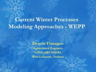
USDA Process-based Tools for Estimating Runoff, Soil Loss, and Sediment Yield – The WEPP Model Dennis C. Flanagan Research Agricultural Engineer USDA-Agricultural Research Service Adjunct Professor Purdue Univ., Dept. of Agric. & Biol. Eng. National Soil Erosion Research Laboratory West Lafayette, Indiana, USA
“The NSERL – to provide the knowledge and technology needed by land users to conserve soil for future generations.” Building dedicated 1/15/1982
Presentation Outline Important Hydrologic and Water Erosion Processes Erosion Prediction Background The WEPP Model Interfaces and Databases Example Model Application Summary & Conclusions
Scales of interest 0.01 to 1 ha – Hillslope scale Hillslope profiles in agricultural fields, forested areas, rangeland parcels, landfills, mines, highways, construction sites, etc. 1 to 1000 ha – Field, farm scale Small watersheds in agricultural fields, on farms, in forested catchments, construction sites, etc.
Important Processes at these Scales Precipitation (and weather in general) – rainfall occurrence, volume, storm duration, intensity Surface hydrology – infiltration, pondage, ET, runoff Subsurface hydrology – percolation, seepage, lateral flow Hillslope erosion processes – detachment by rainfall, shallow flow transport, rill detachment by flow shear stress, sediment transport, sediment deposition. Channel erosion processes – detachment by flow shear stress, sediment transport, downcutting to a nonerodible layer, sediment deposition.
Erosion Prediction Early tools developed in the 1940’s-1970’s were all empirically-based. Universal Soil Loss Equation (USLE) and revisions Beginning in late 1970’s, efforts began to focus on process-based modeling. ANSWERS and CREAMS models were first distributed parameter hillslope/watershed models with some physical processes represented. They still used USLE for sediment generation. In 1985, the Water Erosion Prediction Project (WEPP) was initiated by USDA, at a meeting in Lafayette, Indiana. The goal of this project was to develop next generation erosion prediction technologies, including a physical process-based soil erosion model, to ultimately replace the existing empirically-based USLE and derivatives.
The WEPP Model Physical process based Distributed parameter Continuous simulation (as well as single storm simulations) Implemented on personal computers User-friendly interfaces, and nationwide databases
WEPP Model Background WEPP modeling effort initiated in 1985. Core Team of ARS, SCS, FS, BLM scientists formed Field experiments for model parameterization in 1987-88 on cropland and rangeland soils. FORTRAN model code mainly developed from 1985-1995. Validated WEPP hillslope and watershed model released in 1995, with full documentation and a DOS interface.
WEPP Field Experiments in 1987-88 33 Cropland Soils 24 Rangeland Soils
WEPP Model Background (cont.) After FS and NRCS evaluation of WEPP and DOS-based interface, development of a Windows-based model interface begun in 1996. Windows interface for hillslope profiles and small watersheds released in 1999. Web-based interfaces developed by both the USDA-Forest Service RMRS and by ARS at the NSERL from 1999 – present. Geospatial interfaces to WEPP developed by ARS and SUNY-Buffalo from 1998-present.
WEPP Model Background (cont.) • Continual development work on WEPP model since 1995, particularly with Washington State University and Forest Service • Improved representation of forested regions • Improved subsurface lateral flow, restrictive layers • Improved winter hydrology, frost/thaw, snow melt • Improved channel hydrology representation • Latest developments are geospatial, web-based watershed interfaces and applications.
The WEPP Model Physical process based Distributed parameter Continuous simulation (as well as single storm simulations) Implemented on personal computers User-friendly interfaces, and nationwide databases
Major Model Components • Climate Simulation • Surface & Subsurface Hydrology • Water Balance & Percolation • Soil Component (Tillage impacts) • Plant Growth & Residue Decomposition • Overland Flow Hydraulics • Hillslope Erosion Component • Channel Hydrology & Hydraulics • Channel Erosion • Surface Impoundment Element
WEPP science • Stochastic weather generator (CLIGEN) • Daily updating of soil, plant, residue parameters • Infiltration predicted using a Green-Ampt Mein-Larsen equation modified for unsteady rainfall. • Runoff volume is predicted from rainfall excess adjusted for surface depressional storage.
WEPP science (cont.) • Peak runoff rates predicted using kinematic wave equation solution. • Steady-state sediment continuity equation. • Detachment function of rain intensity, excess flow shear stress, adjusted erodibilities, critical shear • Modified Yalin equation for sediment transport capacity
WEPP predicts soil loss and sedimentdelivery from hillslope profiles.
WEPP predicts erosion and sediment delivery from fields and small watersheds
The WEPP Model Physical process based Distributed parameter Continuous simulation (as well as single storm simulations) Implemented on personal computers User-friendly interfaces, and nationwide databases
Spatially distributed parameters allow for: • Simulation of non-uniform soils down a hillslope profile, or on different channel elements • Simulation of non-uniform cropping and land management down a hillslope profile, or within different areas of a watershed. For example, strip-cropping or buffer strip impacts. • Model outputs provide spatial soil loss and sediment deposition predicted, down a hillslope profile, as well as spatially within a watershed simulation.
Example – WEPP Grass Buffer simulation Cropped area in Yellow. Detachment in RED Grass buffer in dark Green Deposition in light GREEN
The WEPP Model Physical process based Distributed parameter Continuous simulation (as well as single storm simulations) Implemented on personal computers User-friendly interfaces, and nationwide databases
Continuous model simulations • For long time periods, e.g. 100 years • Allow for long-term interactions between climate, cropping / management, and soil factors • Probability risk analyses can be conducted, and return period estimates for runoff and sediment losses can be estimated. • Also provide a research tool to examine impacts of climate change on complex hydrologic and erosion processes.
Continuous WEPP model simulation outputs Average annual precipitation, runoff, soil loss, and sediment yield from the profile. Here you can see that the average annual soil loss on the eroding area of the slope was over 21 tonnes/ha, but sediment yield for the entire profile was only 5 tonnes/ha, due to the sediment deposited in the grass strip. Graphical representations of spatial soil loss and deposition. Here detachment is occurring on the steep upslope cropped portion of the profile, and deposition on the concave region at the bottom that has a grass buffer strip.
Graphical model outputs User can plot over 90 variables versus time (or each other). Here you can see above ground live biomass (kg/m2) versus time in the simulation. Note the corn (higher) and soybean (lower) amounts of biomass. Also the variability caused by weather and soil conditions. Ground cover versus time. Here you can see how residue cover on the ground changes through time. A lot of cover goes on the ground right after harvest, but then a fall chisel tillage operation occurs soon after that. Further spring tillage decreases ground cover further.
Greatest rainfall does not always produce greatest runoff! And greatest runoff does not always produce greatest sediment loss!
Another example - Return Period comparison For Conventional Tillage, daily sediment leaving another profile was predicted to exceed 19 tonnes/ha at least once every 2 years, and 57 tonnes/ha at least once every 25 years. For No-till cropping management, daily sediment leaving the profile was predicted to only exceed 1.5 tonnes/ha once every 2 years, and 5.1 tonnes/ha once every 25 years!
The WEPP Model Physical process based Distributed parameter Continuous simulation (as well as single storm simulations) Implemented on personal computers User-friendly interfaces, and nationwide databases
WEPP for use on PC’s Desktop or laptop use Original software designed to be a stand-alone system, consisting of the FORTRAN science model and user interface (DOS, Windows) New WEPP applications still for use on a PC, but may be only for an internet connection to run a web-browser interface. Future development may progress into handheld device “apps”
The WEPP Model Physical process based Distributed parameter Continuous simulation (as well as single storm simulations) Implemented on personal computers User-friendly interfaces, and nationwide databases
WEPP Interfaces Developed • DOS interface (1992-95) • Windows stand-alone interface (1996-1999) • GeoWEPP extension to ArcView / ArcGIS (2001 – present) • Web-based interfaces • USDA-Forest Service-Rocky Mtn. Res. Station (2000-present) • USDA-ARS National Soil Erosion Res. Lab. (2002-present) • Iowa State University – Daily Erosion Project (2002-2005)
Windows Interface – Hillslope Profiles • Profile depicted graphically in 2-D/3-D. • Graphic image is “hot” and allows viewing & editing of underlying parameters. • Can copy, cut, paste, & delete soil or mgmt. regions. • Erosion & deposition rates shown in shades of red & green in center profile layer. Full flexibility to modify any model input parameter! Extensive model text and graphical outputs, to assist in debugging, creation of new input sets, model calibration and validation exercises.
Real World translated to WEPP World In any WEPP model simulation, the real world topography must be translated into rectangular hillslopes and channels that WEPP can work with. These screen shots are from a WEPP model simulation using the Windows stand-alone interface, with a background image. The watershed configuration was created by hand, and the user can switch from a polygon view (above) to a rectangular view (right).
Windows Interface – Watersheds • Top view of hillslopes, channels and impoundments. • Graphic image is “hot” and allows viewing & editing of underlying components and their input parameters. • Can import a background image (aerial photo, soil survey page, etc.), and scale to known distances. • Erosion & deposition rates shown in shades of red & green on each hillslope profile. Full flexibility to modify any model input parameter! Clicking on an individual element (hillslope region, channel element, impoundment) will bring I/O info to forefront in the right side of the screen.
However – The use of the Windows Interface for Larger Watersheds is not practical !!! • Nothing in the Windows interface is geo-referenced. Thus, the user is responsible for creating the entire watershed simulation by hand. • For very simple small field watersheds of a single channel and 1-3 contributing hillslopes, setting up a simulation is fairly easy and straight-forward. • As the size and complexity of a watershed increases, the burden on the user to correctly build all of the watershed components becomes too difficult and time-consuming. • In particular, the user has to correctly create all of the topographic (slope file) inputs for each channel section and each contributing hillslope region. In addition to being difficult, it can also be fairly subjective, resulting in different model results from different users for the same catchment. • To address all of these problems, geospatial interfaces for WEPP model applications have been created.
Larger, more complex watershed Actual delineated watershed using web-based WEPP GIS system using TOPAZ program output. The large number of subcatchments and channels would be extremely difficult to parameterize by hand.
Geospatial WEPP Watershed Techniques Only way to successfully apply the model to larger, complicated watersheds. Utilize commonly available GIS data, particularly USGS topography DEM’s, USGS land use data, and NRCS soils data. Custom software to direct accessing of local and remote datasets, running topographic delineation software, processing topographic outputs, setting up WEPP model simulations, and processing and graphing outputs. System has to automatically determine WEPP slope representations.
Geospatial Application Techniques Example delineated watershed showing three subcatchments (hillslopes) and main channel (in blue) for a simple watershed. The inset shows a flowpath derived from a grid-based DEM
Two Types of Simulation Methods • Flowpath Method • Creates a slope input file for WEPP for each flowpath within a watershed subcatchment. • Runs model simulations for every flowpath, and translates soil loss / deposition values along profile back to geo-referenced space (GIS pixels). • Hillslope Method – uses a single representative profile (hillslope slope input file) to simulate each subcatchment, feeding to the left, right, or top of a channel element • Uses the information from the individual flowpaths in each subcatchment to estimate a single “representative” hillslope profile • Allows for a complete watershed simulation linking hillslopes, channels, and impoundments
Procedures in all WEPP Geospatial Interfaces Extract channel network from DEM with TOPAZ (Garbrecht and Martz, 1997) program. Select outlet point of watershed. Delineate watershed boundary and subcatchments, using TOPAZ. With flowpath output from TOPAZ delineation, determine representative hillslope profiles using custom NSERL software (Prepwepp).
Procedures in all WEPP Geospatial Interfaces (cont.) Topographic analysis also provides channel slope information. Set up WEPP model simulations (Prepwepp handles this). User can specify soil & landuse for watershed, or can use GIS layer info to define. Run WEPP for all flowpaths, and for representative hillslopes and channels. Map output from WEPP to GIS layers to display.
GeoWEPP Originally an ArcView 3.2 extension Allows user to access and import commonly available data from the Internet (DEM, soils, landuse). Also allows user to import their own unique and detailed data. Can be difficult for a GIS-novice to understand and apply. Has been updated to ESRI ArcGIS 9.x
GeoWEPP Application Cheesman Lake, Jefferson County, Colorado
Web-based Geospatial WEPP Interface Same general procedures described earlier and implemented in GeoWEPP used. PHP, HTML and JavaScript languages used to write main user interface. OpenLayers package used to display image layers in geo-referenced space. Connects to external GIS data servers using Web Mapping Services. MapServer software converts GIS data into images and reprojections compatible with Google Maps image layers.
Web-based Geospatial WEPP Interface (cont.) • Custom programs used to: • Clip the DEM data to the screen view • Call the TOPAZ topographic analysis program • Process the TOPAZ outputs for: • Channel delineation • Watershed delineation • Subcatchment delineation • Flowpath delineation. • Invoke the WEPP model simulations • Process the WEPP runoff, soil loss, and sediment yield outputs for display in the GIS.
Watershed delineated, flowpaths determined, subcatchments determined, representative hillslopes determined, channel slope inputs determined, spatial land use data can be used, spatial soil properties data can be used, nearest climate can be used. Ready for WEPP model simulations.
Output – Average Annual Soil loss by pixel – and other display options