Digital Fault Databases and Elevation Data for Geological Research at Arizona State University
Explore the integration of active fault databases and advanced fault system visualization techniques at Arizona State University's Geological Sciences Department. This work highlights the application of digital topography scenarios using datasets such as Hydro1K, the Shuttle Topography Mission, and Airborne Laser Swath Mapping (ALSM). We analyze the capabilities of various digital elevation models and emphasize collaborative opportunities with the Southern California Earthquake Center (SCEC) to enhance geological mapping and fault representation. This research supports understanding of paleoseismic activity and landscape dynamics.

Digital Fault Databases and Elevation Data for Geological Research at Arizona State University
E N D
Presentation Transcript
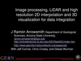
ASU GEON NODE J Ramón Arrowsmith Department of Geological Sciences Arizona State University, Tempe, AZ http://activetectonics.la.asu.edu ramon.arrowsmith@asu.edu
Outline • (Active) Fault databases and fault system visualization • Digital topography use scenarios • Hydro1K (1 km) • Shuttle Topography Mission and National Elevation Dataset (30 m) • Airborne Laser Swath Mapping (1 m) • Ideas for online digital elevation data and (satellite) imagery
Digital (active) fault databases and fault visualization • Typical shapefile fault “databases” • USGS active faults • California Geological Survey • Fault databases in development (incomplete list) • Colorado Geological Survey [Access2000]--http://geosurvey.state.co.us/pubs/ceno/index.htm • Fault Database for Southern California (Donnellan, et al.) [MySQL]--http://infogroup.usc.edu:8080/Fault_Da.doc • SCEC/SCEC-ITR: Fault Activity Database, Fault Information System, Community Fault/Block/Velocity Models
Southern California Earthquake Center LA3D-Java--based structural visualization of Community Fault Model (CFM); GeoWall capable
HYDRO1K • Developed from GTOPO30 (30 arc-second—1 km--DEM) • Reprojected, hydrologically corrected • http://edcdaac.usgs.gov/gtopo30/hydro/
Rockies Testbed HYDRO1K plotted with ArcMap
Rockies Testbed GTOPO30, ANSS seismicity plotted with GMT 84549 eqs!
National Elevation Dataset (NED) & Shuttle Radar Topography Mission (SRTM) • NED—merged, seamless, “best available” 10 or 30 m digital elevation data (mostly 7.5 minute DEM source data) • SRTM—C and X band interferometric synthetic aperture radar for topographic data acquisition over 80% of earth landmass on 11 day shuttle mission (Feb. 2000). Significant processing for 30 m data. Unedited output from processor.
SRTM and NED downloads • http://seamless.usgs.gov • ~1x1 degree tiles for SRTM were ~100Mb; for NED 80 Mb. Total for Rockies = 14.4 Gb • Merge and reduce precision (mm to mm) produces three 1 Gb swaths across the Rockies testbed.
NW Montana NED versus SRTM Wasatch Grand Canyon
Airborne Laser Swath Mapping (ALSM) • Allows for the measurement of surface topographic features with decimeter-level accuracies. • AKA Light Detection and Ranging (LIDAR) • Powerful tool for surface process studies because it allows for the characterization of the landscape at the appropriate scale • Data intensive! • National Center for Airborne Laser Mapping (NCALM)—recently funded NSF project for coordinated research grade ALSM data
Ideas for online digital elevation data and (satellite) imagery http://seamless.usgs.gov/ https://zulu.ssc.nasa.gov/mrsid/ DEMs Landsat TM 742 Or ASTER … +
ASTER-SW scenes (as of 04/03/2003) ASTER images for the southern Rockies Each is ~118Mb ; total here is ~81 Gb
“on-the-fly” processing of user selected ASTER image with JAVA front end to IDL
Conclusions • Collaboration is appropriate with SCEC for Fault representation and visualization efforts • DEM analysis is data processing intensive • Opportunity to link online elevation and imagery databases • Other data/efforts: • Paleoearthquakes • Late Cenozoic vertical motions (exhumation and basins) • Focal mechanisms (Harvard/USGS have <20)