GEON Science Application Demos
GEON Science Application Demos. LiDAR – GEON Lidar Workflow (GLW) Large database and data processing Ramon Arrowsmith , Chris Crosby, AZ State University PIP – Paleo -Integration Project Database federation

GEON Science Application Demos
E N D
Presentation Transcript
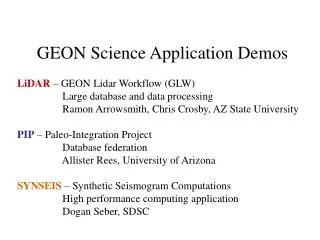
GEON Science Application Demos LiDAR – GEON Lidar Workflow (GLW) Large database and data processing Ramon Arrowsmith, Chris Crosby, AZ State University PIP – Paleo-Integration Project Database federation Allister Rees, University of Arizona SYNSEIS – Synthetic Seismogram Computations High performance computing application Dogan Seber, SDSC
Complete LiDAR Workflow 1. Survey 3. Interpolate / Grid USGS Coastal & Marine 2. Point Cloud x, y, z, … 4. Analyze / “Do Science”
The Vision: Conceptual GEON LiDAR Workflow • Utilize cyberinfrastructure developed by GEON to offer online data distribution, DEM generation, and analysis of large LiDAR datasets. • Completely internet-based workflow: • Point cloud to visualization • Utilize modular web services to complete a variety of processing and analysis tasks. • Offer users control of processing and analysis parameters.
PGAP Graphic Correlation Database The Paleointegration Project in GEON Implications for Paleobiogeography and Paleoclimate Data/Model Comparisons Allister Rees - Department of Geosciences, University of Arizona John Alroy - Paleobiology Database, NCEAS, University of California Chris Scotese - Paleomap Project, University of Texas at Arlington Ashraf Memon - San Diego Supercomputer Center, University of California David Rowley - Department of Geophysical Sciences, University of Chicago Judy Parrish - Department of Geological Sciences, University of Idaho Dave Weishampel - Cell Biology & Anatomy, The Johns Hopkins University Emil Platon - Energy and Geoscience Institute, University of Utah Maureen O'Leary - Department of Anatomical Sciences, SUNY Stony Brook Mark Chandler - Center for Climate Systems Research, Columbia University Wolfgang Kiessling - Humboldt-University of Berlin
JURASSIC – ANTARCTICA The PaleoIntegration Project (PIP) is facilitating interoperability between global-scale fossil and sedimentary rock databases, enabling a greater understanding of the life, geography and climate of our planet throughout the Phanerozoic.
PGAP Graphic Correlation Database
How? 3-tier architecture: Front - user interface (computer terminal, user-friendly search terms and tools) Back - databases (schema, ontology coding - age, geography, content) Middleware - translates user-selected parameters for database searches - keeps track of user selections (workflow), so a modified search doesn’t mean “starting over” - routes user requests to different software components (e.g. data query, spatial data conversion), bringing results from multiple databases and tools together on one screen
SYNSEIS: A grid application in GEON • SYNSEIS is a SYNthetic SEISmogram calculation tool built as part of the GEON system • Uses E3D in the background • Enables 2D and 3D seismic waveform simulations using a service-oriented architecture • Utilizes both local as well as national computational platforms such as TeraGrid • Integrated with GEON resources allowing utilization of archival and storage resources
HPCCenters • Earthquakes • Stations • Waveform IRIS NCSA SDSC SYNSEIS Digital Libraries/GEON Data Grid Earth model Earth model Earth model SYNSEIS Components -- e3d
SYNSEIS Architecture Job Database Data Repository GEONGrid Portal GEONTools MyWorkbench Synseis Portlet SYNSEIS Computations Macromedia Flash GUI Map Server HTTP Web Services Earth Model Service Job Submission/Monitoring and File Service Data Archives Service Grid Services JDBC IIOP/CORBA Grid FTP IRIS DMC HPC Resources