Download
1 / 30
300 likes | 449 Vues
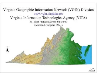
Virginia Geographic Information Network (VGIN) Division www.vgin.virginia.gov Virginia Information Technologies Agency (VITA) 411 East Franklin Street, Suite 500 Richmond, Virginia 23219. VGIN in the VITA ( the Virginia Information Technologies Agency). National. Statewide. Regional.

E N D
Virginia Geographic Information Network (VGIN) Division www.vgin.virginia.gov Virginia Information Technologies Agency (VITA) 411 East Franklin Street, Suite 500 Richmond, Virginia 23219
VGIN in the VITA (the Virginia Information Technologies Agency)
National Statewide Regional Local
18 state agencies (with over 30 district offices) 140 local governments (106 or 86% active - 2001) 100 private utilities (plus 400 municipal utilities) 11 federal agencies (give or take) 268 primary data producers and users 12 universities and colleges 16 junior colleges 21 regional planning district commissions 307 data producers and users
Planimetrics & Cadastre Stakeholder Driven Guidelines, Standards, and Leadership guide local government data development R-1 R-2 R-15 Critical E-911 Data Addresses – E 911 22 23 24 25 26 27 28 41 42 43 44 36 Street Centerline ² ² ² ² ² Hydrography Digital Orthophoto Base Digital Orthophotography Base Imagery
Virginia Base Mapping Program (VBMP) • Digital Orthophotography • Road Centerlines / Addresses • Hydrography • Digital Terrain Model • Rail • Airports • Public Safety Data • Critical Multi-use Data
Planimetrics & Cadastre Stakeholder Driven Guidelines, Standards, and Leadership guide local government data development R-1 R-2 R-15 Critical E-911 Data Addresses – E 911 22 23 24 25 26 27 28 41 42 43 44 36 Street Centerline ² ² ² ² ² Hydrography Digital Orthophoto Base Digital Orthophotography Base Imagery
1 Digitize 2 Conflate Local RCL to VBMP VBMP + Local 3 Conflate VDOT RCL to VBMP 4 Conflate Census to VBMP VBMP + Local + VDOT
Surrounding/Adjacent Jurisdictions (donut) Local Jurisdiction (donut hole) Local Geography enhanced by VBMP Regional Geography enhanced by VBMP Local / In-house attribution - including addresses Standard attribution fields – duplicated addresses (from above) Standard attribution fields – with addresses
Geospatial Support Services – One-Stop • Geospatial Information Portal • Metadata Clearinghouse • Geospatial Data Library • Internet Map Services
CURRENT - Information Portal www.vgin.virginia.gov
Metadata Clearinghouse The Virginia Metadata Clearinghousewww.vgin.state.va.us An interactive directory of the Commonwealth’s spatial data assets (101 entries through 1/05/02)
Geospatial Data Library • Goal: To provide one-stop portal for geospatial data access in Virginia • Primary Functions: • Download capabilities • Extract Services • Transformation Services • Metadata Links
Web / Map Services • Goal: To provide cost-effective access to data and spatial functionality • Primary Functions: • Image Services • Feature Services • Geospatial Decision-support Functions
Geospatial Support Services – One-Stop • Geospatial Information Portal • Metadata Clearinghouse • Geospatial Data Library / Exchange Service • Internet Map Services Virginia Base Mapping Program (VBMP) • Digital orthophotography • Road Centerlines • Hydrology / DTM / Rail • Public Safety Data
VGIN Homeland Security Responsibilities • Develop a seamless framework for cataloguing public and private Critical Infrastructures in the state using a standard GIS. [Secure Virginia Panel Recommendations, September 2002] • Build an Internet accessible GIS, with seamless, statewide, high resolution aerial photography, critical geocoded databases, and user-friendly access and analysis capabilities that will serve as a visual, and virtual “single tactical landscape”. [Commonwealth Preparedness Homeland Security Grant]
Department of Emergency Management (VDEM) • State Police • Department of Health (VDH) • Department of Fire Programs (DFP) • National Guard • Department of Game and Inland Fisheries (DGIF) • Department of Transportation • Department of Conservation and Recreation (DCR) • Department of Environmental Quality (DEQ) • Department of Agriculture and Consumer Affairs • Department of Forestry (DOF) • Marine Resources Commission (MRC) • Virginia Information Technologies Agency (VITA) • Department of Rail and Public Transportation (DRPT) • Virginia Port Authority
Virginia Readiness, Response, and Recovery GIS (VR3) Governor’s Office, Budget and Policy Staff FEMA, Coast Guard, etc. State Agencies Regional Planning Staff Utilities Local Government Agencies Red Cross - Non-profits Emergency Operations
Architecture - Business Continuity Fault-tolerance and “load-balancing” is built into critical architecture components Coupled with a highly available storage infrastructure • Scaling out promotes “fail-over”
Virginia Geographic Information Network (VGIN) Division www.vgin.virginia.gov Virginia Information Technologies Agency (VITA) 110 S. Seventh Street, Suite 135 Richmond, Virginia 23219