Download

1 / 101
1.01k likes | 1.14k Vues
Right of Way Plan Development April 12 th 2013. FINAL R/W PLAN PREPARATION. Differences in Project Design R/W Plans and Final R/W Plans? Project Design R/W Plans show R/W design requires for the construction of the project.

E N D
Right of Way Plan Development April 12th 2013
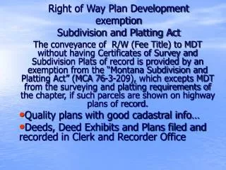
FINAL R/W PLAN PREPARATION • Differences in Project Design R/W Plans and Final R/W Plans? • Project Design R/W Plans show R/W design requires for the construction of the project. • Project Design R/W Plans are prepared according to Chapter 85 – Part 9 of INDOT Design Manual, Stage 2 plans . • Final R/W Plans show what R/W was actually acquired/purchase for the project. Final R/W Plans are prepared for INDOT appraisers, buyers, property owners, and other surveyors. R/W Plans are public record.
R/W and Plans and owners and buyers and appraisers and you INDOT owns more than 134,000 acres, 31,000 acres was purchased in the last 12 years.
RIGHT OF WAY MEANS? • (j) “Right-of-way” means land taken by either: • (1) easements; or • (2) fee simple title; • for the linear routes identified in subsection (k). • (k) “Route survey” refers to surveys executed for the purpose of acquiring an interest in the tracts of land required for the following: • (1) Highways. • (2) Railroads. • (3) Waterways. • (4) Pipelines. • (5) Electric lines. • (6) Any other linear transportation or utility route. • The term does not include surveys executed for acquisition parcels that are of even width and immediately adjacent to an existing title, easement, or right-of-way line and do not require a property survey in order to prepare an accurate legal description for the parcel. Route surveys are not considered either original surveys or Retracement surveys. Parallel Line type descriptions.-------From Title 865--
IC 8-23-7-2 • IC 8-23-7-2Purposes for acquiring real property Sec. 2. The department may acquire real property for any purpose necessary to carry out this article, including the following: (1) To locate, relocate, construct, reconstruct, repair, or maintain a state highway, including area for: (A) the placement of a utility facility within the right-of-way of the state highway system; or (B) the relocation of a utility facility within the right-of-way of the state highway system due to interference with a highway improvement project. (2) To widen or straighten a highway. (3) To clear and remove obstructions to vision at crossings and curves. (4) To construct weigh stations and rest areas. (5) To provide scenic easements and other areas necessary to cooperate with the federal government or carry out a federal law. (6) To facilitate long-range transportation planning.
IC 8-23-7-31 • Acquisition of property, rights, and easements; legal description; taxation Sec. 31. (a) Whenever the department acquires real property, rights, or easements for the construction, repair, and maintenance of a state highway, a legal description of all rights-of-way and easements, including the area of the land acquired, shall be filed by the department in the office of the recorder in the county in which the real property is located. The description shall be recorded in the deed records of the county. No fee may be charged for filing and recording the description. The department shall also file the description with the county auditor. (b) Real property and interests in real property acquired for permanent highway purposes are exempt from taxation from the date of acquisition, provided that all taxes, interest, and penalties recorded on the property tax duplicates have been paid. Where real property or interests in real property are acquired after the assessment date of any year but before December 31, the taxes on the property in the ensuing year are not a lien on the property and shall be removed from the tax duplicates by the county auditor.
CONSTRUCTION R/W STAKING • 865 IAC 1-12-5 Property surveys affected • Authority: IC 25-21.5-2-14 • Affected: IC 25-21.5 • (2) Construction surveys made for the purpose of marking the limits of existing easements or rights-of-way for the construction • of improvements within the easement or rights-of-way must be executed by a registered land surveyor but are only subject to • the provisions of sections 1 through 4 and 6 of this rule.
865 IAC 1-12-20 • Route survey preliminary research • (b) Client specifications (INDOT) may set forth technical minimums for route surveys more stringent than those stated in this section.
865 IAC 1-12-21 • Route survey fieldwork • Sec. 21. When conducting a route survey, a land surveyor shall do the following: • (1) Establish the location of the control survey points upon which all subsequent work will be based so that they can be • retraced and are recoverable by other surveyors without difficulty during and after construction.
865 IAC 1-12-22 • Measurements for route surveys • sec. 22. (a) When conducting a route survey, the land surveyor shall be responsible to use the minimum standards of • measurement for urban surveys provided for in section 7 of this rule, except that relative positional accuracy may not exceed five tenths • (0.5) feet for a route survey. • (b) Measurements generally shall be shown on the route survey plat with a number of significant figures representative of the • precision of the work. • (c) The measurements specifications outlined in this section will apply to all of the following items shown on a route survey: • (1) The control survey points. • (2) Survey ties to either of the following: • (A) The nearest United States Public Land Survey subdivision corners that are reasonably accessible on both sides of the controlling survey line. (and along the survey centerline all USPLSC) • (B) Monuments with established state plane coordinates. • (3) All monuments and reference monuments, and any ties thereto, that are set relative to the controlling survey line. • (d) If the route survey references or is based on state plane coordinates or utilizes the Global Positioning System (GPS), the
865 IAC 1-12-22 Continues… • written surveyor’s report shall identify the following: • (1) The datum and projection. • (2) The year of applicable datum adjustment. • (3) The originating or controlling monuments. • (4) The GPS base stations or positioning software used, for example, the Online Positioning User Service (OPUS). • (5) The source and format of the corrections if real time kinematic GPS was used. • (6) The Geoid model used, if applicable. • (7) The scale, elevation, and combination factors used in the coordinate calculations. • (8) Information on any translation to or from a local system. • (9) The collection processes and methodology of final positioning. • (10) Whether the distances shown are grid or ground.
865 IAC 1-12-24 • Route survey monumentation • Sec. 24. (a) When conducting a route survey, a registered land surveyor shall be responsible to set monuments in accordance • with the following: • (1) Control survey points that are to be shown on the route survey plat shall be monumented at: • (A) each angle point; and • (B) intervals that typically do not exceed one quarter (¼) mile. • (2) Section 18(c) through 18(f) of this rule. • (3) Any comparable or better monuments required by more stringent local ordinances shall be set. • (4) Monuments shall be referenced in such a manner that will facilitate recovery of the monuments. A minimum of three (3) • permanent points referencing each controlling survey line monument shall be established, preferably at locations outside the • planned construction area.
865 IAC 1-12-25 • Route survey plats • Sec. 25. When conducting a route survey, a land surveyor shall prepare a route survey plat as Follows:…………………………… • (8) Nothing in this section shall prevent a complete route survey plat from being the composite of the work of one (1) or more • surveyors preparing separate plats of their work as long as the following requirements are met: • (A) All of the information required under this section and in sections 21, 22, 24, and 25 of this rule is reflected in the • composite of the separate plats, and the data on each of the separate plats is tied to the initial controlling survey line. • (B) The separate plats are all recorded. • (C) Any plats related to the route survey that are subsequently recorded are cross-referenced to any previously recorded • plats related to the same route survey. • (D) The work is conducted in accordance with the requirements of section 3 of this rule.
NOTE • THIS IS NOT AN EXTENSIVE STUDY OF RULE 12, BUT I DO WANT TO BRING TO YOUR ATTENTION THAT THERE WERE SIGNIFICANT CHANGES TO THE RULE IN (Check for Changes)
TAX ID • MANY/MOST OF THE COUNTIES IN INDIANA REQUIRE THAT PRIVATE PROPERTY BE IDENTIFIED BY TAX ID NUMBER. WHEN AN OWNER ACQUIRED THEIR PROPERTY BY MORE THAT ONE TAX ID NUMBER AND THE NEW RIGHT OF WAY TAKING IS FROM BOTH TAX ID NUMBERS, THE AREA TAKEN FROM EACH TAX ID NUMBER MUST BE DETERMINED. TO DETERMINE THE AREA TAKEN FROM EACH TAX ID NUMBER A SEPARATE LEGAL DESCRIPTION MUST BE PREPARED FOR THE NEW R/W TAKING FROM THE TAX ID NUMBER PARCEL. INDOT IS NO LONGER EXCEMPT FROM THE SALES DISCLOSURE FORM REQUIRED FOR RECORDING. THE AREA OF THE NEW R/W TAKING OUT OF EACH TAX ID MUST BE DESCRIBED SEPARTELY.
IC 8-23-7-32 • IC 8-23-7-32Preservation of abstracts of title, title insurance policies, and other title papers (Title & Encumbrance Reports) Sec. 32. All abstracts of title, policies of title insurance, and other title papers shall be kept and preserved permanently by the department.
IC 8-23-7-4 • IC 8-23-7-4Description of property to be acquired; preparation and filing Sec. 4. If: (1) the department determines the location of a state highway; and (2) the location of the highway requires the department to acquire real property, easements in real property, or rights in real property;the department may prepare a metes and bounds or other description of the property or rights to be acquired. The description shall be filed in the office of the recorder in the county in which the real property is located
IC 8-23-7-10 • IC 8-23-7-10Publication of information concerning purchased property Sec. 10. Whenever the department purchases real property by agreement with the owner of the real property as to purchase price, the department shall, in accordance with IC 5-3-1-2(i), publish a list of the following: (1) The owners from whom the property was purchased. (2) The number of acres in each property purchased. (3) The purchase price of each property.As added by P.L.18-1990, SEC.216. Amended by P.L.64-1995, SEC.9.
INDOT ABSTRACTING REQUIREMENTS • TITLE & ENCUMBERANCE REPORT – FEE TAKING • 20 YEAR SEARCH – MEANS BACK TO A DATE OF TRANSFER OF THE SUBJECT PROPERTY WAS BY WARRANTY DEED, AT LEAST 20 YEARS. • INCLUDES – MORTGAGE SEARCH • MISCELLANEOUS RECORD SEARCH • JUDGMENT SEARCH • TAX – INFORMATION STATEMENT • EASEMENT(S) • REFERANCE DEEDS – COPY OF SUBDIVISION PLATS – COPY OF EASEMENTS
TITLE & ENCUMBRANCE REPORT • TEMPORARY R/W TAKING - ONLY • LAST DEED OF RECORD OWNER • TAX – INFORMATION STATEMENT
IC 32-24-1-4 • Complaint Sec. 4. (a) If the person seeking to acquire the property does not agree with the owner of an interest in the property or with the guardian of an owner concerning the damages sustained by the owner, the person seeking to acquire the property may file a complaint for that purpose with the clerk of the circuit court of the county where the property is located. (b) The complaint must state the following: (1) The name of the person seeking to acquire the property. This person shall be named as the plaintiff. (2) The names of all owners, claimants to, and holders of liens on the property, if known, or a statement that they are unknown. These owners, claimants, and holders of liens shall be named as defendants. (3) The use the plaintiff intends to make of the property or right sought to be acquired. (4) If a right-of-way is sought, the location, general route, width, and the beginning and end points of the right-of-way.
IC 32-24-1-4 Continues… (5) A specific description of each piece of property sought to be acquired and whether the property includes the whole or only part of the entire parcel or tract. If property is sought to be acquired by the state or by a county for a public highway or by a municipal corporation for a public use and the acquisition confers benefits on any other property of the owner, a specific description of each piece of property to which the plaintiff alleges the benefits will accrue. Plats of property alleged to be affected may accompany the descriptions. (6) That the plaintiff has been unable to agree for the purchase of the property with the owner, owners, or guardians, as the case may be, or that the owner is mentally incompetent or less than eighteen (18) years of age and has no legally appointed guardian, or is a nonresident of Indiana. (c) All parcels lying in the county and required for the same public use, whether owned by the same parties or not, may be included in the same or separate proceedings at the option of the plaintiff. However, the court may consolidate or separate the proceedings to suit the convenience of parties and the ends of justice. The filing of the complaint and a lispendens notice in any eminent domain action under this article constitutes notice of proceedings to all subsequent purchasers and persons taking encumbrances of the property, who are bound by the notice.
ABSTRACTING & OWNERSHIP • Each ownership of land within the limits of the project is abstracted with a 20 year search of the title. This includes properties not identified as a take area but which property lies within the project limits. Each Ownership is identified by adding a parcel number to the code number. Also abstracting may be needed to verify INDOT ownership of the existing R/W shown on the plans. Abstracting coverage should be from start of construction to end of construction.
ABSTRACT INVESTAGATION • Each Title & Encumbrance Report is plotted and an analysis of the owners deed description is performed, and ownership lines are established. In addition, any special interest noted in the report is plotted and a note placed on the plans. Property owner names are checked and corrected if necessary. Additional abstracting may be needed to resolve any property line location conflicts or uncertainly of the property line location.
ABSTRACTING REPORT • The abstracting report is prepared parcel by parcel, any additional title information must be gotten from the county records. Additional title information may include additional copies of subdivision plat(s) or private surveys or reference deeds necessary to determine ownership of property or to clarify property line location. When the abstracting report is being prepared a list of special interests that effect each parcel and which interests must be cleared for future reference, when the parcel is prepared for appraising
EXISTING RIGHT OF WAY • All existing R/W information is gathered and separated by parcel ownership, not by project or from station to station. All areas where no evidence of title to existing R/W is found are noted for additional abstracting research of title is needed. If no record document is found to establish the existing road boundary, the edge of the pavement/traveled way is used as the road boundary. When using edge of pavement/traveled way as the road boundary a decision must be made as to the width of the pavement, 24 foot, 22 foot, 18 foot etc. no radii or fillet areas are considered only tangents of pavement are run to intersection.
PLOTTING EXISTING R/W LINE • NOTE: any existing R/W line drawn on the R/W Plans must be documented, such as recorded in the county records. There must be a conveyance to INDOT or other public agency. Power poles, utility lines, fences are never used as existing R/W Lines but are evidence of apparent right of way. R/W Grants not recorded timely must be evaluated and a determination made as to whether a grant of easement was made to the State before the grant is used as evidence of existing R/W line.
DEFINE SOME R/W TERMS R/W APPARENT-clearly seen or understood R/W EASEMENT-a limited right to make use of a property owned by another R/W DEDICATION-an act of setting something aside for a purpose R/W GRANT-lawful transfer, property or rights to somebody in a legal transaction R/W FEE SIMPLE-absolute ownership by INDOT
Example of Existing R/W Record COUNTY COMMISSIONER ROADRECORDS
EXISTING RIGHT OF WAY REPORT • The existing R/W report is prepared on a parcel by parcel basis. The report states either the State holds fee simple title or valid highway easement or that re-acquiring the present existing right of way (PER) is required. (PER) is always an area under pavement. • All existing R/W must be verified within the limits of the project. This includes areas not identified as new R/W takings on the Design R/W Plans. • INDOT holds clear title only in those cases where we have a warranty deed recorded or a R/W Grant recorded timely or dedication by plat. • If Area of R/W Grant is being re-acquired the area is considered PER.
SEPCIAL NOTE ON EXISTING R/W • INDOT has several old projects where the R/W Grants were signed but the Grant was not recorded until several years later. The out of sequence recording creates an uncertainly as to what title INDOT holds to the area of the Grant. Parcel documentation regarding existing right of way must contain how INDOT acquired title (by what document) and why the document is evidence of existing R/W.
AREA COMPUTATION SHEET • CAREFUL ATTENTION MUST BE GIVEN IN CALCULATING THE RESIDUE AREA. • NOTE: THE AREAS OF PRESENT EXISTING R/W (PER) IS INCLUDED IN THE AREA ACQUIRED. • NOTE: THE AREA OF “PER” STATED IN THE LEGAL DESCRIPTION v. THE PER AREA STATED ON THE AREA COMPUTATION SHEET AND OTHER VERIFIED EXISTING R/W AREAS. • AREAS ARE CALCULATED FOR THE PURPOSE OF ESTABLISHING JUST COMPENSATION TO THE OWNER.
L-10 – DATA LAND ACQ. CODE NUMBER and PARCEL NUMBER • OWNERS NAME – LAST NAME FIRST(always) • TOTAL AREA • R/W EXISTING AREA VERIFIED • LEFT/RIGHT • CENTERLINE • STATION TO STATION • AREA OF FEE TAKING (INCLUDING PER) • RESIDUE AREA • RESIDUE AREA + FEE AREA + R/W EXISTING AREA = TOTAL AREA