Advanced LIDAR Mobile Technologies by Drakkar Ltd: Innovation in Geodesy and Surveying
300 likes | 414 Vues
Drakkar Ltd specializes in cutting-edge LIDAR mobile technologies, designed for real-time 3D cartography, topography, and civil engineering applications. Our ISO 9001 certified solutions integrate geodetic tools with advanced algorithmic support for accurate data collection in various environments. With versatile equipment mountable on vehicles, aircraft, and drones, we ensure exceptional accuracy and speed. Our services include architectural and cultural heritage surveys, aerial photography, and comprehensive mapping. Leverage our expertise for precise and efficient survey results.

Advanced LIDAR Mobile Technologies by Drakkar Ltd: Innovation in Geodesy and Surveying
E N D
Presentation Transcript
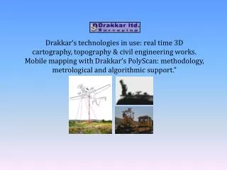
Drakkar‘s technologies in use: real time 3D cartography, topography & civil engineering works. Mobile mapping with Drakkar‘s PolyScan: methodology, metrological and algorithmic support.”
Partner and representative of: In friendly relations with: … and others LIDAR mobile technologies from Drakkar ltd.
Drakkar’s main directions of activity: • Geodesy & Topography • Map making • Mine survey • Architectural and cultural heritage survey • Archeological survey • … • Aerial photography & Lidar (Laser scanning) survey. The company is ISO 9001 certified LIDAR mobile technologies from Drakkar ltd.
Our approach: 1) “Home-made” geodetic tools (apparatus, software) and technologies. 2) Technological partners up to the mark – Microsoft-Vexcel, Terrasolid, AHAB, … 3) Searching for “borderline” own technologies. LIDAR mobile technologies from Drakkar ltd.
… just put into operation: • All equipment can be mounted on a car, fixed wing plane or helicopter. • The effective accuracy within 1 cm can be expected while using a car as a carier. • The survey can be implemented with an unlimited speed (theoretically). LIDAR mobile technologies from Drakkar ltd.
Functional scheme includes: • Laser scanner • GPS • Inertial Measurement Unit • Digital metric photo camera • Computer for data storage and control • Software Laser repetition rate: 24 kHz Maximum range: 2000 m Mission duration: practically unlimited LIDAR mobile technologies from Drakkar ltd.
Can be mounted on: • Planes and helicopters • And also: • Boats • Balloons • Paragliders • Unmanned systems, • … Carriages Cars LIDAR mobile technologies from Drakkar ltd.
Interesting features: • Extremely light. • Can scan in “swings mode” or vertically. LIDAR mobile technologies from Drakkar ltd.
Current Drakkar’s camera: Price about 10 000 Euro Just introduced: · 72 images per second in full resolution· 25 MPixel Sensor resolution· Very compact housing· CoaxPress high-speed Interface· Monochrome or color sensor· Real-time image data transfer Price principally the same LIDAR mobile technologies from Drakkar ltd.
Colored 3D clouds: Distance: 200 m • Related tasks: • Data fusion (Riegl, Novatel, Waypoint, Drakkar, …) • Off-set measurement. • Lidar and camera calibration. • others. LIDAR mobile technologies from Drakkar ltd.
Applications: “Regular” man-made object (Power Lines, for example) LIDAR mobile technologies from Drakkar ltd.
Examples: That’s what we have - point clouds. What to do with point clouds? Distance: 50 m LIDAR mobile technologies from Drakkar ltd.
That’s what we need: mathematical models + IR data + data fusion algorithms Remark: Lidar to Thermovison fusion is standard now LIDAR mobile technologies from Drakkar ltd.
Power Lines Lidar Survey: Main goals: • Full automation of wire, cables and other similar 1-D object recognition (done!) • Insulators, wires break points (derivative break) • Tower detection, recognition and geopositioning: - with a priory defined exact frame model (done!) - without (know how to do) Innovative Lidar Solutions Conference, June 26, 2009
Wires and other similar 1-D object detection in noisy environment Innovative Lidar Solutions Conference, June 26, 2009
Applications: Surface modeling and making cross-sections LIDAR mobile technologies from Drakkar ltd.
Making cross-sections in AutoCAD format (Israel road agency)
Cross-section accuracy estimations No worse than 50 cm No worse than 5 cm No worse than 2 cm
Applications: Dispersed objects (forest) LIDAR mobile technologies from Drakkar ltd.
3-D reconstruction and modeling of a tree stand structure and a separate trees A Possibility for Topography Detection Under Forest Canopy Innovative Lidar Solutions Conference, June 26, 2009
N E DSM local maximums – to detect probable stem position
Empirical distribution lines for larch trees by morphometric indices of stems and crowns and approximated by Weibull distribution: а) - DBH, b) - H, c) – Dcr, d) - Lcr., e) - Scr., f) - G f (Dcr.) Innovative Lidar Solutions Conference, June 26, 2009
Selected points Unselected points Result Under canopy object detection Arial photo Innovative Lidar Solutions Conference, June 26, 2009
Intermediate conclusions: • Drakkar technologies and skills cover all above-water part of any lidar (as well sonar) bathymetrical project. • Drakkar is especially strong in alliance with its friendly companies, such as Airborne Hydrography, Terrasolid, Marine Construction. • Final reminder • A lot of additional information on modern lidars, photogrammetry, geospatial modeling will be delivered at: LIDAR mobile technologies from Drakkar ltd.
Combining laser scanning and digital photography: • - Making photorealistic 3D models . • Clear detection of traffic lane marking. • Making ortophotomaps. LIDAR mobile technologies from Drakkar ltd.
Conclusions • Using Mobile Liders have a number of decisive technical and economical advantages for making civil engineering works for roads, real roads, runways and other similar objects: accuracy within 1-2 cm, direct geopositioning, productivity up to 30 km per day. • Main technological stages (calibration, data acquiring, office processing) are automated which guarantees achieving reliable output materials. • Output includes precise 3D models including DTM, DSM, deformation, edges, crevices, cavities, traffic lane marking and so on. • Drakkar ltd. is fully equipped and has an extensive experience for any kinds of mobile laser scanning works in Israel and globally. LIDAR mobile technologies from Drakkar ltd.
Thank you! LIDAR mobile technologies from Drakkar ltd.