Download
1 / 37
370 likes | 493 Vues
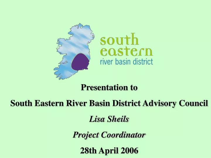
Presentation to South Eastern River Basin District Advisory Council Lisa Sheils Project Coordinator 28th April 2006. Groundwater. The Water Framework Directive. Directive 2000/60/EC of the European Parliament and of the Council of 23 October 2000

E N D
Presentation to South Eastern River Basin District Advisory Council Lisa Sheils Project Coordinator 28th April 2006
Groundwater The Water Framework Directive Directive 2000/60/EC of the European Parliament and of the Council of 23 October 2000 • Establishes a framework for community action on water policy • Rationalises and updates existing legislation • Introduces river basin management planning Surface freshwaters Transitional & coastal waters USGS (1998)
achieve at least “good status” of all waters by 2015 maintain “high status” of waters where it exists prevent any deterioration in existing status of waters Overall objective of WFD ECOLOGICAL STATUS HIGH GOOD WFD Min Objective MODERATE POOR BAD Waters = surface waters + groundwater Surface waters = rivers, lakes, transitional & coastal waters also canals & reservoirs Good Status = Good ecological status & good chemical status
8 RBDs National LegislationEC (Water Policy) Regulations & Amendments S.I. No. 722 of 2003 S.I. No. 413 of 2005 • Co-ordination of actions by all relevant public authorities • Responsibilities: EPA, Lead LA, Relevant Public Authorities • Characterisation of each RBD • Development of a Programme Of Measures to achieve WFD objectives • Development and adoption of RBMP in each RBD and review every 6 years
Schedule 1 - relevant public authorities · the Environmental Protection Agency · the relevant local authorities · the regional authorities in the area · the regional fisheries boards in the area · the Geological Survey of Ireland · Teagasc · the Radiological Protection Institute of Ireland · the Marine Institute · the Central Fisheries Board · the Electricity Supply Board · Waterways Ireland · Tourism Ireland · the Heritage Council · the Health and Safety Authority · the Local Government Computer Services Board · the Commissioners of Public Works · the Minister for Enterprise, Trade and Employment · the Minister for Communications, Marine and Natural Resources · the Minister for Agriculture and Food
SERBD The South Eastern River Basin District (SERBD) • Established in 2002: first project established for the implementation of the WFD • Original project - 4 years (to April ’06) • Extension proposal to December 2008 submitted to • allign project with those in other RBDs • to achieve delivery of RBMP • Extension proposal- approved in principle by DEHLG • Cost of approx 11 million euro.
South Eastern River Basin District project River Basin District Advisory Council River Basin Management Group+ SERBD Network Group Project Steering Group Participating local authorities Co-ordinator GIS Manager & Monitoring Team 13 LAs Carlow CoCo Lead LA Contractor EG Pettit + RPS
Project Tasks • Task 1 – Background Information – Policy & Legislation • Task 2 – Characterisation of SERBD (Article 5 of WFD) • Task 3 – Develop River Basin Management System • Monitoring System • Computerised mapping system (GIS) • Programme of Measures • Public Awareness & Consultations • Environmental Management System (EMS) • Task 4 – Implement River Basin Management System • Task 5 – Prepare River Basin Management Strategy
Characterisation of SERBD • Initial Characterisation • Data collection - physical characteristics, water quality, pressures etc • Data management included the development of GIS • Foundation for the Article 5 Risk Assessment Characterisation report • Article 5 Characterisation • Process applied finalised risk assessment methodologies developed Nationally. • Ireland’s Article 5 Characterisation Report (April, 2005) is available at www.wfdireland.ie • What did Article 5 characterisation involve?
Water Bodies & Risk Assessment • “Waterbodies”: the management units for Article 5 Characterisation & the WFD No. No. in 5 Water CategoryNationallySERBD • River Water Bodies: 4468 655 • Lake water Bodies: 745 11 • Transitional (Estuarine) Water Bodies: 196 21 • Coastal Water Bodies: 113 9 • Ground Water Bodies: 758 151 • For each WB, an analysis of pressures and impacts was required: “Risk Assessment” • an assessment of the degree of risk placed on water bodies by human activities • “Risk” means the risk that a water body will not achieve “good” status by 2015 • 4 – category risk classification scheme was adopted: 2b Water Body not at risk and available information is comprehensive and / or conclusive 2a Water Body Probably not at risk but available information could be improved 1b Water Body Probably at risk 1a Water Body at risk What pressures were examined?
Article 5 Characterisation: Risk Assessment Results Groundwaters 61% WB at risk
Article 5 Characterisation: Risk Assessment Results Rivers 64% WB at risk
Article 5 Characterisation: Risk Assessment Results Lakes 38% WB at risk
Article 5 Characterisation: Risk Assessment Results Transitional 53% WB at risk
Article 5 Characterisation: Risk Assessment Results Coastal 27% WB at risk
Where do we stand now ?WFD Implementation (May 2005) Status May 2005
Access to data through a map interface, or through data base queries Ready access to help on front page, and throughout site
Simple map interface with basic map navigation tools Simple step by step instructions
User selects feature of interest; selection shows on map and in box. Once a feature is selected, click on ‘Create Report’ button.
WFD Monitoring Programme priorities • Surveillance long term trends - range of status conditions all quality elements have to be recorded (therefore costly) • Operational record responses due to measures - sites experiencing pressures targeted quality elements (but perhaps more frequently) • Investigative unpredicted water quality problems or pollution events targeted quality elements Water Policy Regulation Timescales • June 2006 publish monitoring programmes • December 2006 programmes become operational
WFD Monitoring Groundwaters • 71 Chemical Status Monitoring points • 64Quantitative/level points
Dangerous Substances Screening Monitoring Programme • 17 Surface Water sites • 4 Eastern RBD • 6 South Eastern RBD • 4 Shannon RBD • 2 South Western RBD • 1 Western RBD • 4 Groundwater sites • 3 South Eastern RBD • 1 Shannon • WWTP Site – Eastern RBD • Landfill Site – Eastern RBD
Programme Of Measures (POM) • POM: main element of the RBMP • National POM Co-ordination Group (PCG) formed to oversee development of POM • Priority pressure areas were agreed- study specifications for each topic approved • Responsibility for studies divided amongst RBD projects. • Each study will deliver to the Significant Water Management Issues report in 2007 and the draft River Basin Management Plan in 2008. Each will include consultation with stakeholders.
PoMS • 4. SERBD: Setting Chemical Water Quality Standards • Primary Study Objective • to support the EPA in establishing Ireland’s environmental quality • standards (EQSs) for selected supporting elements, in relevant water categories, by June 2006 • Study Steering Committee • Chair: EPA • SERBD Project Co-ordinator (Representing Carlow Co.Co) • Nominees from DEHLG, NPWS(DEHLG), Marine Institute (DCMNR) • New information to be collated (sources) or generated (i.e. deliverables)? • Benchmarking, Data Collection & Literature Review: • other Member States, existing standards, Intercalibration Programme, expert input • Identification of Phase 1 List: • for which standards are necessary and feasible by 2006 SERBD: Setting Chemical Water Quality Standards
PoMS • (...new Information, continued.) • Water balance Model: • separate POMS Study establishing flow proportion from groundwaters • Standards Compilation, Analysis and Trial Application • Category and type specific, water phase only, ecological status boundaries for each pollutant • Standards and Tool Delivery • Fieldwork element? • No. This is a desk study but will involve input from studies with a field element, such as the National Dangerous Substances Screening Programme. • Study to be undertaken with application across all RBDs? • Standards set by this POMS study will have National application. SERBD: Setting Chemical Water Quality Standards
Public Information & Consultation • Cornerstone of WFD_ Article 14 • Advisory Council - 2006 • Consultation on • Characterisation Report.2004-2005 • Monitoring Programme • Significant Water Management Issues (SWMI)-2007 • River Basin Management Plans 2008-2009 • Public Awareness Campaign • SERBD & National Publications • eg DVD, NewsSheet etc
RBD Advisory Councils Article 16 of S.I. No. 722 of 2003, amended by S.I. No. 413 of 2005 DEHLG Circular WQ 03/05 2005 RBDAC -Terms of Reference : “to consider matters relating to the preparation of river basin management plans (RBMP) and other matters relevant to the protection and use of the aquatic environment and water resources in the district and to advise and make recommendations on these matters to the relevant public authorities.” SERBD Advisory Council ≈ 45 members 2 from each LA - elected member or sectoral representative = 26 6 from AMAI 13 from representative pillars/sectors
Public Participation • Policy & Legislation report • Initial characterisation Report • SERBD Leaflet 2004 • News sheet 2005 : non technical summary of Article 5 Char • SERBD Characterisation Technical Summary Report • DVD • Also, other topic reports • Available on SERBD website- public downloads page www.serbd.com
The Water Framework Directive Programme SERBD project Identify location and boundaries of surface waters and groundwaters Identify types of water bodies Analysis of pressures and impacts Characterisation of surface water and groundwater bodies Economic analysis of water use Register of protected areas Publish RBMP Directive entered into force Publish overview of significant water management issues 2002 2008 2009 2000 2004 2005 2006 2007 Identify location and boundaries of RBDs Designate competent authorities Make administrative provisions Publish draftRBMP Monitoring programmes operational Programme of measures Publish timetable for RBMP Source: P. Duggan (DEHLG)