Groundwater
Groundwater. David R. Maidment CE 394K.2 Spring 2005. Reading: Handbook of Hydrology, Chapter 6, Sec 6.1 to 6.7. Groundwater Investigation. Can’t “see” groundwater so a lot more is done by inference and interpretation than for surface water Site investigation

Groundwater
E N D
Presentation Transcript
Groundwater David R. Maidment CE 394K.2 Spring 2005 Reading: Handbook of Hydrology, Chapter 6, Sec 6.1 to 6.7
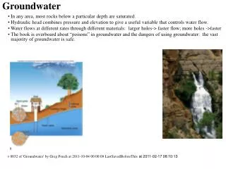
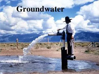
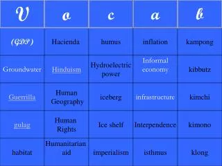
Groundwater Investigation • Can’t “see” groundwater so a lot more is done by inference and interpretation than for surface water • Site investigation • Conceptual model of geological environment and the flow system through it • Field measurements (bore holes, pump tests, geophysics) • Hydrogeologic simulation model (e.g. Modflow)
Groundwater Investigation Figure 6.1.1
Comal and San Marcos Springs are the major outflow points for the “Southern Segment” of the Edwards Aquifer
Barton Springs Segment of Edwards Aquifer http://www.bseacd.org/geology.html
Geological Evolution http://www.edwardsaquifer.net/geology.html
Hydrogeology of Aquifer http://www.bseacd.org/hydrogeology.html
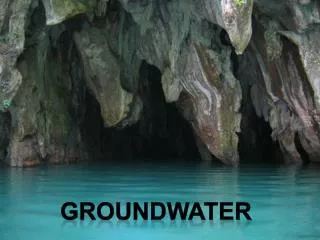
Karst terrain – caves, sinkholes and underground streams http://www.bseacd.org/karst.html
2002 2003 2004 2001 2000 Flow in Barton Springs http://www.bseacd.org/cc_water_levels.html
Piezometric Head Map Tucson, Az. Figure 6.3.2
Barton Springs (surface water) Lovelady Dowell Buda Negley Monitoring Points Well Stream gage
Piezometric Head Level Depth from the ground surface Pressure head Piezometric head Elevation head
Buda 2002 2003 2004 http://www.bseacd.org/cc_water_levels.html
Dowell Buda 2003 2004 2002 2003 2004 Piezometric head in monitoring wells Dowell Monitoring Well Buda Monitoring Well 2002
Equipotential Lines and Flow q = K dh/dx Figure 6.3.5
Flow Net Figure 6.4.1