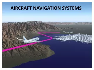
Advancements in Air Navigation Systems: Insights from Hershey Airport Conference
The Hershey Airport Conference, held on March 7, 2007, presented crucial updates on the evolving National Airspace System. Key highlights included the growth of 4,000 public-use airports and the introduction of advanced navigation capabilities like the RNAV (GPS) and the cancellation of many outdated NDB approaches. Attendees learned about new Required Navigation Performance (RNP) procedures, including various approach zone specifications and obstacle evaluations. This conference underscored the importance of dynamic navigation systems to handle the anticipated annual growth of 10% in air traffic and the associated operational changes.


Advancements in Air Navigation Systems: Insights from Hershey Airport Conference
E N D
Presentation Transcript
Transition to Advanced Navigation Systems Hershey Airport Conference Gerard Lebar – Eastern Flight Procedures Wednesday March 7, 2007
The Expanding National Airspace System • 4,000 Public Use Airports (Paved) • 14,800 Instrument Approach Procedure • 10% annual growth • 30,000 Obstruction Evaluations • 18% annual growth
NDB (No FAF) IAP TRAP 1. Length: Starts at Facility & extends out 10 NM. 2. Primary Area: 2.5 NM wide at Facility & expands out uniformly to 8 NM at 10 NM point. 3. Secondary Area: 0 NM at Facility & expands out uniformly to 2 NM at 10 NM point. 4. ROC: 350 FT.
RNAV (GPS) IAP TRAP 1. Length: Starts at Thld & extends out 5 NM. 2. Primary Area: 1.0 NM each side of FAWP & tapers in uniformly to .5 NM at the MAWP Displacement area. 3. Secondary Area: 1 NM wide at the FAWP & tapers to a width of .5 NM at the MAWP Displacement area. 4. ROC: 250 FT, Primary Area 250 Ft at inner edge & 0 Ft at outer edge.
CAT I/LPV TRAP Starts at Threshold and extends about 5 NM (depends on GS Intercept Altitude Threshold width 400’ each side of Rwy Centerline for W surface. At Precsion Final Approach Fix, width is 2200’ each side of Rwy Centerline for W surface There are two secondary surfaces (X and Y) that have 4:1 and 7:1 slopes (See slide seven for graphic) ROC is clear 34:1 slope with no GQS penetrations.
Final segment size LPV FINAL RNP FINAL
IAP Cancellation Program NDB IAPs – Cancelled nearly all NDB approaches. Only kept those where there were no other ground based approaches (VOR or ILS/LOC) VOR/DME (RNAV) – Converted to RNAV (GPS) approaches VOR - Seldom used approaches – only after coordination with Air Traffic and Airport Managers