Download
1 / 21
210 likes | 227 Vues
Explore Georgia's geography and its influence on development, focusing on major features like Fall Line, rivers, mountains, and barrier islands. Learn the significance of physical landmarks and their role in Georgia's history and economy.

E N D
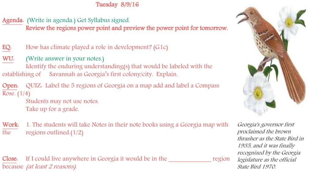
Tuesday 8/9/16 Agenda: (Write in agenda.) Get Syllabus signed. Review the regions power point and preview the power point for tomorrow. EQ: How has climate played a role in development? (G1c) WU: (Write answer in your notes.) Identify the enduring understanding(s) that would be labeled with the establishing of Savannah as Georgia’s first colony/city. Explain. Open: QUIZ: Label the 5 regions of Georgia on a map add and label a Compass Rose. (1/4) Students may not use notes. Take up for a grade. Work: 1. The students will take Notes in their note books using a Georgia map with the regions outlined.(1/2) Close: If I could live anywhere in Georgia it would be in the _____________ region because (at least 2 reasons). Georgia's governor first proclaimed the brown thrasher as the State Bird in 1935, and it was finally recognized by the Georgia legislature as the official State Bird 1970.
8-9 c. Locate and evaluate the importance of key physical features on the development of Georgia; include the Fall Line, Okefenokee Swamp, Appalachian Mountains, Chattahoochee and Savannah Rivers, and barrier islands.HW: Bring in Notecards and color pencils to make “Trading Cards” on regions tomorrow.
SavannahRiver Chattahoochee River
Chattahoochee River • Starts in the mountains of North Georgia (Blue Ridge Region) and empties into the Gulf of Mexico • Forms part of the natural border between Georgia and Alabama • Major source of water for Atlanta and surrounding cities • Water war between Georgia, Alabama, and Florida The name Chattahoochee is thought to come from a Muskogean word meaning "rocks-marked" (or "painted"), from chato ("rock") plus huchi ("marked"). This possibly refers to the many colorful granite outcroppings along the northeast-to-southwest segment of the river.
Savannah River • Forms border between Georgia and South Carolina • Begins in Hart County, forms Lake Hartwell, and then flows to the Atlantic Ocean. The only river that flows into Georgia from outside of its borders. • In addition to shipping, the river is used as a major source of drinking water for Savannah and Augusta, to cool two nuclear power plants in South Carolina, and to generate hydroelectric power.
Appalachian Mountains • The southernmost point of the Appalachian Mountains is located in Georgia. • Stretch across all three mountain regions in the northern part of the state. • Also know as the Blue Ridge mountains because of the blue haze that appears around their peaks. • One of the oldest mountains in the world. • Over time, weather has worn them down and they are more rounded and less jagged than new mountains such as the Rockies in western U.S.
Fall Line Fall Line
Fall Line • Separates the Coastal Plain region from the Piedmont region • Runs through Columbus, Macon, and Augusta • Narrow rivers in the northern part of the state flow over the last hard rock of the Piedmont, creating waterfalls and rapids • As the rivers flow into the softer and sandier soil of the Coastal Plain, the rivers spread out and become wider and slower.
Fall Line • Use to mark the beginning of the Atlantic Ocean. • Prevented early explorers from traveling further. • Excellent source of power.
Barrier Islands • The Barrier Islands, also known as the Sea Islands or Golden Isles, are a chain of sandy islands off the coastline of Georgia. • These islands protect the mainland from wind and water erosion.
Barrier Islands • There are 14 Barrier Islands off Georgia’s coast including Tybee, St. Simons, Jekyll, and Cumberland. • Some of the islands, such as Cumberland, are wild life refuges and are national or state parks. Others, like St. Simons, have been developed and three (Little Cumberland, Little St. Simons, and St. Catherine’s) are still privately owned. • Today, the islands are mainly tourist and recreation destinations though the fishing and paper industries are still important economic enterprises.
Okefenokee Swamp • Name means land of the trembling earth • Located in the Coastal Plain Region • Covers 700 square miles making it the largest swamp in North America • Protected by the federal government with hundreds of animals species living in the area… most known the American alligator.
Wednesday 8/10/16 (Woliver/Aiken – Adv.) Agenda: (Write in agenda.) Get Syllabus signed. Review the regions power point and preview the power point for tomorrow. EQ: How has climate played a role in development? (G1c) WU: (Write answer in your notes.) Connect two things you have learned about geography, Georgia’s regions and physical features. Open: (Write answer in your notes.) Make predictions about the climates that are found in each region of Georgia. Overall how would you characterize our climate? Work: 1. The students will take Notes in their note books incorporating self- drawn weather symbols to express climatological differences throughout Georgia on a map with the regions outlined. (1/2 sheet) 2. Investigate (use BYOT) the cash crops of each region, hypothesize how the climate impacts what is grown. Close: To close the notes students will write a summary of the overall climate found in the state. Hot Questions L1: What is Georgia’s climate like? L2: How do the different physical features/regions impact Georgia’s climate. L3: What conclusions about the climate can you draw about regions from the type of produce that is grown? L4: Explain the relationship between climate and economic opportunities.
How does the climate effect the economy?What changes have to be made either in production or agriculture?
Which letter represents the correct location of the Blue Ridge Mountains region? A C B D E
Which letter represents the correct location of the Coastal Plain region? A C B D E
Which letter represents the correct location of the Piedmont region? A C B D E
Which letter represents the correct location of the Valley and Ridge region? A C B D E


